Chesterfield in St. Louis County, Missouri — The American Midwest (Upper Plains)
First Baptist Church of Chesterfield
Historical Synopsis

Photographed by Duane and Tracy Marsteller, July 20, 2024
1. First Baptist Church of Chesterfield Marker
African-Americans have suffered from religious and racial oppression throughout many periods of American history. Years ago, Christian-minded slaves often worshipped with their owners. However, in 1846, the slaves in Chesterfield and nearby areas were blessed when Marie Long granted this designated plot of land to the slaves. The land was consecrated to be both a church and a cemetery.
On this plot of land, the adult slaves built a crude log cabin, which functioned as the first church building. Together, these slaves labored to establish their own place of worship, where they prayed standing, sitting, and on their knees. With freedom from a life of bondage, the people worshipped and served the God they loved and trusted.
As the people flourished, the church served a two-fold purpose - both as a place of worship and a schoolhouse. In the schoolhouse, the people were taught what was commonly known as the "Three R's" - "Reading", "Riting" and "Rithmetic".
Although the original church building was finished in 1846, it underwent many structural changes throughout its history. Rebuilding took place in 1870,
this page online
Many original headstones were constructed out of wood, which have since deteriorated. Therefore, an accurate account of the deceased lying here cannot be given.
We give our special thanks to the following people who gratefully dedicated their lives toward the building of God's Kingdom here on Earth.
Marie Long, The Founding Slaves,
The Most Tenured Pastor – the Rev. Theopolis Peoples
A special thanks to all friends and organizations who have assisted in the growth and development of the First Baptist Church of Chesterfield.
May grace and peace be with all of our members of the past, present, and future. For an expanded chronology of our history, visit the First Baptist Church of Chesterfield at 17155 Wildhorse Creek Road
Erected by First Baptist Church of Chesterfield.
Topics. This historical marker is listed in these topic lists: African Americans •

Photographed by Duane and Tracy Marsteller, July 20, 2024
2. First Baptist Church of Chesterfield Marker
Featured marker is on the right pillar.
Location. 38° 39.452′ N, 90° 34.038′ W. Marker is in Chesterfield, Missouri, in St. Louis County. It can be reached from Chesterfield Parkway West 0.1 miles south of Wild Horse Creek Road, on the left when traveling south. Touch for map. Marker is at or near this postal address: 16187 Chesterfield Pkwy W, Chesterfield MO 63017, United States of America. Touch for directions.

Regionally, this marker is in Greater St. Louis. It is also in the American Midwest, in the Lewis & Clark Corridor, in the Corn Belt, and in the Great River Road Region. Globally, it is in North America, the Western Hemisphere, the Western World, and the Anglosphere. Historically, it finds itself in what was once the Viceroyalty of New France, the territory of the Mississippian Culture, the Louisiana Purchase, and the Antebellum South.
Other nearby markers. At least 8 other markers are within 2 miles of this marker, measured as the crow flies: Chesterfield, Missouri (approx. half a mile away); Clester Cabin (approx. 1.3 miles away); Thornhill
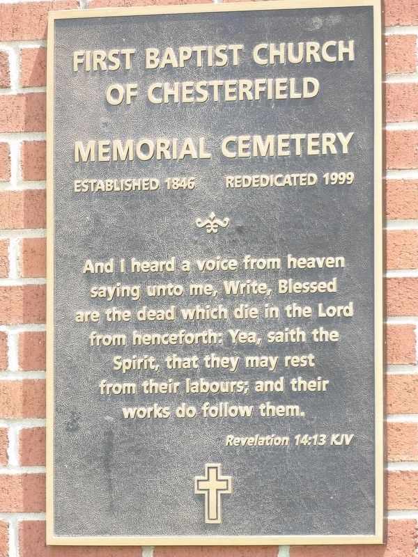
Photographed by Duane and Tracy Marsteller, April 11, 2019
3. First Baptist Church of Chesterfield Cemetery Marker
Also see . . .
1. Church History. Timeline of the church's history. (First Baptist Church of Chesterfield) (Submitted on August 15, 2024, by Duane and Tracy Marsteller of Murfreesboro, Tennessee.)
2. First Baptist Church of Chesterfield - Looking Back and Moving Forward. A brief history lesson on the building of First Baptist Church of Chesterfield. (Ronald Moore, uploaded Feb. 10, 2015) (Submitted on August 15, 2024, by Duane and Tracy Marsteller of Murfreesboro, Tennessee.)
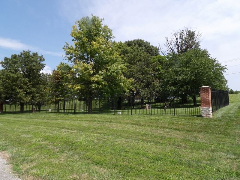
Photographed by Duane and Tracy Marsteller, April 11, 2019
4. First Baptist Church of Chesterfield Cemetery
There are 82 known graves in the cemetery, but there likely are more than that because of missing and/or deteriorated gravestones. The oldest gravestone dates to 1838.
Credits. This page was last revised on October 31, 2025. It was originally submitted on August 15, 2024, by Duane and Tracy Marsteller of Murfreesboro, Tennessee. This page has been viewed 668 times since then and 69 times this year. Photos: 1, 2, 3, 4. submitted on August 15, 2024, by Duane and Tracy Marsteller of Murfreesboro, Tennessee.
