Centreville in Queen Anne's County, Maryland — The American Northeast (Mid-Atlantic)
Site of Goldsborough House
Circa 1798
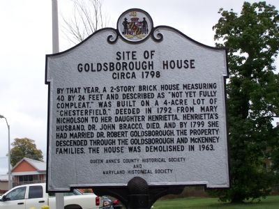
Photographed by Beverly Pfingsten, October 19, 2007
1. Site of Goldsborough House Circa 1798 Marker
Erected by Queen Anne’s County Historical Society and Maryland Historical Society.
Topics and series. This historical marker is listed in these topic lists: Settlements & Settlers • Women. In addition, it is included in the Maryland Historical Trust series list. A significant historical year for this entry is 1792.
Location. 39° 2.618′ N, 76° 3.831′ W. Marker is in Centreville, Maryland, in Queen Anne's County. It is on Happy Lady Lane 0.1 miles Railroad Avenue, on the left. Marker is behind the Post Office. Touch for map. Marker is in this post office area: Centreville MD 21617, United States of America. Touch for directions.

Regionally, this marker is on the Eastern Shore. It is also in the American Mid-Atlantic,
this page online
Other nearby markers. At least 8 other markers are within walking distance of this marker: Carmichael House (here, next to this marker); Wright’s Chance (about 500 feet away); a different marker also named Wright's Chance (about 500 feet away); Centrally Located (about 500 feet away); The Brass Pin (about 500 feet away); Centreville National Bank of Maryland (about 500 feet away); William Harper, Sr. Houses (about 500 feet away); The Courthouse (about 600 feet away). Touch for a list and map of all markers in Centreville.
Other markers no longer nearby. Connecting Centreville to the Worlds of Commerce Beyond the Eastern Shore (was about 400 feet away, measured in a direct line but has been permanently removed); The Railroad as Community Connector to the World (was about 400 feet
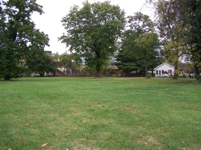
Photographed by Beverly Pfingsten, October 19, 2007
2. Open lot where Goldsborough House stood.
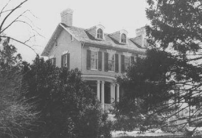
Maryland Historical Trust Historic Sites Survey
3. Historical photo of the Goldsborough house
Credits. This page was last revised on August 18, 2024. It was originally submitted on October 23, 2007, by Bill Pfingsten of Bel Air, Maryland. This page has been viewed 1,684 times since then and 33 times this year. Last updated on August 16, 2024, by Rico Ramirez of Prince Frederick, Maryland. Photos: 1, 2. submitted on October 23, 2007, by Bill Pfingsten of Bel Air, Maryland. 3. submitted on April 8, 2008, by Christopher Busta-Peck of Shaker Heights, Ohio. • Devry Becker Jones was the editor who published this page.
