Magna in Salt Lake County, Utah — The American Mountains (Southwest)
Looking Back in Time

Photographed by Jeremy Snow, August 18, 2024
1. Looking Back in Time Marker
Looking Back in Time
Look around. Visible fragments of bygone era wait for the eyes to discover. Pieces of a giant jigsaw puzzle, these "scattered bits of time," give form to present visitas showing a path that flows forward from over a billion years ago up to the present day
Billions of years:
Across the waters of the lake, Antelope Island slips slowly westward at a tiny fraction of an inch per year. Precambrian rocks are visible at the southern tip. Thes metamorphic rocks are some of the oldest on earth and were subjected to extreme pressure and heat while buried about 10 miles deep, approximately 1.7 billion years ago (Photo by John George)
Millions of years:
The Oquirrh Mountains rise above the site to the south. A deep depression, called the Oquirrh Basin, formed 250 to 300 million years ago, covered in a great sea. The remains of ancient sea life formed limestone beds thousands of feet deep. Layers of rotated and deformed limestone, once at the bottom of this sea, now tower above the present landscape, the result of faults that created the basin and range topography of the Great Basin (Accumulated snowfall
this page online
Thousands of years ago:
Look up About 15,000 years ago when Lake Bouneville was at its deepest and glaciers crept down higher canyon of the Wasatch Range, this spot lay submerged by over 800 feet of fresh water. Wind-drive waves lapped against the Oquirrh Mountains and Antelope Island, carving the coastal beach terraces observable today.
In the last 10,000 years, as the lake shrank to become the Great Salt Lake, there has been little change to the geological appearance of the area. During this time, humans began to populate northern Utah. Early inhabitas lived, walked, and forged for food in this land where you stand.
Found in excavations at Deadman Cave, just two miles to the southwest, are bits and pieces of daily life from thousands of years ago. Human remains interred in the cave have recently been dated at 4000, 6000, 6990 and 8300 years of age. Archeological evidence suggests human use of the date dating back 11,000 years. Grayish pottery, sandstone manos and metates, quartzite and obsidian projectile points, scrapers,
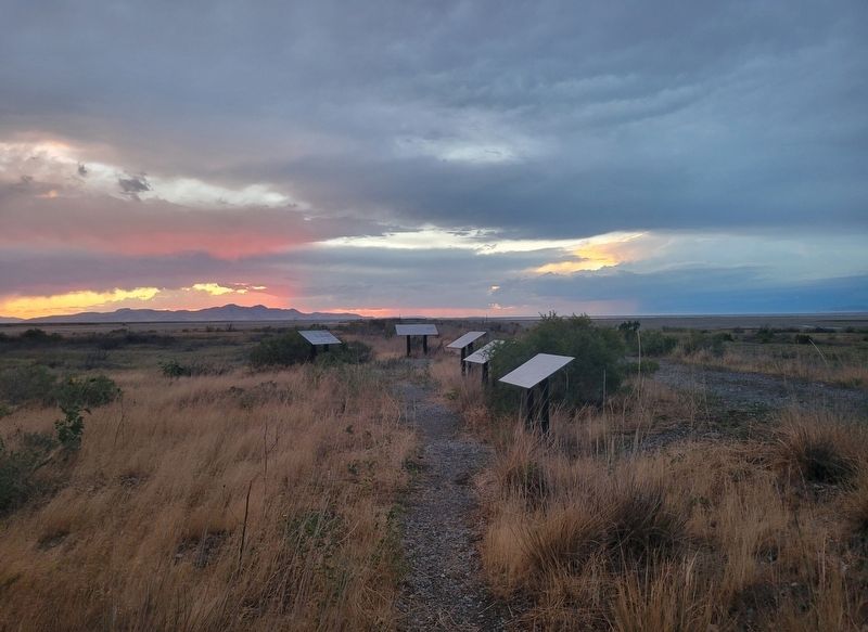
Photographed by Jeremy Snow, August 18, 2024
2. Looking Back in Time Marker
Even in the hardscrabble existence, polished bone and calcite beads and pendants demonstrate the ever-present human desire for adornment. Rock art at the southern tip of the Oquirrh Mountains include spirals and myriad foras These ancient figures leave room to ponder the meaning of these symbols to the early inhabitants. (Photo by Ann Neville)
Hundreds of years: As soon as pioneers arrived in the Salt Lake Valley, the south shore of Great Salt Lake became a destination for recreation and industry. Two parallel earthen projections extend from Lee Creek Area toward the interior of the lake. These two silent relicts hint of a former time when the area bustled with activity. The northernmost is an abandoned aqueduct used to pump salt water to evaporative ponds located east of I-80.
The southernmost is a levee that leads to the deserted site of the original Saltair resort. The ever restive and wandering shoreline of the lake had reached a peak and was slowly withdrawing in the early 1890s when Saltair was built, perched on wooden pilings 5 feet above the salty lake water.
Elements of the shoreline are harsh to human endeavors, and Saltair was not immune. Fire twice ravished the resort, leaving only charred remains. Heavily laden saltwater waves corrosively attacked and battered the wooden structure. Constant maintenance was necessary Strong gales frequented the area. One mighty wind swept through downing the famed rollercoaster and crashing it into the lake.
Today, you can see metal structural scraps, old pipes, broken pieces of pottery, and some of wood piling still stalwartly standing, marking a ghostly outline of that once glorious resort. (Remains of Saltair today. Photo by John George)
Topics. This historical marker is listed in this topic list: Parks & Recreational Areas.
Location. 40° 46.187′ N, 112° 9.262′ W. Marker is in Magna, Utah, in Salt Lake County. It is on Frontage Road. Touch for map. Marker is in this post office area: Magna UT 84044, United States of America. Touch for directions.

Regionally, this marker is in the Wasatch Front and in Greater Salt Lake. It is also in the American Mountain West and on the Colorado Plateau. Globally, it is in North America, the Rocky Mountains, the Western Hemisphere, the Western World, and the Anglosphere. Historically, it finds itself in what was once New Spain and also Mexico’s Alta California.
Other nearby markers. At least 8 other markers are within 7 miles of this marker, measured as the crow flies: Garfield & Lake Point Resorts (approx. 2.3 miles away); Pioneer Black Rock Resort (approx. 2.3 miles away); Jedediah Smith's Trail - Great Salt Lake (approx. 2.3 miles away); Black Rock Historic Site (approx. 4.7 miles away); Empress Theatre (approx. 4.7 miles away); Pleasant Green Ward (approx. 5 miles away); Magna Community Baptist Church (approx. 5.1 miles away); Early Magna Settlements (approx. 6.8 miles away). Touch for a list and map of all markers in Magna.
Credits. This page was last revised on January 6, 2026. It was originally submitted on August 18, 2024, by Jeremy Snow of Cedar City, Utah. This page has been viewed 262 times since then and 54 times this year. Photos: 1. submitted on August 18, 2024, by Jeremy Snow of Cedar City, Utah. 2. submitted on August 19, 2024, by Jeremy Snow of Cedar City, Utah. • J. Makali Bruton was the editor who published this page.
