Columbia in Howard County, Maryland — The American Northeast (Mid-Atlantic)
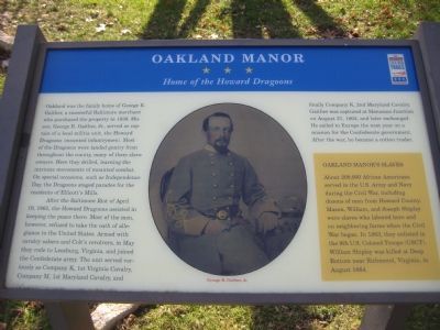
Oakland Manor
Home of the Howard Dragoons
Photographed by F. Robby, January 8, 2008
1. Oakland Manor Marker
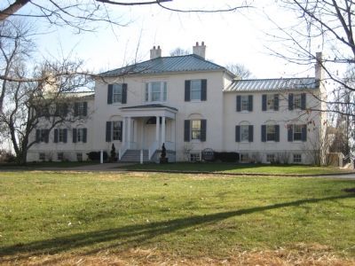
Oakland was the family home of George R. Gaither, a successful Baltimore merchant who purchased the property in 1838. His son, George R. Gaither, Jr., served as captain of a local militia unit, the Howard Dragoons (mounted infrantrymen). Most of the Dragoons were landed gentry from throughout the county, many of them slave owners. Here they drilled, learning the intricate movements of mounted combat. On special occasions, such as Independence Day, the Dragoons staged parades for the residents of Ellicott's Mills.
After the Baltimore Riot of April 19, 1861, the Howard Dragoons assisted in keeping the peace there. Most of the men, however, refused to take the oath of allegiance to the United States. Armed with cavalry sabers and Colt's revolvers, in May they rode to Leesburg, Virginia, and joined the Confederate army. The unit served variously as Company K, 1st Virginia Cavalry, Company M, 1st Maryland Calvary, and finally Company K, 2nd Maryland Cavalry. Gaither was captured at Manassas Junction on August 27, 1862, and later exchanged. He sailed to Europe the next year on a mission for the Confederate government. After
this page online
[Sidebar:]
Oakland Manor's Slaves
About 200,000 African Americans served in the U.S. Army and Navy during the Civil War, including dozens of men from Howard County. Mason, William, and Joseph Shipley were slaves who labored here and on neighboring farms when the Civil War began. In 1863, they enlisted in the 9th U.S. Colored Troops (USCT). William Shipley was killed in Deep Bottom near Richmond, Virginia, in August 1864.
Erected by Maryland Civil War Trails.
Topics and series. This historical marker is listed in these topic lists: African Americans • War, US Civil. In addition, it is included in the Maryland Civil War Trails series list. A significant historical month for this entry is April 1791.
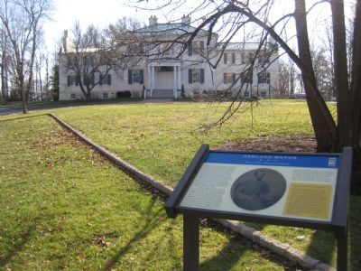
Location. Marker has been permanently removed. It was located near 39° 13.38′ N, 76° 51.257′ W. Marker was in Columbia, Maryland, in Howard County. It could be reached from Vantage Point Road 0.2 miles Little Patuxent Parkway, on the right when traveling south. Marker is on the left side of drive to Oakland Manor, about one tenth of a mile from Vantage Point Road where you see the Oakland sign. Touch for map.
Photographed by F. Robby, January 8, 2008
2. Oakland Manor Marker
We have been informed that this marker is no longer there and will not be replaced. This page is an archival view of what was.
Regionally, this marker was in the Baltimore Metro Region and in Central Maryland. It was also in the American Mid-Atlantic and on the Eastern Seaboard. Globally, it was in the North Atlantic Region, North America, the Western Hemisphere, the Western World, and the Anglosphere. Historically, it found itself in what was once one of the original Thirteen Colonies and also the Antebellum South.

Other nearby markers. At least 8 other markers are within 3 miles of this location, measured as the crow flies: Kittamaqundi Community Church 50th Anniversary (within shouting distance of this marker); a different marker also named Oakland Manor (about 400 feet away, measured in a direct line); James W. Rouse (approx. 0.3 miles away); Wilde Lake (approx. 0.3 miles away); The First Kindergarten Class in Columbia to Graduate from High School (approx. half a mile away); The Dealings (approx. 0.6 miles
Photographed by F. Robby, January 8, 2008
3. Oakland Manor
More about this marker. Marker replaced by new CWT marker at site
Related marker. Click here for another marker that is related to this marker. This marker has been replaced with the linked marker.
Also see . . . Historic Oakland. Venue website homepage (Submitted on February 10, 2008, by F. Robby of Baltimore, Maryland.)
Photographed by F. Robby, January 8, 2008
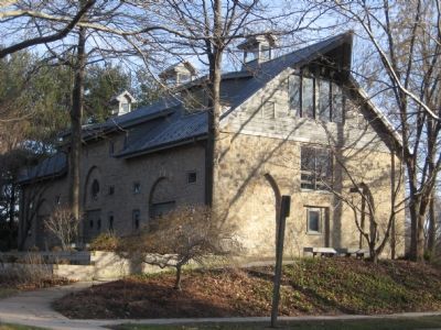
4. Oliver's Carriage House
Kittamaqundi Community Church worships in the former Oliver's Carriage House which was once a part of Oakland Manor property. The building is located on the opposite side of Vantage Point Road, about 300 feet north of Oakland Manor house.
Credits. This page was last revised on August 19, 2024. It was originally submitted on February 10, 2008, by F. Robby of Baltimore, Maryland. This page has been viewed 5,156 times since then and 152 times this year. Last updated on August 19, 2024, by Mike McKeown of Baltimore, Maryland. Photos: 1, 2, 3, 4. submitted on February 10, 2008, by F. Robby of Baltimore, Maryland. • Devry Becker Jones was the editor who published this page.
