Mackinaw City in Cheboygan County, Michigan — The American Midwest (Great Lakes)
Mackinac Island Passenger Ferries
| — | Mackinaw City Historical Pathway | — |
Photographed by J. J. Prats, August 2, 2024
1. Mackinac Island Passenger Ferries Marker
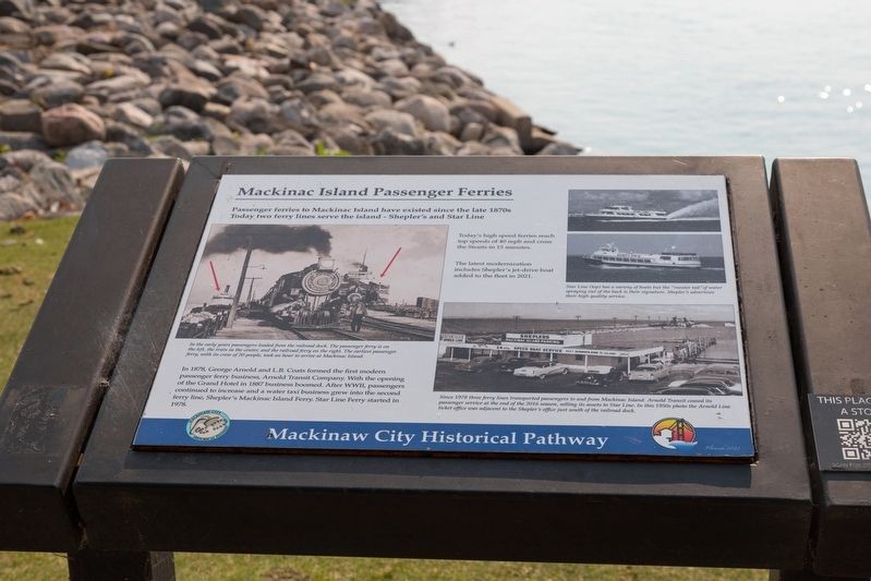
In 1878, George Arnold and L.B. Coats formed the first modern passenger ferry business, Arnold Transit Company. With the opening of the Grand Hotel in 1887 business boomed. After WWII, passengers continued to increase and a water taxi business grew into the second ferry line, Shepler’s Mackinac Island Ferry. Star Line Ferry started in 1978.
Today’s high speed ferries reach top speeds of 40 mph and cross the straits in 15 minutes. • The latest modernization includes Shepler’s jet-drive boat added to the fleet in 2021.
Erected 2023.
Topics. This historical marker is listed in this topic list: Waterways & Vessels. A significant historical year for this entry is 1878.
Location. 45° 46.887′ N, 84° 43.338′ W. Marker is in Mackinaw City, Michigan, in Cheboygan County. It can be reached from the intersection of South Huron Avenue and South Huron Avenue. It is at the east end of the sidewalk that is on the south side of Shepler's Mackinac Island Ferry parking lot. Touch for map. Marker
this page online

Regionally, this marker is in Northern Michigan Lower Peninsula, on the Straits of Mackinac, and in one of the Lake Huron Shore counties. It is also in the American Midwest. Globally, it is in North America, in the Great North Woods, on the Great Lakes, in the Western Hemisphere, in the Western World, and in the Anglosphere. Historically, it finds itself in what was once the Northwest Territory.
Other nearby markers. At least 8 other markers are within walking distance of this marker: A different marker also named Mackinac Island Passenger Ferries (about 500 feet away, measured in a direct line); Mackinaw’s First Business District (about 600 feet away); Mackinac and the Water Highway (about 600 feet away); Mackinaw’s Early Growth (about 700 feet away); Chief Wawatam (about 700 feet away); Iron Horse (about 700 feet away); Historic Timeline (about 700 feet away); Mackinaw City (about 700 feet away). Touch for a list and map of all markers in Mackinaw City.
Another marker is no longer nearby.
Photographed by J. J. Prats, August 2, 2024
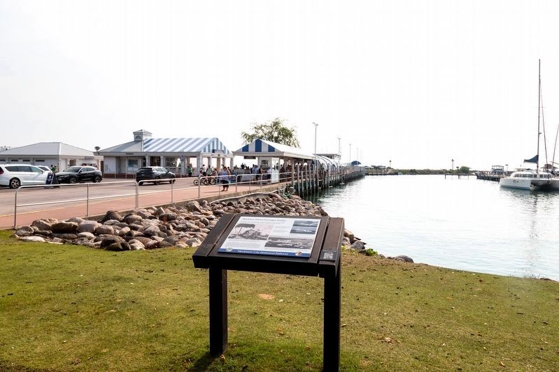
2. Shepler’s Ferry Dock and Marker
More about this marker. This interpretive panel is illustrated with four photographs. They are captioned,
• In the early years, passengers loaded from the railroad dock. The passenger ferry is on the left, the train in the center, and the railroad ferry on the right. The earliest passenger ferry, with its crew of 20 people, took an hour to arrive at Mackinac Island.
• Star Line (top) has a variety of boats but the “rooster tail” of water spaying out of the back is their signature. Shepler’s (bottom) advertises their high quality service.
• Since 1973 three ferry lines transported passengers to and from Mackinac Island. Arnold Transit ceased its passenger service at the end of the 2016 season, selling its assets to Star Line. In this 1950s photo the Arnold Line ticket office was adjacent to the Shepler’s office just south of the railroad dock.
Credits. This page was last revised on August 19, 2024. It was originally submitted on August 19, 2024, by J. J. Prats of Powell, Ohio. This page has been viewed 241 times since then and 61 times this year. Photos: 1, 2. submitted on August 19, 2024, by J. J. Prats of Powell, Ohio.
