Bluefield in Mercer County, West Virginia — The American South (Appalachia)
Andrew Davidson
Photographed by J. J. Prats, October 16, 2015
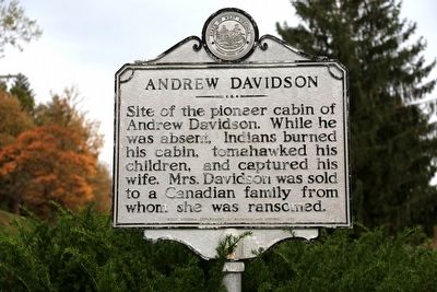
1. Andrew Davidson Marker
Site of the pioneer cabin of Andrew Davidson. While he was absent, Indians burned his cabin, tomahawked his children, and captured his wife. Mrs. Davidson was sold to a Canadian family from whom she was ransomed.
Erected 1973 by West Virginia Department of Archives and History.
Topics and series. This historical marker is listed in these topic lists: Indigenous Peoples and Communities • Settlements & Settlers. In addition, it is included in the West Virginia Archives and History series list. A significant historical year for this entry is 1791.
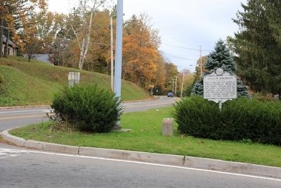
Location. Marker has been permanently removed. It was located near 37° 15.151′ N, 81° 12.526′ W. Marker was in Bluefield, West Virginia, in Mercer County. It was at the intersection of West Cumberland Road (U.S. 52) and Bland Road (U.S. 52), on the right when traveling south on West Cumberland Road. Touch for map. Marker was at or near this postal address: 103 W Cumberland Rd, Bluefield WV 24701, United States of America.
We have been informed that this marker is no longer there and will not be replaced. This page is an archival view of what was.
Regionally, this marker
this page online

Other nearby markers. At least 8 other markers are within 2 miles of this location, measured as the crow flies: Miss Blanche Miller's Kindergarten and Continuation School (approx. ¾ mile away); Bluefield (approx. 1.2 miles away); Bailey Building (approx. 1.2 miles away); Elizabeth Kee (approx. 1.2 miles away); Kee Federal Building (approx. 1.2 miles away); Old City Hall (approx. 1.3 miles away); Peery Building (approx. 1.3 miles away); The West Virginian Hotel (approx. 1.3 miles away). Touch for a list and map of all markers in Bluefield.
Also see . . . Andrew Davidson's Family Killed. Chapter from Emory L. Hamilton's Indian Atrocities Along the Clinch. Excerpt: “In the spring of 1791, Andrew Davidson was living at the head spring of East River, about a half mile
Photographed by J. J. Prats, October 16, 2015
2. Andrew Davidson Marker
“The Indians went into the house and took such plunder as they wished to carry away, set fire to the cabin, and began their
Photographed by Dave W, August 18, 2024
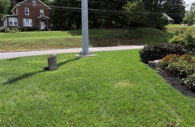
3. Andrew Davidson Marker
The area of grass behind and to the right of the traffic pole and the cement block containing a Blue Star marker is where the mounting pole was prior to removal.
Credits. This page was last revised on March 16, 2026. It was originally submitted on October 24, 2015, by J. J. Prats of Powell, Ohio. This page has been viewed 3,078 times since then and 1,577 times this year. Last updated on August 19, 2024, by Dave W of Co, Colorado. Photos: 1, 2. submitted on October 24, 2015, by J. J. Prats of Powell, Ohio. 3. submitted on August 19, 2024, by Dave W of Co, Colorado. • Devry Becker Jones was the editor who published this page.
