Forest View in Cook County, Illinois — The American Midwest (Great Lakes)
The Chicago Portage Site at the Forest Preserves of Cook County

Photographed by Lou Donkle, February 9, 2024
1. The Chicago Portage Site at the Forest Preserves of Cook County Marker
This site preserves the west end of the old Chicago Portage which linked the Illinois River with Lake Michigan.
Early Explorers
In 1673 French explorer Louis Jolliet and missionary Father Jacques Marquette were returning to Canada from an expedition to the Mississippi River when their American Indian guides suggested a quicker and easier way back. The explorers had followed the Mississippi River to the Illinois River and on to the Des Plaines River to pass through Portage Creek into Mud Lake to cross the ancient Chicago Portage.
Jolliet realized that the American Indians had shown them a much shortened route between Lake Michigan and the Mississippi River, one that would greatly simplify trade and exploration. But the Chicago Portage was difficult and dangerous. Jolliet reported his discovery: "It would only be necessary to make a canal, by cutting through but half a league of prairie..." providing an easy water passage between the Great Lakes and the Gulf of Mexico.
Traders
French and American traders traveled in this region. They too used the Chicago Portage. The fur traders had to invert their birchbark
this page online
A Chicago Visionary
Gurdon Hubbard spent his long and active life in northern Illinois. He saw Chicago grow from "a town of four and a half houses, a fort and a Potawatomi town," to more than a half million people by the time of his death in 1886. In his younger years he was a successful fur trader and trapper and crossed the Chicago Portage many times.
Later in life, Hubbard was elected to the Illinois General Assembly and worked with others including Abraham Lincoln to campaign for a canal to replace the portage. The idea for a canal endured and finally a bill for the construction of the Illinois & Michigan Canal, introduced by Hubbard, passed. Construction started on July 4, 1836 and it opened in 1848.
Upgrading the Connection
Although the Chicago Portage was an easy route when Mud Lake was full and not frozen, Chicago's growing industries needed better connections to markets. When the Illinois & Michigan Canal
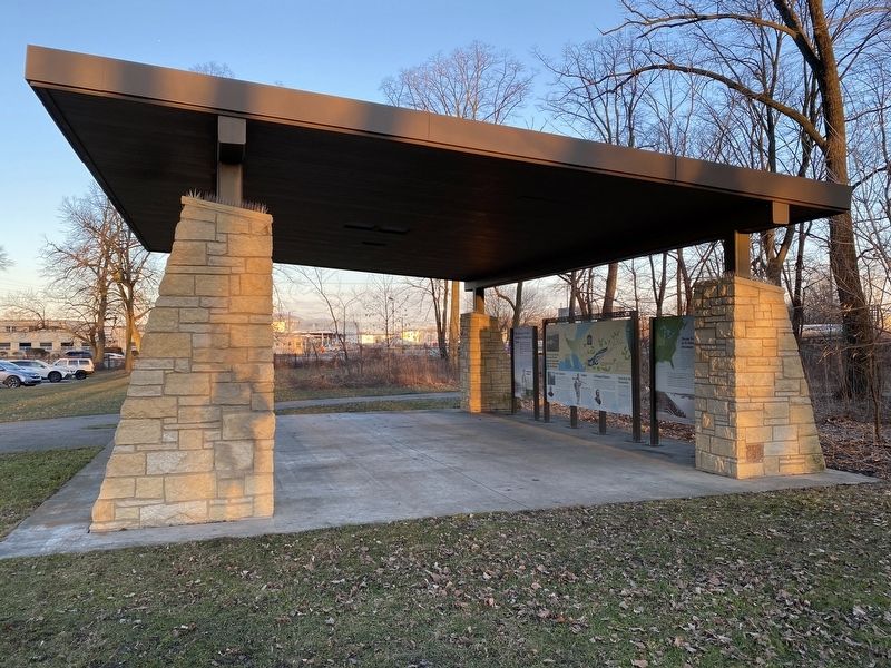
Photographed by Lou Donkle, February 9, 2024
2. Pavilion with markers
[Captions:]
When lake levels were high it was an easy passage between the Des Plaines and Chicago rivers, but when water levels were low, traders and travelers had to portage around Mud Lake.
Explorers and fur traders easily portaged their light canoes around the lake. Later traders used heavy boats they had to drag through the muddy leech-filled marsh.
Erected by Cook County Forest Preserve District.
Topics and series. This historical marker is listed in these topic lists: Exploration • Indigenous Peoples and Communities • Industry & Commerce • Settlements & Settlers. In addition, it is included in the Illinois & Michigan Canal series list. A significant historical year for this entry is 1673.
Location. 41° 48.292′ N, 87° 48.167′ W. Marker is in Forest View, Illinois, in Cook County. It can be reached from the intersection of South Harlem Avenue (Illinois Route 43) and Portage Trail, on the right when traveling south. Touch for map. Marker is at or near this postal address: 4800 S Harlem Ave, Berwyn IL 60402, United States of America. Touch for directions.

Regionally, this marker is in Greater Chicago. It is also in the American Midwest. Globally, it is in North America, on the Great Lakes, in the Western Hemisphere, in the Western World, and in the Anglosphere. Historically, it finds itself in what was once the Viceroyalty of New France, the territory of the Mississippian Culture, and the Northwest Territory.
Other nearby markers. At least 8 other markers are within walking distance of this marker: Chicago Trades on its Natural Advantages (here, next to this marker); The Chicago Portage: A History of People and Travel (a few steps from this marker); Portage Creek Passage (a few steps from this marker); Chicago Portage Timeline (within shouting distance of this marker); Chicago Portage National Historic Site (within shouting distance of this marker); The Chicago Portage (within shouting distance of this marker); Portage Passage (about 400 feet away, measured in a direct line); 09.11.2001 (approx. 0.4 miles away). Touch for a list and map of all markers in Forest View.
Credits. This page was last revised on August 21, 2024. It was originally submitted on August 20, 2024, by Lou Donkle of Valparaiso, Indiana. This page has been viewed 238 times since then and 50 times this year. Photos: 1, 2. submitted on August 20, 2024, by Lou Donkle of Valparaiso, Indiana. • Devry Becker Jones was the editor who published this page.
