Bar Harbor in Hancock County, Maine — The American Northeast (New England)
Glacial Freight
Photographed by Beverly Pfingsten, July 18, 2009
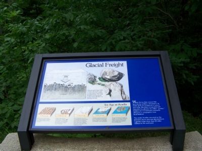
1. Glacial Freight Marker
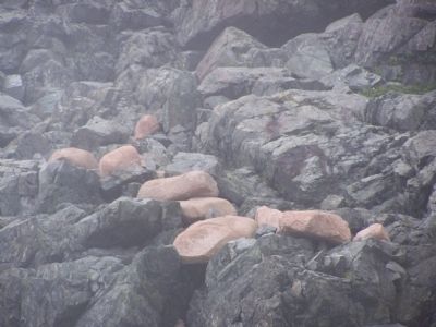
When the ice that covered this land slowly melted, it dropped in its tracks great accumulations of gravel and rocks. Boulders transported and deposited by glaciers are called "erratics." Erratics are rounded and noticeably different in composition from local bedrock.
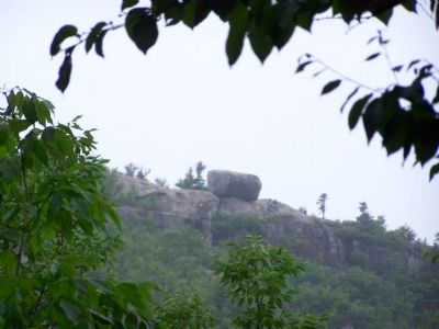
Glaciers carry huge loads of rock. The rocks come to rest where the melting ice crops them. The large boulder perched above on the South Bubble is a striking example.
20,000 years ago
Before the ice sheet came, the rugged Acadian highland was a granite ridge running east-west.
17,000 years ago
Huge tongues of ice invaded the valleys on the north slopes, cut through the passes, and engulfed the mountains on their way to the sea.
15,000 years ago
At its maximum the ice covered Acadia with a sheet over 8,000 feet (2400m) thick! The sheet extended about 200 miles (320km) seaward to the edge of the continental shelf.
13,500 years ago
Climatic warming caused the ice to melt back to the north. Ocean waters rose, flooding the foothills of the mountains.
10,000 years ago to present
The ice changed the shape of Acadia. It cut deep U-shaped valleys running north-south,
this page online
Topics. This historical marker is listed in this topic list: Natural Features.
Location. 44° 20.296′ N, 68° 15.03′ W. Marker is in Bar Harbor, Maine, in Hancock County. It is on Park Loop Road. Touch for map. Marker is in this post office area: Bar Harbor ME 04609, United States of America. Touch for directions.

Regionally, this marker is on Mount Desert Island and in Downeast Maine. It is also in the American Northeast, in New England, and on the Eastern Seaboard. Globally, it is in the North Atlantic Region, North America, the Great North Woods, the Western Hemisphere, the Western World, and the Anglosphere. Historically, it finds itself in what was once the Viceroyalty of New France and also Acadia.
Other nearby markers. At least 8 other markers are within 2 miles of this marker, measured as the crow flies: Granite Foundations (approx. 0.9 miles away); Drink in the View (approx. one mile away); To the Top! (approx. 1.3 miles away); Gateway to Acadia (approx. 1.3 miles away); Carriage Roads - The Gate Lodges (approx. 1.3 miles
Photographed by Beverly Pfingsten, July 18, 2009
2. Glacial rocks or erratics.
Photographed by Beverly Pfingsten, July 18, 2009
3. Rock left by glacier.
Credits. This page was last revised on March 19, 2026. It was originally submitted on December 13, 2009, by Bill Pfingsten of Bel Air, Maryland. This page has been viewed 1,325 times since then and 21 times this year. Photos: 1, 2, 3. submitted on December 13, 2009, by Bill Pfingsten of Bel Air, Maryland.
