Sutton-Alpine in Matanuska-Susitna Borough, Alaska — Northwest (North America)
Geology

Photographed by William Fischer, Jr., August 13, 2024
1. Geology Marker
The Matanuska River valley in which you are standing is a structural trough formed by the collision of the North American and North Pacific tectonic plates during the Jurassic and Cretaceous Periods (200-65 million years before present, MYBP), a time when dinosaurs roamed the Earth. This trough was inundated by a shallow sea during the late Cretaceous times (100-65 MYBP) with marine waters depositing shales, siltstones and sandstones of the Matanuska Formation that can be viewed at many locations along the canyon of the Matanuska River between Palmer and the Matanuska Glacier. The fossil remains of a Hadrosaur (duck-billed dinosaur) called 'Lizzy' were discovered in this formation during the 1990's. After the Hadrosaur died, it is speculated that the carcass was carried by water from the shore out into the shallow marine environment where it was entombed and preserved.
As the shallow sea subsided, a sinuous river system occupied the Valley bottom during the Tertiary Period (65-35 MYBP) including large swamps and wetlands that provided the abundant organic deposits to form the coal beds of the Chickaloon Formation
this page online
Surrounding the Matanuska Valley are the Chugach and Talkeetna Mountains. From the Park Crag Peak is the most prevalent landmark of the Chugach Mountains to the south and was formed in sedimentary rocks of the Jurassic Period (200-145 MYBP). Behind this mountain, further south, lies the igneous core of the Chugach Range where molten rock was injected into the previously existing mountains which eroded away exposing the resistant granitic intrusive rocks. King Mountain about ten miles further up the Valley provides an excellent example of this process. The Border Ranges fault, a complex of right lateral strike
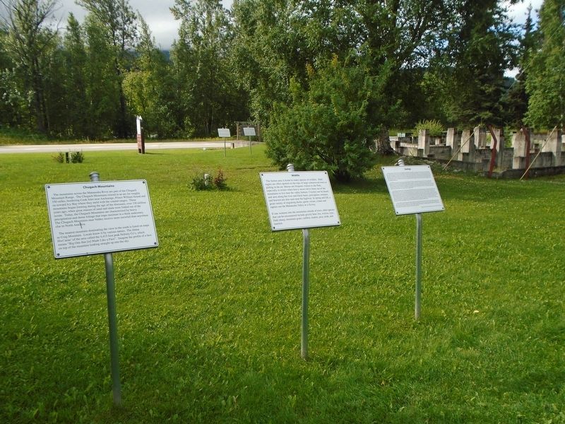
Photographed by William Fischer, Jr., August 13, 2024
2. Geology Marker
Glaciers bulldoze materials forming hills, ridges, and plains, covering the underlying bedrock with loosely unconsolidated sediments. Large rivers poured from melting ice during the end of the last glaciation depositing the extensive sand and gravel deposits common throughout the Valley including the ground on which we now stand. Winds, for which local residents are so familiar, deposits dust called 'loess' which provides the valuable growing medium on which much of the Valley's farms rely. Paraphrased by Mark Clark from Roadside Geology of Alaska, 2nd Edition, by Cathy Conner.
Erected by Alpine Historical Park.
Topics. This historical marker is listed in these topic lists: Environment • Paleontology.
Location. 61° 42.603′ N, 148° 52.55′ W. Marker is in Sutton-Alpine, Alaska, in Matanuska-Susitna Borough. It is on Glenn Highway (State Highway 1 at milepost 61.6) east of Chickaloon Way, on the left when traveling east. Marker is in Alpine Historical Park. Touch for map. Marker is at or near this postal address: 11266 Chickaloon Way, Sutton AK 99674, United States of America. Touch for directions.

Regionally, this marker is in the Alaska Railroad Corridor, in the Athabascan Region, in the Mat-Su Valley, and in Southcentral Alaska. It is also on the American Pacific Coast. Globally, it is in North America, on the Pacific Rim, in the Western Hemisphere, in the Western World, and in the Anglosphere. Historically, it finds itself in what was once the Russian Empire.
Other nearby markers. At least 8 other markers are within walking distance of this marker: Chugach Mountains (here, next to this marker); Sutton Post Office (a few steps from this marker); Matanuska River (a few steps from this marker); The Glenn Highway (a few steps from this marker); Chickaloon Bunkhouse (a few steps from this marker); Living Network (within shouting distance of this marker); Boilers (within shouting distance of this marker); a different marker also named Chickaloon Bunkhouse (within shouting distance of this marker). Touch for a list and map of all markers in Sutton-Alpine.
Also see . . . First Occurrence Of A Hadrosaur (Dinosauria) From The Matanuska Formation...(Pasch & May, UAF). (Submitted on August 23, 2024, by William Fischer, Jr. of Reynoldsburg, Ohio.)
Credits. This page was last revised on August 23, 2024. It was originally submitted on August 23, 2024, by William Fischer, Jr. of Reynoldsburg, Ohio. This page has been viewed 227 times since then and 36 times this year. Photos: 1, 2. submitted on August 23, 2024, by William Fischer, Jr. of Reynoldsburg, Ohio.
