Big Bay State Park near La Pointe in Ashland County, Wisconsin — The American Midwest (Great Lakes)
Blow Down Area

Photographed by McGhiever, September 5, 2019
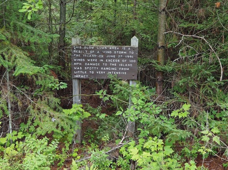
1. Blow Down Area Marker
This blow down area is a result of a wind storm to the island on June 27 1991. Winds were in excess of 100 mph. Damage to the island was spotty ranging from little to very intensive impact.
Erected by Wisconsin Department of Natural Resources.
Topics. This historical marker is listed in these topic lists: Disasters • Environment. A significant historical date for this entry is June 27, 1991.
Location. 46° 48.367′ N, 90° 41.483′ W. Marker is near La Pointe, Wisconsin, in Ashland County. It is in Big Bay State Park. It is on the Lagoon Ridges Trail, on the right when traveling north. Touch for map. Marker is at or near this postal address: 2402 Hagen Road, La Pointe WI 54850, United States of America. Touch for directions.

Regionally, this marker is on the North Shore. It is also in the American Midwest, in the Corn Belt, and on Lake Superior’s South Shore Region. Globally, it is in North America, in the Great North Woods, on the Great Lakes, in the Western Hemisphere, in the Western World, and in the Anglosphere. Historically, it finds itself in what was once the Viceroyalty of New France, the territory of
this page online
Other nearby markers. At least 8 other markers are within 6 miles of this marker, measured as the crow flies: Gidanamikaagoo omaa Mooningwanekaaning (approx. 1.2 miles away); Human History at Big Bay (approx. 1.2 miles away); Early Vessels (approx. 4.9 miles away); La Pointe Indian Cemetery (approx. 4.9 miles away); Site of First Catholic Church (approx. 4.9 miles away); Mooningwaanikaaning (approx. 4.9 miles away); Michel Cadotte (approx. 5.6 miles away); The Booth Cooperage (approx. 5.8 miles away). Touch for a list and map of all markers in La Pointe.
Another marker is no longer nearby. Madeline Island (was approx. 4.9 miles away but has been permanently removed).
Photographed by McGhiever, September 5, 2019
2. Marker along the Lagoon Ridges Trail in Big Bay State Park
Credits. This page was last revised on August 24, 2024. It was originally submitted on August 24, 2024, by McGhiever of Minneapolis, Minnesota. This page has been viewed 199 times since then and 35 times this year. Photos: 1, 2. submitted on August 24, 2024, by McGhiever of Minneapolis, Minnesota.
