Mackinaw Township in Mackinaw City in Cheboygan County, Michigan — The American Midwest (Great Lakes)
Graveyard of the Deep
Straits of Mackinac Shipwreck Preserve
| — | Mackinaw City Historical Pathway | — |
Photographed by J. J. Prats, August 2, 2024
1. Graveyard of the Deep Marker
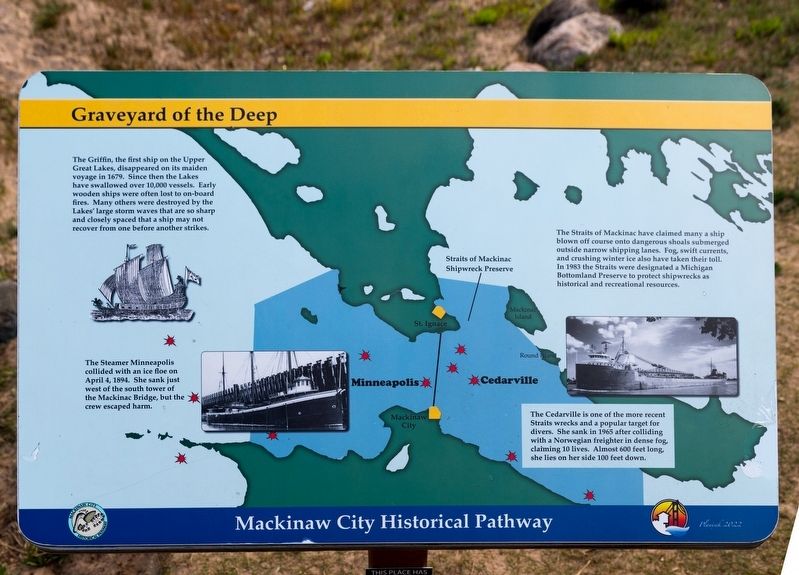
The Straits of Mackinac have claimed many a ship blown off course onto dangerous shoals submerged outside narrow shipping lanes. Fog, swift currents, and crushing winter ice also have taken their toll. In 1983 the Straits were designated a Michigan Bottomland Preserve to protect shipwrecks as historical and recreational resources.
The Griffin, the first ship on the Upper Great Lakes, disappeared on its maiden voyage in 1679. Since then the Lakes have swallowed over 10,000 vessels. Early wooden ships were often lost to on-board fires. Many others were destroyed by the Lakes’ large storm waves that are so sharp and closely spaced that a ship may not recover from one before another strikes.
The Steamer Minneapolis collided with an ice floe on April 4, 1894. She sank just west of the south tower of the Mackinac Bridge, but the crew escaped harm.
The Cedarville is one of the more recent Straits wrecks and a popular target for divers. She sank in 1965 after colliding with a Norwegian freighter in dense fog, claiming 10 lives. Almost 600 feet long, she lies on her side 100 feet down.
Erected 2022.
this page online
Topics and series. This historical marker is listed in these topic lists: Disasters • Waterways & Vessels. In addition, it is included in the Lost at Sea series list. A significant historical date for this entry is April 4, 1894.
Location. 45° 47.233′ N, 84° 43.662′ W. Marker is in Mackinaw City, Michigan, in Cheboygan County. It is in Mackinaw Township. It can be reached from the intersection of North Huron Avenue and Henry Street, on the right when traveling west. It is in the Alexander Henry Park behind the Riviera Motel. Touch for map. Marker is at or near this postal address: 520 N Huron Ave, Mackinaw City MI 49701, United States of America. Touch for directions.

Regionally, this marker is in Northern Michigan Lower Peninsula, on the Straits of Mackinac, and in one of the Lake Huron Shore counties. It is also in the American Midwest. Globally, it is in North America, in the Great North Woods, on the Great Lakes, in the Western Hemisphere, in the Western World, and in the Anglosphere. Historically, it finds itself in what was once the Northwest Territory.
Other nearby markers. At least 8 other markers are within walking distance

Photographed by J. J. Prats, August 2, 2024
2. Building the Mighty Mac and Graveyard of the Deep Markers
This marker is the one on the right.
Other markers no longer nearby. Graveyard of the Deep (has been replaced with this marker); Building Mighty Mac (was here, next to this marker but has been replaced with another marker now near it); a different marker also named Crossroads of the Great Lakes (was within shouting distance of this marker but has been replaced with another marker now near it).
Credits. This page was last revised on August 25, 2024. It was originally submitted on August 25, 2024, by J. J. Prats of Powell, Ohio. This page has been viewed 174 times since then and 22 times this year. Photos: 1, 2. submitted on August 25, 2024, by J. J. Prats of Powell, Ohio.
