Mackinaw City in Cheboygan County, Michigan — The American Midwest (Great Lakes)
Crossroads of the Great Lakes
| — | Mackinaw City Historical Pathway | — |
Photographed by J. J. Prats, August 2, 2024
1. Crossroads of the Great Lakes Marker
Click on the image to zoom in.
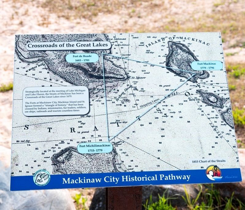
Strategically located at the meeting of Lake Michigan and Lake Huron, the Straits of Mackinac has been a Crossroads of the Great Lakes since 1670.
The Forts at Mackinaw City, Mackinac Island and St. Ignace formed a “triangle of history,” that has been crossed by Indians, missionaries, fur traders, soldiers, ore ships, railroads and tourists countless times.
Erected 2022.
Topics. This historical marker is listed in these topic lists: Forts and Castles • Waterways & Vessels. A significant historical year for this entry is 1670.
Location. 45° 47.243′ N, 84° 43.684′ W. Marker is in Mackinaw City, Michigan, in Cheboygan County. It is at the intersection of North Huron Avenue and Henry Street, on the right when traveling west on North Huron Avenue. It is in Alexander Henry Park, behind the Riviera Motel. Touch for map. Marker is at or near this postal address: 520 N Huron Ave, Mackinaw City MI 49701, United States of America. Touch for directions.

Regionally, this marker is in Northern Michigan Lower Peninsula, on the Straits of Mackinac, and in one of the Lake Huron Shore counties. It is also in the American
this page online
Other nearby markers. At least 8 other markers are within walking distance of this marker: Shipwrecks in the Straits (here, next to this marker); Michilimackinac State Park (within shouting distance of this marker); Building the Mighty Mac (within shouting distance of this marker); Graveyard of the Deep (within shouting distance of this marker); Alexander Henry Park Kiosk (within shouting distance of this marker); Alexander Henry 1739 - 1834 (within shouting distance of this marker); Radio Beacon 1937/1938 (about 300 feet away, measured in a direct line); Fog Signal Station (about 300 feet away). Touch for a list and map of all markers in Mackinaw City.
Other markers no longer nearby. Crossroads of the Great Lakes (has been replaced with this marker); Building Mighty Mac (was within shouting distance of this marker but has been replaced with another marker now near it); a different marker
Photographed by J. J. Prats, August 2, 2024
2. Two Markers and the Bridge Across the Straits
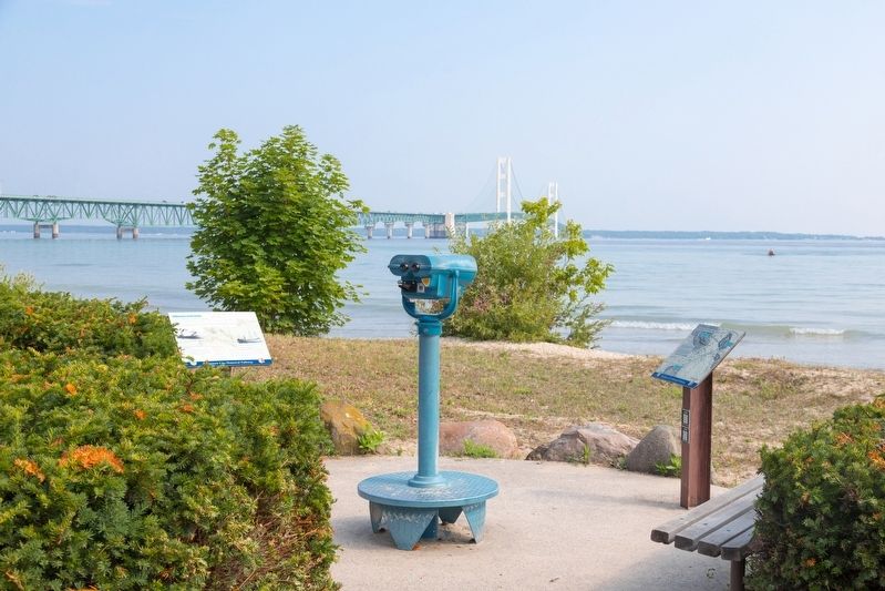
This marker is on the right. The Shipwrecks in the Straits marker is on the left.
More about this marker. This interpretive panel is illustrated with a crop of a 1853 Chart of the Straits map over which the locations of Fort Michilimackinac (here), Fort Mackinac (on Mackinac Island) and Fort De Buade (north of St. Ignace on the upper peninsula) are superimposed.
Credits. This page was last revised on August 25, 2024. It was originally submitted on August 25, 2024, by J. J. Prats of Powell, Ohio. This page has been viewed 185 times since then and 20 times this year. Photos: 1, 2. submitted on August 25, 2024, by J. J. Prats of Powell, Ohio.
