Glennallen in Copper River Census Area, Alaska — Northwest (North America)
Gulkana
(C'UUL C'ENA' IN AHTNA ATHABASCAN)
| — | Lit. 'Eroded River' | — |
Photographed by William Fischer, Jr., August 14, 2024
1. Gulkana Marker
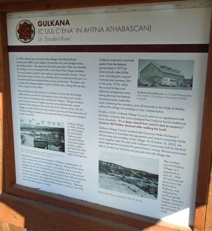
In 1943, without any warning to the villagers, the Alaska Road Commission (ARC) crews began construction of a new bridge across the Gulkana River. The approach from the west side of the river divided the village in two and passed within a few feet of the village cemetery. The road graders pushed rocks right up against people's homes. None of the Ahtna knew what to say, and they did not understand the law in a way that might have enabled them to stop construction. The berm was so steep that village residents could not climb over, cutting off one side of the village from the other.
Beyond destroying the village as a cohesive community, the bridge made Gulkana unsafe during breakup due to flooding and ruined a prime salmon dipnetting area used by the villagers. Village members were forced to move to higher ground and established the current location of the village on the north side of the Gulkana River. The old village was demolished, leaving a barren gravel pad. The destruction of Gulkana Village showed our ancestors that they had become strangers in their own land.
World War II spurred many changes in
this page online
Gulkana received a townsite patent from the federal government in 1971 for land on both sides of the river, including the original townsite and cemetery. But in the early 1970s, when the current bridge and highway realignment were being planned, the federal township trustee ceded the land containing the cemetery and old townsite to the State of Alaska without the village's knowledge or any compensation.
Finally in 2018, Gulkana Village Council came to an agreement with the State of Alaska that acknowledged that Gulkana lost its traditional land unlawfully. "It's a deep cultural hurt, and it's time to correct it," Governor Bill Walker declared after walking the lands.
Gulkana
Photographed by William Fischer, Jr., August 14, 2024
2. Gulkana Marker
[Photo captions, clockwise from left, read]
• Gulkana Village in 1928, showing the 1913 bridge. The Richardson Highway went around Gulkana. Note that Suslota Charlie's cabin, and all of the other houses, are to the right of the highway.
Guy F. Cameron photograph, Alaska Engineering Commission, PCA 131-83, Alaska Historical Library, Juneau.
• Gulkana Roadhouse. A. C. Kuehl Photographs, UAF-2009-1-33, Archives, University of Alaska Fairbanks.
• The northern part of Gulkana Village as it appeared on July 22, 1944. This photograph shows how the Richardson Highway was realigned to cut through the village. Note that Suslota Charlie's cabin is now to the left of the road.
Alaska State Library, Collection, PCA-61-20-40.
Erected by Gulkana Village Council, in collaboration with the Alaska Department of Transportation & Public Facilities.
Topics. This historical marker is listed in these topic lists: Bridges & Viaducts • Indigenous Peoples and Communities • Settlements & Settlers • War, World II. A significant historical date for this entry is July 22, 1944.
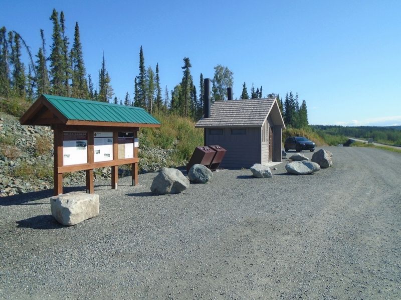
Location. 62° 16.143′ N, 145° 23.438′ W. Marker is in Glennallen in Copper River Census Area, Alaska. It is on Richardson Highway (State Highway 1/4 at milepost 126.6), on the left when traveling north. Marker kiosk is at a roadside comfort station, just west of a bridge over the Gulkana River. Touch for map. Marker is in this post office area: Gakona AK 99586, United States of America. Touch for directions.

Regionally, this marker is on the American Pacific Coast. Globally, it is in North America, on the Pacific Rim, in the Western Hemisphere, in the Western World, and in the Anglosphere. Historically, it finds itself in what was once the Russian Empire.
Other nearby markers. At least 5 other markers are within 4 miles of this marker, measured as the crow flies: Welcome to the Site of the Old Gulkana Village (here, next to this marker); Honoring Our Elders (here, next to this marker); Telegraph Links (approx. 2.8 miles away); Ggax Kucae'e (approx. 2.8 miles away); Gakona Roadhouse (approx. 3.6 miles away).
Also see . . . Gulkana Village: Our History. (Submitted on August 28, 2024, by William Fischer, Jr. of Reynoldsburg, Ohio.)
Credits. This page was last revised on August 28, 2024. It was originally submitted on August 28, 2024, by William Fischer, Jr. of Reynoldsburg, Ohio. This page has been viewed 251 times since then and 27 times this year. Photos: 1, 2. submitted on August 28, 2024, by William Fischer, Jr. of Reynoldsburg, Ohio.
