Near Tignall in Wilkes County, Georgia — The American South (South Atlantic)
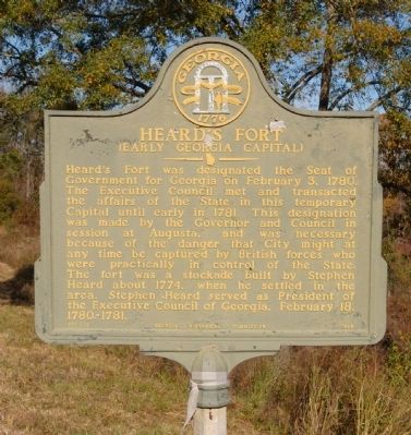
Heard's Fort
(Early Georgia Capital)
Erected 1958 by Georgia Historical Commission. (Marker Number 157-16.)
Topics and series. This historical marker is listed in these topic lists: Colonial Era • Forts and Castles • Government & Politics • Settlements & Settlers • War, US Revolutionary. In addition, it is included in the Georgia Historical Society series list. A significant historical month for this entry is February 1861.
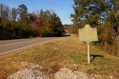
Location. 33° 49.347′ N, 82° 41.546′ W. Marker is near Tignall, Georgia, in Wilkes County. Marker is on Danburg Road (Georgia Route 44) one mile south of Sandtown Road SE, on the right when traveling north. Touch for map. Marker is in this post office area: Tignall GA 30668, United States of America. Touch for directions.
Other nearby markers. At least 8 other markers are within 7 miles of this marker, measured as the crow flies. First Court North of Augusta (approx. one mile away); Fishing Creek Baptist Church (approx. one mile away); The Village of Danburg (approx. 3.9 miles away); Walnut Hill Academy (approx. 4.3 miles away); The Rev. John Springer (approx. 4.3 miles away); Independence United Methodist Church (approx. 4.4 miles away); First Presbyterian Ordination in Georgia (approx. 6.2 miles away); Site of Presbyterian Poplar (approx. 6.2 miles away). Touch for a list and map of all markers in Tignall.
Credits. This page was last revised on June 16, 2016. It was originally submitted on December 14, 2009, by David Seibert of Sandy Springs, Georgia. This page has been viewed 1,750 times since then and 99 times this year. Photos: 1. submitted on December 14, 2009, by David Seibert of Sandy Springs, Georgia. 2. submitted on January 31, 2015, by Brian Scott of Anderson, South Carolina. 3. submitted on December 14, 2009, by David Seibert of Sandy Springs, Georgia. • Craig Swain was the editor who published this page.


