Berwyn in Cook County, Illinois — The American Midwest (Great Lakes)
A Brief History of the Berwyn Park District

Photographed by Sean P. Flynn, August 28, 2024
1. A Brief History of the Berwyn Park District Marker
According to court records 253 men's votes were properly cast for and 141 men's votes were properly cast against said park district. The court records further show that 214 women's votes were properly cast for and 88 women's votes were cast against said park district. The majority of votes cast represented a two-to-one majority in favor of forming
this page online
The original territory of the District as established by referendum was as follows: "On the Northerly side by the right of way of the Illinois Central Railroad on the Easterly side by Ridgeland Avenue on the Southerly side by Ogden Avenue and on the Westerly side by Harlem Avenue all within the said City of Berwyn and Cook County."
The court also decreed that the five persons who received the highest number of votes be elected as Commissioners of the Berwyn Park District. There names were Alban W. Coen, A.J. Dunham, Mrs. H.V. Church, Mrs. Frank Mellish, and Jerry Winholtz.
The last increase in Berwyn Park District territory occurred in 1976 when the District territorial

Photographed by Sean P. Flynn, August 28, 2024
2. A Brief History of the Berwyn Park District Marker
Over the years the monthly Board of Commissioners meetings have been held at various locations including the Berwyn State Bank, Irving School, Berwyn City Hall, Proksa Park, Freedom Park, and the Liberty Cultural Center. The original administration offices were located at Proksa Park but were relocated to their current location at Freedom Park in 1985.
Until 1976 the District owned and maintained one park, Proksa Park, when it purchased a lot on 34th &
Photographed by Sean P. Flynn, August 28, 2024
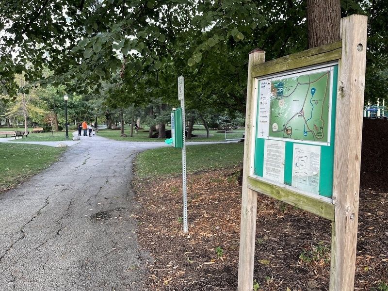
3. Proska Park
The District has also assisted Berwyn School District 100 in building and maintaining several playground areas at Hiawatha, Piper, Komensky, and Emerson Schools.
More information on Berwyn Park District is available at www.berwynparks.org.
Erected by Berwyn
Photographed by Sean P. Flynn, August 28, 2024
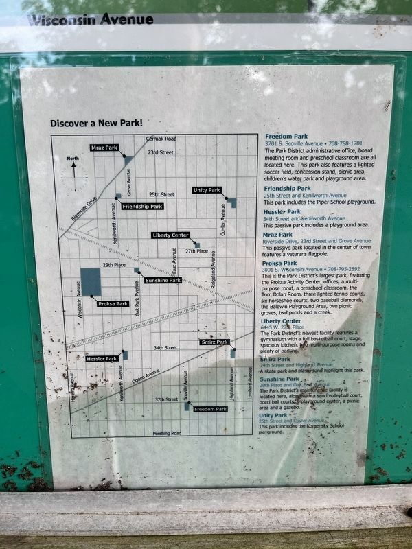
4. Berwyn Park District map
This map, affixed right next to the park history, shows the parks in the Berwyn Park District.
Topics. This historical marker is listed in these topic lists: Education • Government & Politics • Parks & Recreational Areas. A significant historical date for this entry is May 10, 1920.
Location. 41° 50.18′ N, 87° 48.023′ W. Marker is in Berwyn, Illinois, in Cook County. It is on Wisconsin Avenue north of 31st Street, on the left when traveling south. The marker is near the southwest corner of Proksa Park, close to the playground. Touch for map. Marker is at or near this postal address: 3100 Wisconsin Avenue, Berwyn IL 60402, United States of America. Touch for directions.

Regionally, this marker is in Greater Chicago. It is also in the American Midwest. Globally, it is in North

Photographed by Sean P. Flynn, August 28, 2024
5. Proksa Park
The marker is off camera to the left. In the background is the Proksa Park activity center.
Other nearby markers. At least 8 other markers are within walking distance of this marker: World War I Memorial (about 300 feet away, measured in a direct line); Berwyn 9/11 Memorial (about 400 feet away); Proksa Park (about 500 feet away); Arthur J. Dunham Centennial Home (about 600 feet away); a different marker also named A Brief History of the Berwyn Park District (about 600 feet away); Illinois Open Space Lands (approx. 0.4 miles away);

Photographed by Sean P. Flynn, August 28, 2024
6. Proksa Park plaque
This plaque honoring the park's namesake and long-time caretaker is near the center of the park, by the World War I memorial.
More about this marker. An identical marker can be found near the park's southwestern corner.
Regarding A Brief History of the Berwyn Park District. The approximately 15-acre Proksa Park was originally known by names such as Community Park and Berwyn Park before being permanently renamed in 1958 after Joseph Proksa, who retired that year after 30 years as the park superintendent.
There are actually two independent and autonomous park districts inside Berwyn's city limits. Berwyn Park District covers roughly the southern two-thirds of the city south of Cermak Avenue (22nd Street) to its southern border at Pershing Avenue (39th Street), while North Berwyn Park District covers the portion of Berwyn north of Cermak to its northern border at Roosevelt Road.
Also see . . .
1. Proska Park. Official page from the Berwyn Park District (Submitted on August 29, 2024, by Sean P. Flynn of Oak Park, Illinois.)
2. About Berwyn. A history of Berwyn from the city's official website (Submitted on August 29, 2024, by Sean P. Flynn of Oak Park, Illinois.)
Credits. This page was last revised on August 29, 2024. It was originally submitted on August 29, 2024, by Sean P. Flynn of Oak Park, Illinois. This page has been viewed 724 times since then and 92 times this year. Photos: 1, 2, 3, 4, 5, 6. submitted on August 29, 2024, by Sean P. Flynn of Oak Park, Illinois.
