Morristown in Belmont County, Ohio — The American Midwest (Great Lakes)
The Brick Road
The Historic National Road in Ohio
Photographed by Jason Voigt, April 16, 2024
1. The Brick Road Marker
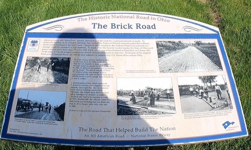
The brick-paving industry derived in Ohio for 50 years, from the 1880s to the 1930s. Ohio has rich deposits of shale and fireclays, the basic materials needed for brick production. By 1893, 44 different companies were producing paving bricks. The annual output, of about 292 million bricks, was enough to pave approximately 600 miles of road (it took about 500,000 bricks to pave a single mile of roadway 25
this page online
A typical paving brick, which measured 9 inches by 4 inches and weighed about 10 pounds, was larger than the conventional brick used in building construction. The larger size helped keep the brick from being dislodged by weather or traffic. The brick also had to be resistant to wear. In 1910, Steubenville city officials noted that their brick-paved streets had cost them less than $1.00 in repairs since they were laid in 1884.
Erected by the Ohio National Road Association.
Topics and series. This historical marker is listed in these topic lists: Industry & Commerce • Roads & Vehicles • War, World I. In addition, it is included in the The Historic National Road series list. A significant historical year for this entry is 1893.
Location. 40° 3.956′ N, 81° 3.751′ W. Marker is in Morristown, Ohio, in Belmont County. It is at the intersection of Main Street/Old National Road and National Road (U.S. 40), on the left when traveling east on Main Street/Old National Road. Touch for map. Marker is at or near this postal address: 101 Old National Rd, Bethesda OH 43719, United States of America. Touch for directions.

Regionally,
Photographed by Jason Voigt, April 16, 2024
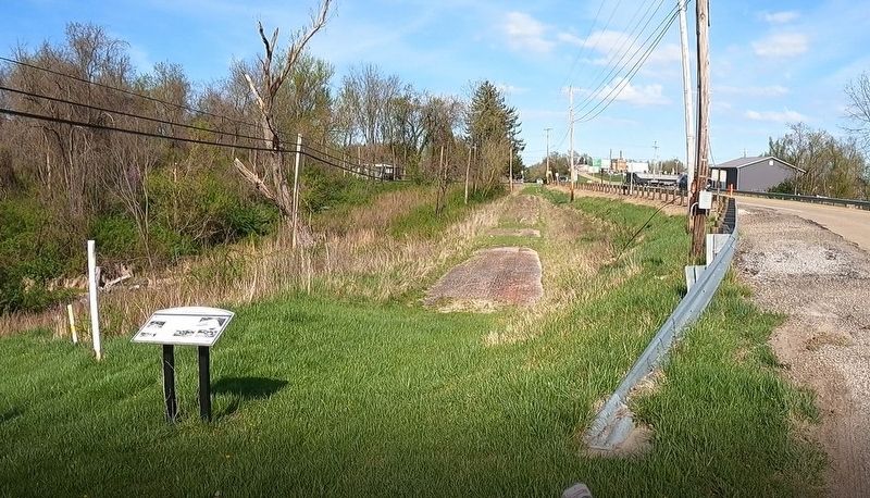
2. The Brick Road Marker
Other nearby markers. At least 8 other markers are within 3 miles of this marker, measured as the crow flies: Morristown (within shouting distance of this marker); Morristown District WWII Roll Of Honor (about 500 feet away, measured in a direct line); Ohio Native Plants (approx. 2.6 miles away); Ohio Buckeye Tree (approx. 2.6 miles away); Mile Marker (approx. 2.6 miles away); a different marker also named Ohio Native Plants (approx. 2.6 miles away); a different marker also named Ohio Native Plants (approx. 2.6 miles away); a different marker also named Ohio Native Plants (approx. 2.6 miles away). Touch for a list and map of all markers in Morristown.
Photographed by Jason Voigt, April 16, 2024
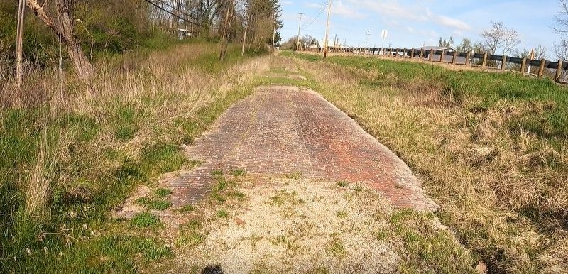
3. Closeup of the brick road
Credits. This page was last revised on August 29, 2024. It was originally submitted on August 29, 2024, by Jason Voigt of Glen Carbon, Illinois. This page has been viewed 390 times since then and 81 times this year. Photos: 1, 2, 3. submitted on August 29, 2024, by Jason Voigt of Glen Carbon, Illinois.
Editor’s want-list for this marker. better quality photo of the marker • Can you help?
