Hurricane in Washington County, Utah — The American Mountains (Southwest)
The History of Hurricane Valley

Photographed by Tom Bosse, July 22, 2024
1. The History of Hurricane Valley Marker
Early History
It is believed the Paiutes moved in Utah about A.D. 1100-1200. They were hunter-gatherers with some limited agriculture. Their first contact with Europeans was probably with the Escalante-Dominguez party in 1776 and then with Jedediah Smith in 1826 and 1827. But then more Europeans came through the area, culminating with settlement by Mormons in the 1850s and later. Native numbers dwindled as they were crowded out and succumbed to diseases. Once numbering in the thousands, the Paiute population reached a low of 800.
The Paiute Indians called the area Timpoweap, “Rock Canyon”. It is a deep gorge where the Virgin River emerges from the Hurricane Fault. The town of Hurricane lied below the fault to the south of the river and the community of La Verkin. Hot sulphur springs boil up from the bottom and sides of the river on the fault line. About one mile below the hot springs the conjoined streams of Ash Creek and La Verkin Creek make a common confluence with the Virgin River. It is a site of great historical significance.
Dominguez and Escalante in 1776 made the first historical reference to American irrigation
this page online
The river has cut deep into the volcanic walls of Timpoweap Canyon, thus making it impossible to take water directly to the table-lands above. However, the soil was fertile and there was good forage, so the pioneer residents of Toquerville and Virgin town were able to use the benchland as range for their herds. There users always dreamed that some day they could get irrigation water onto the flat surface.
Modern History
Hurricane was first settled in 1906, and received its name after a whirlwind blew the top off a buggy in which Erastus Snow was riding. Snow exclaimed, “Well, that was a Hurricane. We’ll name this ‘Hurricane Hill’”.
Hurricane, which is pronounced
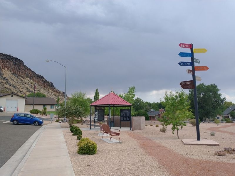
Photographed by Tom Bosse, July 22, 2024
2. The History of Hurricane Valley Marker
The town boasts multiple community parks, dog parks, a city pool, large community center, and several ranked golf courses, two reservoirs noted for bass fishing, recreational boating, paddling, scuba diving, and myriad opportunities for ATV exploration at Sand Mountain and Sand Hollow State Park, and mountain biking over 25 miles of trail around Quail Creek State Park, as well as a small municipal airfield. There are several medical clinics in the area.
Geography & Demographics
According to the United States Census Bureau, the city has a total area of 31.5 square miles (81.7 km2), of which 31.1 square miles (80.6 km2) is land and .4 square mile (1.1 km2) (1.39%) is water.
As

Photographed by Tom Bosse, July 22, 2024
3. The History of Hurricane Valley Marker
[Caption]: Petroglyphs, made by early native peoples
[Caption]: Christy Mill and mill pond. Silver Reef, UT.
[Caption]: Samuel & Elizabeth Isom Home in Hurricane. Completed 1910. Architecture is “Victorian Eclectic” style, typical of the era.
[Caption]: Zion Narrows
[Caption]: The Gateway to Zion and More. National Parks and Monuments: Hurricane is the gateway to Zion, and is a perfect launch pad for exploring Utah’s fabulous collection of national parks and monuments, all within a day’s drive. Here are some travel distances: 58 miles – Cedar Breaks National Monument * 100 miles – Bryce Canyon National Park * 130 miles – Grand Canyon North Rim * 130 miles – Lake Powell.
Sources:
Onlineutah.us/hurricanehisory.shtml
En.wikipedia.org/wiki.Hurricane_Utah
Photos courtesy of the Washington County Historical Society and Public Domain assets
Erected by Rotary International, Hurricane Valley Chapter Sons of Utah Pioneers, Lions International.
Topics and series. This historical marker is listed in these topic lists: Indigenous Peoples and Communities • Settlements & Settlers. In addition, it is included in the Rotary International, and the Sons of Utah Pioneers series lists. A significant historical year for this entry is 1776.
Location. 37° 10.612′ N, 113° 17.07′ W. Marker is in Hurricane, Utah, in Washington County. It is on North 200 E, on the left when traveling north. Touch for map. Marker is in this post office area: Hurricane UT 84737, United States of America. Touch for directions.

Regionally, this marker is in Utah’s Color Country. It is also in the American Southwest, in the Mountain West, and on the Colorado Plateau. Globally, it is in North America, the Rocky Mountains, the Western Hemisphere, the Western World, and the Anglosphere. Historically, it finds itself in what was once New Spain and also Mexico’s Alta California.
Other nearby markers. At least 8 other markers are within walking distance of this marker: The Hurricane Canal: A Feat of Necessity (here, next to this marker); Hurricane Canal Replica (a few steps from this marker); Early Pioneer Granary and Home (approx. 0.2 miles away); Pioneer Hay Barn, Manger, and Corral (approx. 0.2 miles away); Threshing Machine (approx. 0.2 miles away); Shetlar Wagon (approx. 0.2 miles away); Spencer and Helen Isom "Home" (approx. 0.2 miles away); Grain Reaper (approx. 0.2 miles away). Touch for a list and map of all markers in Hurricane.
Credits. This page was last revised on August 31, 2024. It was originally submitted on August 31, 2024, by Tom Bosse of Jefferson City, Tennessee. This page has been viewed 513 times since then and 108 times this year. Photos: 1, 2, 3. submitted on August 31, 2024, by Tom Bosse of Jefferson City, Tennessee. • Andrew Ruppenstein was the editor who published this page.
