Marker Logo
THE HISTORICAL
MARKER DATABASE
“Bite-Size Bits of Local, National, and Global History”
St. Thomas in Elgin County, Ontario — Central Canada (North America)
 

Elgin County Courthouse/ Palais de Justice Elgin County

Governor’s Residence/ Résidence du Gouverneur
 
 
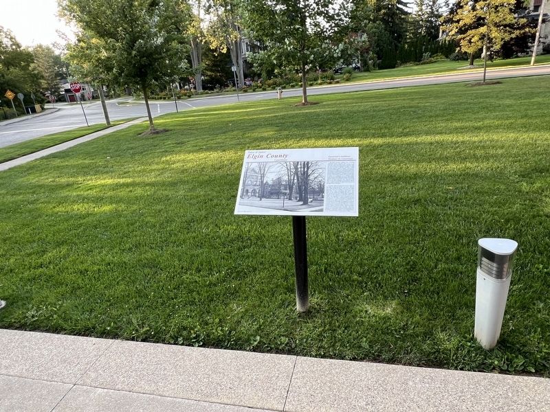
Elgin County Courthouse/ Palais de Justice Elgin County Marker image. Click for full size.
Photographed by Tim Boyd, August 23, 2024
1. Elgin County Courthouse/ Palais de Justice Elgin County Marker
Inscription.  
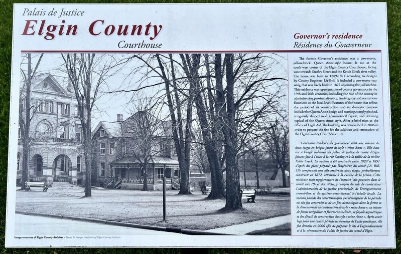
The former Governor's residence was a two-storey, yellow-brick, Queen Anne-style house. It sat at the south-west corner of the Elgin County Courthouse, facing west towards Stanley Street and the Kettle Creek river valley. The house was built in 1889-1891 according to designs by County Engineer J.A Bell. It included a two-storey rear wing that was likely built in 1872 adjoining the jail kitchen. This residence was representative of county governance in the 19th and 20th centuries, including the role of the county in administering provincial justice, land registry and corrections functions at the local level. Features of the house that reflect the period of its construction and its domestic purpose include the Queen Anne design and massing, steeply pitched, irregularly shaped roof, asymmetrical façade, and detailing typical of the Queen Anne style. After a brief stint as the offices of Legal Aid, the building was demolished in 2006 in order to prepare the site for the addition and restoration of the Elgin County Courthouse.

L'ancienne résidence du governeur était une maison de deux étages en brique jaune de style « reine Anne ». Elle était sise à l'angle sud-ouest du palais de justice du comté d'Elgin faisant face à l'ouest à la rue Stanley et à la vallée de la rivière Kettle Creek. La maison a été construite entre 1889 et 1891 d'après des plans préparés par l'ingénieur du comté J.A. Bell. Elle comprenait une aile arrière de deux étages, probablement construite en 1872, attenante à la cuisine de la prison. Cette résidence était représentative de l'exercice des pouvoirs dans le comté aux 19e et 20e siècles, y compris du rôle du comté dans 'administration de la justice provinciale, de l'enregistrement immobilier et du système correctionnel à l'échelle locale. La maison possède des caractéristiques qui témoignent de la période où elle fut construite et de ses fins domestiques dont la forme et la dimension de la construction de style « reine Anne », sa toiture de forme irrégulière et fortement inclinée, sa façade asymétrique et des détails de construction du style « reine Anne ». Après avoir logé pour une courte période les bureaux de l'aide juridique, elle fut démolie en 2006 afin de préparer le site à l'agrandissement et à la rénovation du Palais de justice du comté d'Elgin.
 
Topics.
Paid Advertisement
Click or scan to see
this page online
This historical marker is listed in these topic lists: ArchitectureGovernment & PoliticsLaw Enforcement. A significant historical year for this entry is 1889.
 
Location. 42° 46.505′ N, 81° 12.147′ W. Marker is in St. Thomas, Ontario, in Elgin County. It is at the intersection of Stanley Street and Wellington Street, on the left when traveling south on Stanley Street. Touch for map. Marker is in this post office area: St Thomas ON N5R 3E9, Canada. Touch for directions.

Regionally, this marker is in the Southwest Ontario Area and in Southwestern Ontario. It is also in Central Canada. Globally, it is in North America, the Western Hemisphere, the Western World, and the Anglosphere. Historically, it finds itself in what was once a British colony, the Viceroyalty of New France, the Haudenosaunee (Iroquois) Confederacy, and Rupert’s Land.

Other nearby markers. At least 8 other markers are within walking distance of this marker: A different marker also named Elgin County Courthouse/ Palais de Justice Elgin County (here, next to this marker); Col. the Hon. Thomas Talbot 1771-1853 (within shouting distance of this
Elgin County Courthouse/ Palais de Justice Elgin County Marker image. Click for full size.
Photographed by Tim Boyd, August 23, 2024
2. Elgin County Courthouse/ Palais de Justice Elgin County Marker
marker); Elgin County Courthouse/ Palais de Justice Elgin County (2014) (within shouting distance of this marker); Elgin County Courthouse/ Palais de Justice Elgin County (1898) (within shouting distance of this marker); Elgin County Courthouse/ Palais de Justice Elgin County (1853) (about 90 meters away, measured in a direct line); Elgin County Courthouse / Palais de Justice Elgin County (about 120 meters away); McArthur’s Raid, November 11, 1814 (approx. 0.4 kilometers away); St. Thomas’ Church 1824 (approx. 0.4 kilometers away). Touch for a list and map of all markers in St. Thomas.
 
 
Credits. This page was last revised on September 27, 2024. It was originally submitted on September 1, 2024, by Tim Boyd of Hamilton, Ontario. This page has been viewed 109 times since then and 9 times this year. Photos:   1, 2. submitted on September 1, 2024, by Tim Boyd of Hamilton, Ontario. • Andrew Ruppenstein was the editor who published this page.

m=255655

CeraNet Cloud Computing sponsors the Historical Marker Database.
This website earns income from purchases you make after using our links to Amazon.com. We appreciate your support.
Paid Advertisement
Jul. 13, 2026