Coney Island in Brooklyn in Kings County, New York — The American Northeast (Mid-Atlantic)
Century Playground
2.28 acres
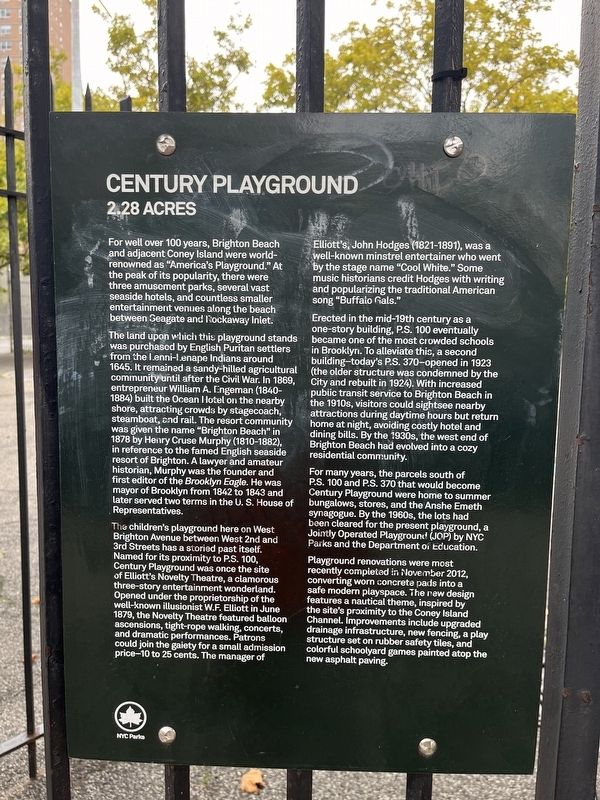
For well over 100 years, Brighton Beach and adjacent Coney Island were world-renowned as "America's Playground." At the peach of its popularity, there were three amusement parks, several vast seaside hotels, and countless smaller entertainment venues along the beach between Seagate and Rockaway Inlet.
The land upon which this playground stands was purchased by English Puritan settlers from the Lenni-Lenape Indians around 1645. IT remained a sandy-hilled agricultural community until after the Civil War. In 1869, entrepreneur William A. Engeman (1840-1884) built the Ocean Hotel on the nearby shore, attracting crowds by stagecoach, steamboat, and rail. The resort community was given the name "Brighton Beach" in 1878 by Henry Cruse Murphy (1810-1882), in reference to the famed English seaside resort of Brighton. A lawyer and amateur historian, Murphy was the founder and first editor of the Brooklyn Eagle. He was mayor of Brooklyn from 1842 to 1843 and later served two terms in the U. S. House of Representatives.
The children's playground here on West Brighton Avenue between West 2nd and 3rd Streets has a storied past
this page online
Erected in the mid-19th century as a one-story building, P.S. 100 eventually one of the most crowded schools in Brooklyn. To alleviate this, a second building—today's P.S. 370—opened in 1923 (the older structure was condemned by the City and rebuilt in 1924). With increased public transit service to Brighton Beach in the 1910s, visitors could sightsee nearby attractions during daytime hours but return home at night, avoiding costly hotel and dining bills. By the 1930s,
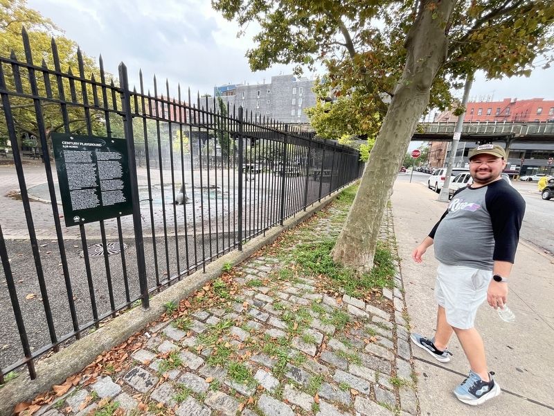
For many years, the parcels south of P.S. 100 and P.S. 370 that would become Century Playground were home to summer bungalows, stores, and the Anshe Emeth synagogue. By the 1960, the lots had been cleared for the present playground, a Jointly Operated Playground (JOP) by NYC Parks and the Department of Education.
Playground renovations were most recently completed in November 2012, converting worn concrete pads into a safe modern playspace. The new design features a nautical theme, inspired by the site's proximity to the Coney Island Channel. Improvements include upgraded drainage infrastructure, new fencing, a play structure set on rubber safety tiles, and color schoolyard games painted atop the new asphalt paving.
Erected by NYC Parks.
Topics and series. This historical marker is listed in these topic lists: Education • Entertainment • Parks & Recreational Areas. In addition, it is included in the NYC Parks series list. A significant historical month for this entry is June 1879.
Location. 40° 34.616′ N, 73° 58.222′ W. Marker is in Brooklyn, New York, in Kings County. It is on Coney Island. It is on West 2nd Street north of West Brighton Avenue, on the left when traveling south. Touch for map. Marker is at or near this postal address: 3055 W 2nd St, Brooklyn NY 11224, United States of America. Touch for directions.

Regionally, this marker is in New York City and on Long Island. It is also in the American Northeast, in the Mid-Atlantic, and on the Eastern Seaboard. Globally, it is in the North Atlantic Region, North America, the Western Hemisphere, the Western World, and the Anglosphere. Historically, it finds itself in what was once New Netherland and also one of the original Thirteen Colonies.
Other nearby markers. At least 8 other markers are within walking distance of this marker: Theodore Roosevelt Memorial (about 700 feet away, measured in a direct line); Private William J. Hennessy Memorial (approx. 0.2 miles away); In Memoriam (approx. 0.2 miles away); The History of the New York Aquarium (approx. 0.4 miles away); Highlights and Mishaps (approx. 0.4 miles away); The Record-Breaking Dive (approx. 0.4 miles away); The First Dives (approx. 0.4 miles away); Pioneers of the Deep (approx. 0.4 miles away). Touch for a list and map of all markers in Brooklyn.
Credits. This page was last revised on September 2, 2024. It was originally submitted on September 2, 2024, by Devry Becker Jones of Washington, District of Columbia. This page has been viewed 239 times since then and 24 times this year. Photos: 1, 2. submitted on September 2, 2024, by Devry Becker Jones of Washington, District of Columbia.
