Pre-Emption in Geneva in Ontario County, New York — The American Northeast (Mid-Atlantic)
Site of Kanadesaga

Photographed by Howard C. Ohlhous, December 3, 2025
1. Site of Kanadesaga Marker
The Seneca Nation
Destroyed Sept. 7, 1779,
In Gen. John Sullivan's
Raid
Erected 1932 by State Education Department.
Topics. This historical marker is listed in these topic lists: Forts and Castles • Indigenous Peoples and Communities • War, US Revolutionary. A significant historical date for this entry is September 7, 1779.
Location. 42° 52.652′ N, 77° 0.716′ W. Marker is in Geneva, New York, in Ontario County. It is in Pre-Emption. It can be reached from the intersection of Castle Road (County Road 4) and Pre Emption Road (County Road 6), on the right when traveling east. Touch for map. Marker is at or near this postal address: 803 Castle Road, Geneva NY 14456, United States of America. Touch for directions.

Regionally, this marker is in Upstate New York, specifically in Western New York, in the Finger Lakes, and in the Rochester Metropolitan Area. It is also in the American Northeast and in the Mid-Atlantic. Globally, it is in North America, the Western Hemisphere, the Western World, and the Anglosphere. Historically, it finds itself in what was once the Haudenosaunee (Iroquois)
this page online
Other nearby markers. At least 8 other markers are within 2 miles of this marker, measured as the crow flies: Kan-a-de-sa-ga (within shouting distance of this marker); a different marker also named Kan-a-de-sa-ga (within shouting distance of this marker); Kanadesaga (within shouting distance of this marker); Smith Observatory (approx. 0.6 miles away); Washington Street (approx. 1½ miles away); Soldiers • Sailors Memorial Library (approx. 1½ miles away); Pulteney Land Office (approx. 1.6 miles away); Smith's Opera House (approx. 1.6 miles away). Touch for a list and map of all markers in Geneva.
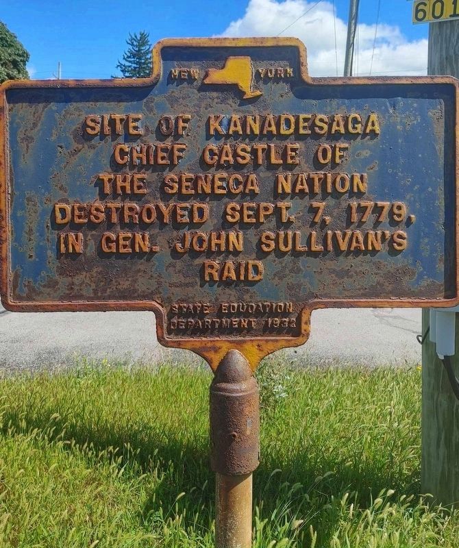
Photographed by James Turcotte, September 2, 2024
2. Site of Kanadesaga Marker

Photographed by Howard C. Ohlhous, December 3, 2025
3. Site of Kanadesaga Marker
This view is looking east along Castle Road toward the intersection with Pre Emption Road.

Photographed by James Turcotte, September 2, 2024
4. Site of Kanadesaga Marker
Credits. This page was last revised on December 4, 2025. It was originally submitted on September 2, 2024, by James Turcotte of Phelps, New York. This page has been viewed 688 times since then and 179 times this year. Photos: 1. submitted on December 4, 2025, by Howard C. Ohlhous of Duanesburg, New York. 2. submitted on September 2, 2024, by James Turcotte of Phelps, New York. 3. submitted on December 4, 2025, by Howard C. Ohlhous of Duanesburg, New York. 4. submitted on September 2, 2024, by James Turcotte of Phelps, New York. • Devry Becker Jones was the editor who published this page.
