Guilderland in Westmere in Albany County, New York — The American Northeast (Mid-Atlantic)
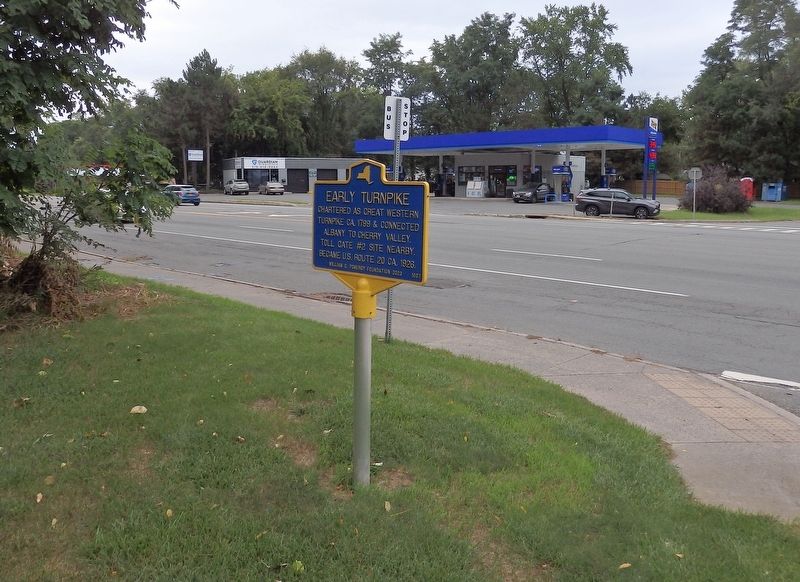
Early Turnpike

Photographed by William Kidd, August 29, 2024
1. Early Turnpike Marker
Turnpike ca. 1799 & connected
Albany to Cherry Valley.
Toll Gate #2 site nearby.
Became U.S. Route 20 ca. 1926.
Erected 2023 by Guilderland Historical Society; William G. Pomeroy Foundation. (Marker Number 1007.)
Topics. This historical marker is listed in these topic lists: Industry & Commerce • Roads & Vehicles. A significant historical year for this entry is 1799.
Location. 42° 41.717′ N, 73° 52.879′ W. Marker is in Westmere, New York, in Albany County. It is in Guilderland. It is at the intersection of Western Avenue (U.S. 20) and Highwood Circle, on the left when traveling west on Western Avenue. Touch for map. Marker is in this post office area: Albany NY 12203, United States of America. Touch for directions.

Regionally, this marker is in Upstate New York, in the Capital District, and in the Albany Metropolitan Area. It is also in the American Northeast and in the Mid-Atlantic. Globally, it is in North America, the Western Hemisphere, the Western World, and the Anglosphere. Historically, it finds itself in what was once New Netherland and also one of the
this page online
Other nearby markers. At least 8 other markers are within 2 miles of this marker, measured as the crow flies: Hamilton Glass House (approx. 1.2 miles away); Rose Hill 1842 (approx. 1.3 miles away); Red Men’s Hall (approx. 1.4 miles away); Rapp Road Community (approx. 1½ miles away); Site of Hamilton Union Church (approx. 1½ miles away); Schoolcraft House (approx. 1.6 miles away); Glass Works (approx. 1.6 miles away); Henry Rowe Schoolcraft (approx. 1.6 miles away).
Also see . . . Great Western Turnpike, and McKownville (McKownville Improvement Association). Some history of this eastern section of the Turnpike, including an old photo of Tollgate No. 2 (Submitted on September 3, 2024, by William Kidd of Albany, New York.)
Photographed by William Kidd, August 29, 2024
2. Early Turnpike Marker
Credits. This page was last revised on September 9, 2026. It was originally submitted on September 3, 2024, by William Kidd of Albany, New York. This page has been viewed 270 times since then and 60 times this year. Photos: 1, 2. submitted on September 3, 2024, by William Kidd of Albany, New York. • Michael Herrick was the editor who published this page.
