
Mount Sylvan near Garden Valley in Smith County, Texas — The American South (West South Central)
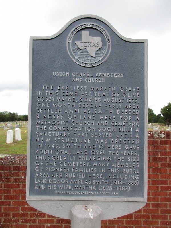
Union Chapel Cemetery and Church
Photographed by Jeff Leichsenring, September 1, 2024
1. Union Chapel Cemetery and Church Marker
The earliest marked grave in this cemetery, that of Olive Cosby Mayne, is dated August 1873, one month before early area settler Amplias Smith deeded 3 acres of land here for a Methodist Church and cemetery. The congregation soon built a sanctuary that served until a new structure was erected in 1949. Smith and others gave additional land over the years, thus greatly enlarging the size of the cemetery. Many members of pioneer families in this rural area are buried here, including land donor Amplias Smith (1813-1888) and his wife, Martha (1825-1883).
Erected 1986 by Texas Historical Commission. (Marker Number 7765.)
Topics. This historical marker is listed in these topic lists: Cemeteries & Burial Sites • Religion & Religious Structures.
Location. 32° 31.45′ N, 95° 35.478′ W. Marker is near Garden Valley, Texas, in Smith County. It is in Mount Sylvan. It is on State Road 110 near County Road 447, on the left when traveling west. SH 110, 3 mi. west of Garden Valley. Touch for map. Marker is at or near this postal address: 20123
this page online

Regionally, this marker is in the American South, specifically in the Deep South, and in the Piney Woods. Globally, it is in North America, a Gulf of Mexico state, the Western Hemisphere, the Western World, and the Anglosphere. Historically, it finds itself in what was once New Spain, the Republic of Texas, one of the Confederate States of America, and the Antebellum South.
Other nearby markers. At least 8 other markers are within 3 miles of this marker, measured as the crow flies: Van Common School (approx. 2.3 miles away); Van School, 1929-1947 (approx. 2.4 miles away); C.S. Nicks (approx. 2.7 miles away); Van (approx. 2.9 miles away); Swindall School (approx. 2.9 miles away); Garden Valley (approx. 2.9 miles away); Jarman No. 1 Discovery Well (approx. 2.9 miles away); Van United Methodist Church (approx. 2.9 miles away).
Photographed by Jeff Leichsenring, September 1, 2024
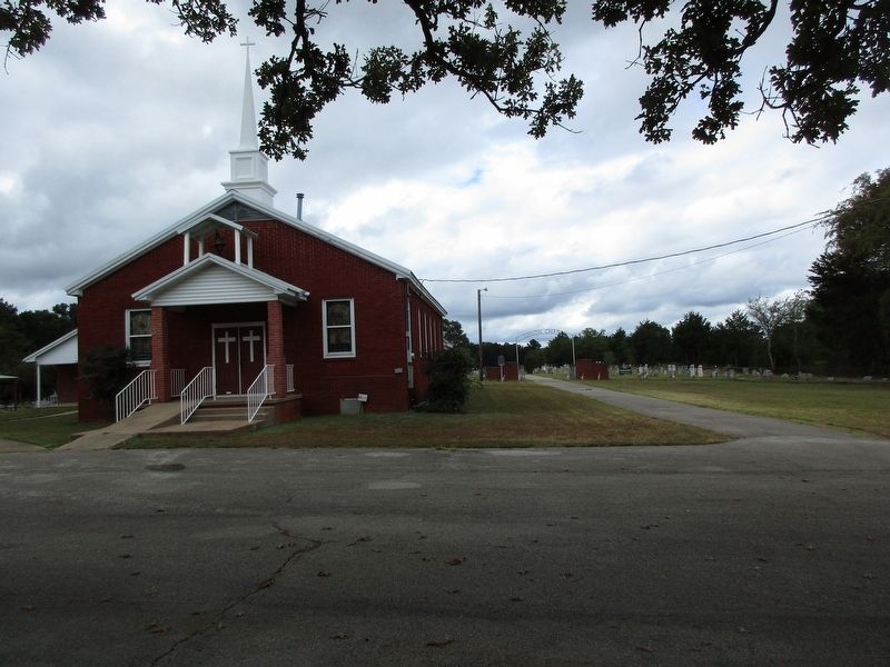
2. Union Chapel Cemetery and Church Marker
Credits. This page was last revised on July 22, 2025. It was originally submitted on September 3, 2024, by Jeff Leichsenring of Garland, Texas. This page has been viewed 798 times since then and 95 times this year. Photos: 1, 2. submitted on September 3, 2024, by Jeff Leichsenring of Garland, Texas. • James Hulse was the editor who published this page.
