
Jellico in Campbell County, Tennessee — The American South (East South Central)
Civil War in Tennessee
War in the Mountains
Photographed by Don Morfe, April 17, 2014
1. Civil War in Tennessee Marker
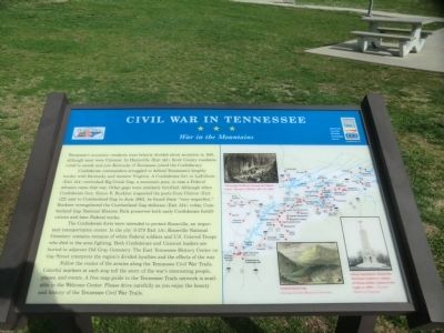
Tennessee’s mountain residents were bitterly divided about secession in 1861, although most were Unionist. In Huntsville (Exit 141), Scott County residents voted to secede and join Kentucky if Tennessee joined the Confederacy.
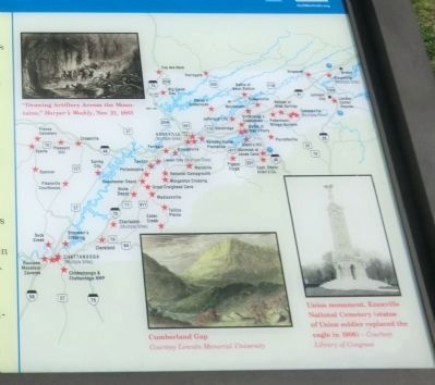
Confederate commanders struggled to defend Tennessee’s lengthy border with Kentucky and western Virginia. A Confederate fort in LaFollette (Exit 134) overlooked Big Creek Gap, a mountain pass, in case a Federal advance came that way. Other gaps were similarly fortified. Although when Confederate Gen. Simon B. Buckner inspected the posts from Clinton (Exit 122) east to Cumberland Gap in June 1863, he found them “very imperfect.” Buckner strengthened the Cumberland Gap defenses (Exit 134); today, Cumberland Gap National Historic Park preserves both early Confederate fortifications and later Federal works.
The Confederate forts were intended to protect Knoxville, an important transportation center. In the city (I-275 Exit 1A), Knoxville National Cemetery contains remains of white Federal soldiers and U.S. Colored Troops who died in the area fighting. Both Confederate and Unionist leaders are
this page online
Follow the routes of the armies along the Tennessee Civil War Trails. Colorful markers at each stop tell the story of the war’s interesting people, places, and events. A free map guide to the Tennessee Trails network is available in the Welcome Center. Please drive carefully as you enjoy the beauty and history of the Tennessee Civil War Trails.
Erected by Tennessee Civil War Trails.
Topics and series. This historical marker is listed in this topic list: War, US Civil. In addition, it is included in the Tennessee Civil War Trails series list. A significant historical month for this entry is June 1863.
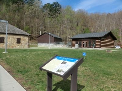
Location. Marker has been permanently removed. It was located near 36° 35.318′ N, 84° 6.358′ W. Marker was in Jellico, Tennessee, in Campbell County. It could be reached from Interstate 75 north of 5th Street (U.S. 25W), on the right when traveling south. Located in front of the Tennessee Welcome Center. Touch for map. Marker was in this post office area: Jellico TN 37762, United
Photographed by Don Morfe, April 17, 2014
2. Close up of map shown on the marker
We have been informed that this marker is no longer there and will not be replaced. This page is an archival view of what was.
Regionally, this marker was in East Tennessee and in the Cumberland Plateau. It was also in the American South, specifically in the Upper South, in Appalachia, and specifically in Southern Appalachia. Globally, it was in North America, the Western Hemisphere, the Western World, and the Anglosphere. Historically, it found itself in what was once the original Cherokee Nation, the territory of the Mississippian Culture, one of the Confederate States of America, and the Antebellum South.

Other nearby markers. At least 8 other markers are within 2 miles of this location, measured as the crow flies: Tennessee Civil War Trails (here, next to this marker); All Veterans Memorial (within shouting distance of this marker); Grace Moore (approx. 1.1 miles away); Tennessee - Campbell County / Kentucky (approx. 1.1 miles away); Kirby Smith Invades Kentucky (approx. 1.1 miles away); Tramell Building (approx. 1.2 miles away); Jellico Area Veterans Memorial (approx. 1.2 miles away); James (Jim) Tidwell, Jr.
Photographed by Don Morfe, April 17, 2014
3. Civil War in Tennessee Marker
Credits. This page was last revised on September 4, 2024. It was originally submitted on June 7, 2014, by Don Morfe of Baltimore, Maryland. This page has been viewed 1,598 times since then and 46 times this year. Last updated on September 4, 2024, by Craig Doda of Napoleon, Ohio. Photos: 1, 2, 3. submitted on June 7, 2014, by Don Morfe of Baltimore, Maryland. • Devry Becker Jones was the editor who published this page.
