Rowlesburg in Preston County, West Virginia — The American South (Appalachia)
Battle of Rowlesburg
April 26, 1863
| — | Establishing a Defense of the B&O | — |
Photographed by Craig Swain, July 24, 2010
1. Panel 1 of Kiosk
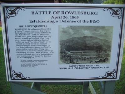
Illustration is from Harper's Weekly, August 3, 1861, depicting General Hill's Headquarters in Rowlesburg, p. 487. (Which differs from the cited page number in the marker text.)
The bridge, which was a composite (wood and iron through-truss designed by Fink, is depicted somewhat inaccurately by the artist since it shows the sides covered, as well as the roof, and does not include the wrought iron laterals. See Workman, May 2005.)
this page online
After arriving in Grafton on June 23, 1861 General George McClellan decided to establish a strong position at Philippi and protect his line of supply, the B&O. McClellan, who had served as chief engineer for the Illinois Central Railroad and was intimately familiar with the B&O, assigned forty-eight companies to guard it. To protect the costly Cheat River Bridge and viaducts he posted an entire regiment, the 1st Virginia Infantry, fresh from its victory at Philippi, at Rowlesburg, after visiting the isolated town in person.
Fearing that McClellan would augment his force along the B&O in Northern Virginia, and then use the rail line to advance to Harpers Ferry in support of an invasion of eastern Virginia, Confederates, led by General Robert E. Lee made plans to cut the B&O. They resolved to demolish the B&Os viaducts
Photographed by Craig Swain, July 24, 2010
2. Panel 2 of Kiosk
Cheat Bridges Become Target
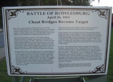
Under McClellan's orders, General Charles E. Hill's Union forces prepared their defensive positions at and near Rowlesburg.
Colonel James Irvine was assigned the duty of protecting the railroad bridge and trestles at Rowlesburg, as well as the Northwestern Turnpike Bridge four miles up the Cheat River. Irvine established his headquarters at the turnpike bridge, which was protected by an advance guard of two companies under Captain Donlon and Captain Chapman. These troops, some two hundred men, built breast works and quartered on this covered bridge. A telegraph line linked Irwin's advance position to the main force at Rowlesburg.
On July 3, 1861 General Hill and staff, accompanied by Captain I.M. Pumphrey, Quartermaster of the 1st Virginia, made a tour of inspection of the Rowlesburg positions. Informing readers of this inspection
Photographed by Craig Swain, July 24, 2010
3. Panel 3 of Kiosk
Jones Elects Two-prong Attack
"Worth to us an Army..." Rowlesburg and Cannon Hill are in the Civil War, Historical Research Project. Prepared by Michael E. Workman, West Virginia University, for the Rowlesburg Area Historical Society with support from the West Virginia Department of Transportation, May 2006. Excerpted by Timothy Weaver, Professor Emeritus, Boston University.
Photographed by Craig Swain, July 24, 2010
4. Panel 4 of Kiosk
Jones' Attack Fails
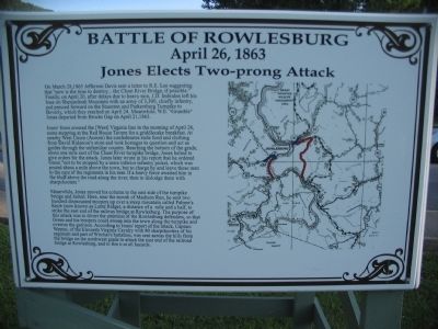
Jones' force crossed the [West] Virginia line in the morning of April 26, some stopping at the Red House Tavern for a griddlecake breakfast. At nearby West Union (Aurora) the confederates stole food and clothing from David Ridenour's store and took hostages to question and act as guides through the unfamiliar country. Reaching the bottom of the grade, about one mile east of the Cheat River turnpike bridge, Jones halted to give orders for the attack. Jones later wrote in his report that he ordered Green "not to be stopped by a mere inferior infantry picket, which was posted about a mile above the town, but to charge by and leave these men to the care of the regiments in his rear. If a heavy force awaited him in the bluff above the road along the river, then to dislodge them with sharpshooters."
Meanwhile, Jones moved his column to the east side of the turnpike bridge and halted.
Photographed by Craig Swain, July 24, 2010
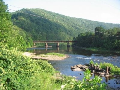
5. Cheat River Bridge
A modern steel bridge stands near where the wartime wood and iron bridge stood.
Photographed by Craig Swain, July 24, 2010
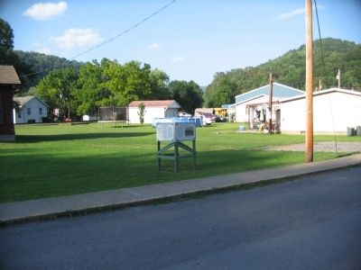
6. Battle of Rowlesburg Marker
Original location on Poplar St.
Citizens of the town armed with a variety of weapons joined the soldiers. Showalter also sent a detachment of about 20 men under Sergeant Gallion of Company F and Lieutenant McDonald of Company L to guard the St. George pike, where Col. Green's detachment was approaching. This force took a position in some rifle pits on a steep hill overlooking the river road where it narrowed about one mile outside of town.
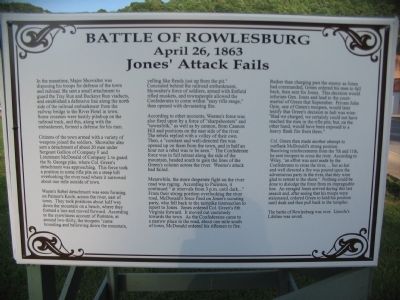
Weem's Rebel detachment was seen forming on Palmer's Knob, across the river, east of town. They took positions about half way down the mountain on a bench, where they formed a line and moved forward. According to the eyewitness account of Purinton, at around two-thirty, the troopers "came bounding and bellowing down the mountain, yelling like fiends just up from the pit." Concealed behind the railroad embankment, Showalter's force of soldiers, armed with Enfield rifled muskets, and townspeople allowed the Confederates to come within "easy rifle range," then opened with devastating fire.
According to other accounts, Weems's force was also fired upon by a force of "sharpshooters"
Photographed by Bradley Owen, May 26, 2022
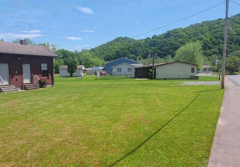
7. Battle of Rowlesburg Marker
Marker has been moved from this location on Poplar St to E Main St.
Meanwhile, the more desperate fight on the river road was raging. According to Purinton, it continued "at intervals from 3 p.m. until dark...." From their strong position overlooking the river road, McDonald's force fired on Jones's scouting party, who fell back to the turnpike intersection to report to Jones. Jones ordered Col. Green's 6th Virginia forward. It moved out cautiously toward the town. As the Confederates came to a narrow place in the road, about one mile south of town, McDonald ordered his riflemen to fire.
Rather than charging past the enemy as Jones had commanded, Green ordered his men to fall back, then sent for Jones. This decision would infuriate Gen. Jones and lead to
Photographed by Devry Becker Jones (CC0), October 27, 2023
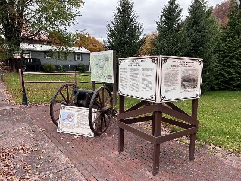
8. Battle of Rowlesburg Marker
Relocated from Poplar St to E Main St
Col. Green then made another attempt to outflank McDonald's strong position. Receiving reinforcements from the 7th and 11th he sent troopers to cross the river. According to Wiley, "an effort was next made by the Confederates to cross the river, ... but so hot and well directed a fire was poured upon the adventurous party in the river, that they were glad to retreat to the shore." Nothing could be done to dislodge the force from its impregnable line. An enraged Jones arrived during this last assault and, after seeing that his troops were stalemated, ordered Green to hold his position until dusk and then pull back to the turnpike.
The battle of Rowlesburg was over. Lincoln's Lifeline was saved.
Topics. This historical marker is listed in this topic list: War, US Civil. A significant historical date for this entry is April 26, 1863.
Location. This marker has been replaced by another marker nearby. It was located near 39° 20.773′ N, 79° 40.166′ W. Marker was in Rowlesburg, West Virginia, in Preston County. It was at the intersection of Poplar Street and South Buffalo Street (West Virginia Route 72), on the left when traveling east on Poplar Street. Touch for map. Marker was at or near this postal address: 15 Poplar St, Rowlesburg WV 26425, United States of America. Touch for directions.

Regionally, this marker was in the American South, specifically in the Upper South, in Appalachia, and specifically in Northern Appalachia. Globally, it was in North America, the Western Hemisphere, the Western World, and the Anglosphere. Historically, it found itself in what was once the territory of the Mississippian Culture.
Other nearby markers. At least 8 other markers are within walking distance of this location: Civil War Memorial (a few steps from this marker); Rowlesburg Veterans Memorial (within shouting distance of this marker); Downtown Rowlesburg (within shouting distance of this marker); Tray Run Viaduct (within shouting distance of this marker); 32 South Church Street (about 400 feet away, measured in a direct line); 34 South Church Street (about 400 feet away); Independent Order of Odd Fellows Building and Property (about 400 feet away); Rowlesburg Post Office Postmasters (about 400 feet away). Touch for a list and map of all markers in Rowlesburg.
More about this marker. This marker was moved from this location in front of the Rowlesburg B&O Depot Museum 700 ft NE to E Main St.
Related markers. Click here for a list of markers that are related to this marker. Battle of Rowlesburg by Markers (including new version of this marker in a new location).
Also see . . . Cannon Hill - Rowlesburg. West Virginia Tourism website entry (Submitted on June 4, 2024, by Larry Gertner of New York, New York.)
Additional commentary.
1.
In this sentence on the marker, “A telegraph line linked Irwin's advance position to the main force at Rowlesburg,” Irwin is not fully identified. Is “Inwin” an error? Was “Irvine” the correct name?
— Submitted August 15, 2024, by Carl Gordon Moore Jr. of North East, Maryland.
Credits. This page was last revised on September 6, 2024. It was originally submitted on August 4, 2010, by Craig Swain of Leesburg, Virginia. This page has been viewed 2,982 times since then and 146 times this year. Last updated on September 5, 2024, by Carl Gordon Moore Jr. of North East, Maryland. Photos: 1, 2, 3, 4, 5, 6. submitted on August 4, 2010, by Craig Swain of Leesburg, Virginia. 7. submitted on May 27, 2022, by Bradley Owen of Morgantown, West Virginia. 8. submitted on October 28, 2023, by Devry Becker Jones of Washington, District of Columbia. • Bernard Fisher was the editor who published this page.
