Warm Springs in Bath County, Virginia — The American South (Mid-Atlantic)
Terrill Hill
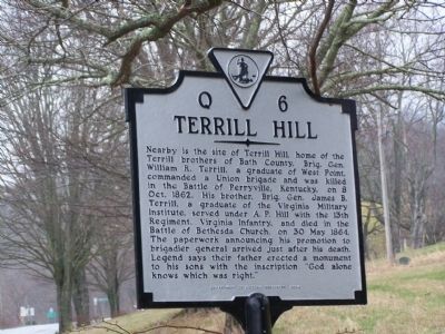
Photographed by Beverly Pfingsten, March 27, 2009
1. Terrill Hill Marker
Erected 2004 by Department of Historic Resources. (Marker Number Q-6.)
Topics and series. This historical marker is listed in this topic list: War, US Civil. In addition, it is included in the Virginia Department of Historic Resources (DHR) series list. A significant historical date for this entry is May 30, 1864.
Location. 38° 3.102′ N, 79° 47.109′ W. Marker is in Warm Springs, Virginia, in Bath County. It is at the intersection of Mountain Valley Road (Virginia Route 39) and Old Germantown
this page online

Regionally, this marker is in Virginia’s Shenandoah Valley, in the Alleghany Highlands, and specifically in the Potomac Highlands. It is also in the American South, specifically in the Upper South, in Appalachia, and specifically in Southern Appalachia. Globally, it is in North America, the Western Hemisphere, the Western World, and the Anglosphere. Historically, it finds itself in what was once the territory of the Mississippian Culture, one of the original Thirteen Colonies, one of the Confederate States of America, and the Antebellum South.
Other nearby markers. At least 8 other markers are within walking distance of this marker: The Rev. Dr. William H. Sheppard (approx. 0.2 miles away); Welcome (approx. ¼ mile away); Warm Springs Baths (approx. ¼ mile away); Early Bath County Courthouses (approx. ¼ mile away); Mary Johnston (approx. 0.3 miles away); Overshoot Wheel (approx. 0.4 miles away); Waterwheel Restaurant Building
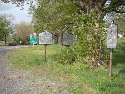
Photographed by J. J. Prats, May 2, 2010
2. Terrill Hill Marker (Center) and Two Others
More about this marker. Marker has been moved 500 yds SW of its original location on US-220/Sam Snead Hwy US-220 (GPS 38.05308, -79.78043).
Also see . . . William R. Terrill. Wikipedia biography of William. (Submitted on August 18, 2009, by Craig Swain of Leesburg, Virginia.)
Credits. This page was last revised on September 8, 2024. It was originally submitted on August 17, 2009, by Bill Pfingsten of Bel Air, Maryland. This page has been viewed 1,781 times since then and 69 times this year. Last updated on September 8, 2024, by Dave W of Co, Colorado. Photos: 1. submitted on August 17, 2009, by Bill Pfingsten of Bel Air, Maryland. 2. submitted on May 4, 2010, by J. J. Prats of Powell, Ohio. • Bernard Fisher was the editor who published this page.
