
Harpers Ferry in Jefferson County, West Virginia — The American South (Appalachia)
Capture of Harpers Ferry
September 15, 1862
| — | No. 2 | — |
Photographed by Craig Swain, August 12, 2007
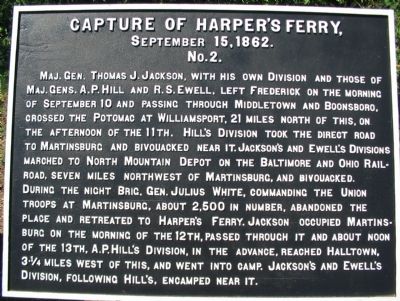
1. Capture of Harpers Ferry (War Department Tablet No. 2) Marker
Maj. Gen. Thomas J. Jackson, with his own Division and those of Maj. Gen. A. P. Hill and R. S. Ewell, left Frederick on the morning of September 10 and passing through Middletown and Boonsboro crossed the Potomac at Williamsport, 21 miles north of this. On the afternoon of the 11th, Hill’s Division took the direct road to Martinsburg and bivouacked near it. Jackson’s and Ewell’s Divisions marched to North Mountain Depot on the Baltimore and Ohio Railroad seven miles Northeast of Martinsburg, and bivouacked. During the night Brig. Gen. Julius White, commanding the Union troops at Martinsburg, about 2,500 in number, abandoned the place and retreated to Harpers Ferry. Jackson occupied Martinsburg on the morning of the 12th, passed through it and about noon of the 13th A. P. Hill’s Division, in the advance, reached Halltown, 3¾ miles West of this and went into camp. Jackson's and Ewell’s Division following Hill’s, encamped near it.
Erected by Antietam Battlefield Board. (Marker Number No. 2.)
Topics and series. This historical marker is listed in this topic list: War, US Civil. In addition, it is included in the
this page online
Location. 39° 19.376′ N, 77° 43.744′ W. Marker is in Harpers Ferry, West Virginia, in Jefferson County. It is on South Potomac Street, on the right when traveling east. Inside Harpers Ferry National Historical Park. Located on just past the railroad overpass, at the overlook to the juncture of the Potomac and Shenandoah Rivers at the location commonly known as “The Point.”. Touch for map. Marker is at or near this postal address: 814 Shenandoah St, Harpers Ferry WV 25425, United States of America. Touch for directions.

Regionally, this marker is in the Washington Metropolitan Area and in the Eastern Panhandle. It is also in the American South, specifically in the Upper South, in Appalachia, and specifically in Northern Appalachia. Globally, it is in North America, the Western Hemisphere, the Western World, and the Anglosphere. Historically, it finds itself in what was once the territory of the Mississippian Culture and also the Antebellum South.
Other nearby markers. At least 8 other markers are within walking distance of
Photographed by Craig Swain, September 22, 2007
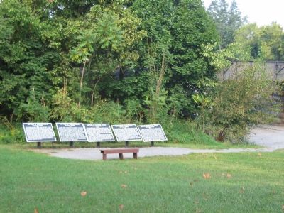
2. Five War Department Tablets at The Point of Harpers Ferry
Regarding Capture of Harpers Ferry. This is one of five tablets at Harpers Ferry describing the action here related to the Battle of Antietam.
Also see . . . 1862 Battle of Harpers Ferry. National Parks Service Site describing the battle. (Submitted on September 26, 2007, by Craig Swain of Leesburg, Virginia.)
The Capture and Execution of John Brown: A tale of Martyrdom by Elijah Avey
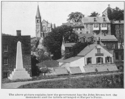
3. The Capture of Harpers Ferry Markers
Photographed by Craig Swain, September 22, 2007
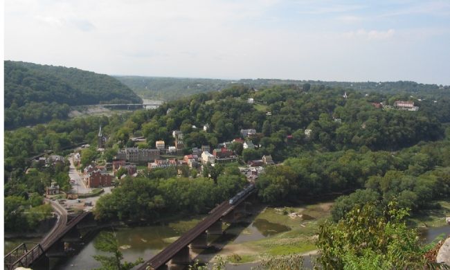
4. Harpers Ferry
Seen from Maryland Heights, the old town of Harpers Ferry rests at the confluence of the Potomac and Shenandoah Rivers. This was Jackson's objective, discussed on the marker. The line of advance for Jackson's forces was from Martinsburg and Halltown in the distance off to the right.
Credits. This page was last revised on September 9, 2024. It was originally submitted on September 26, 2007, by Craig Swain of Leesburg, Virginia. This page has been viewed 1,781 times since then and 29 times this year. Last updated on September 9, 2024, by Carl Gordon Moore Jr. of North East, Maryland. Photos: 1, 2. submitted on September 26, 2007, by Craig Swain of Leesburg, Virginia. 3. submitted on August 26, 2011, by Howard C. Ohlhous of Duanesburg, New York. 4. submitted on September 26, 2007, by Craig Swain of Leesburg, Virginia. • Devry Becker Jones was the editor who published this page.
