Dana Point in Orange County, California — The American West (Pacific Coastal)
The Richfield Tower
Bright and Tall Over Dana Point
October 3, 2021
1. The Richfield Tower Marker
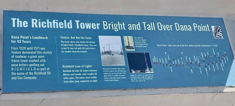
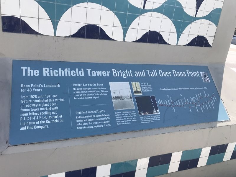
Dana Point's Landmark for 43 Years
From 1928 until 1971 one feature dominated this stretch of roadway: a giant open-frame tower marked with the neon letters spelling out R-I-C-H-F-I-E-L-D as part of the name of the Richfield Oil and Gas Company.
Similar, But Not the Same
The tower above you echoes the design of Dana Point's Richfield tower. This one is just 31 feet tall with 30-inch letters-far smaller than the original.
Richfield Lane of Lights
Richfield Oil build 36 towers between Mexico and Canada, each roughly 50 miles apart. The towers were visible from miles away, especially at night.
photo captions:
· Dana Point’s Richfield Tower stood on PCH at what is now the ARCO gas station you can see from here. This photo shows it in 1969, two years before it was taken down to widen Pacific Coast Highway.
· This 1929 ad from Aero Digest Magazine shows the location of all Richfield Towers.
· Topped with a beacon, the original 125-foot tall towers blazed at night with eight-foot neon letters. Boaters recall seeing Dana Point’s tower while at sea.
· Dana Point’s tower was one of the first towers to be lit on December
this page online
Topics. This historical marker is listed in these topic lists: Arts, Letters, Music • Entertainment • Industry & Commerce • Roads & Vehicles. A significant historical year for this entry is 1928.
Location. 33° 27.862′ N, 117° 41.018′ W. Marker is in Dana Point, California, in Orange County. It is on Pacific Coast Highway (California Route 1) west of Doheny Park Road, on the right when traveling west. Touch for map. Marker is at or near this postal address: 34396 Pacific Coast Highway, Dana Point CA 92629, United States of America. Touch for directions.

Regionally, this marker is in Greater Los Angeles and in the Peninsular Ranges. It is also on the American Pacific Coast. Globally, it is in North America, on the Ring of Fire, on the Pacific Rim, in the Western Hemisphere, in the Western World, and in the Anglosphere. Historically, it finds itself in what was once New Spain and also Mexico’s Alta California.
Other nearby markers. At least 8 other markers are within walking distance of this marker: Dana Point's Early Years (here, next to this marker); California's Highway 1 (here, next to this marker);
Photographed by Adam Margolis, October 3, 2021
2. The Richfield Tower Marker

Photographed by Adam Margolis, October 3, 2021
3. The Replica Richfield Tower
The marker is not visible in this view but is on the reverse of the tower.
Credits. This page was last revised on September 7, 2026. It was originally submitted on October 3, 2021, by Adam Margolis of Mission Viejo, California. This page has been viewed 1,026 times since then and 126 times this year. Last updated on September 9, 2024, by Ronald D. (Ron) Trigueiro of Fresno, California. Photos: 1. submitted on September 7, 2026. 2, 3. submitted on October 3, 2021, by Adam Margolis of Mission Viejo, California. • Devry Becker Jones was the editor who published this page.
