
Near Bridgeport in Harrison County, West Virginia — The American South (Appalachia)
September 11, 2001 Memorial
Photographed by Bradley Owen, September 9, 2024
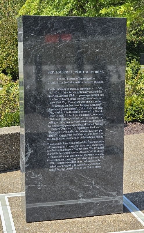
1. September 11, 2001 Memorial
(Front):
Criminal Justice Information Services Division
On the morning of Tuesday September 11, 2001, at 8:46 a.m. hijackers intentionally crashed the American Airlines Flight 11 passenger aircraft into the North Tower of the World Trade Center in New York City. This attack was one in a series committed on that clear Tuesday morning. Another hijacked aircraft, United Airlines Flight 175, crashed into the South Tower of the World Trade Center. A third hijacked aircraft, American Airlines Flight 77, crashed into the Pentagon in Arlington, Virginia. A fourth attack was thwarted by courageous passengers aboard United Airlines Flight 93, causing it to crash into a field near Shanksville, Pennsylvania. In total, 2,977 people died that day in what would come to be known as the deadliest terrorist attack in the nation's history.
These attacks have transformed the Federal Bureau of Investigation in ways that have made it stronger and better, making our country safer. The Criminal Justice Information Services Division's critical role in collaboration and information sharing is essential to detecting and deterring terrorism and crime. The F.B.I. remains steadfast in its dedication to the mission of protecting the American people and upholding the Constitution of the United States.
(Rear):
Criminal Justice Information Services Division
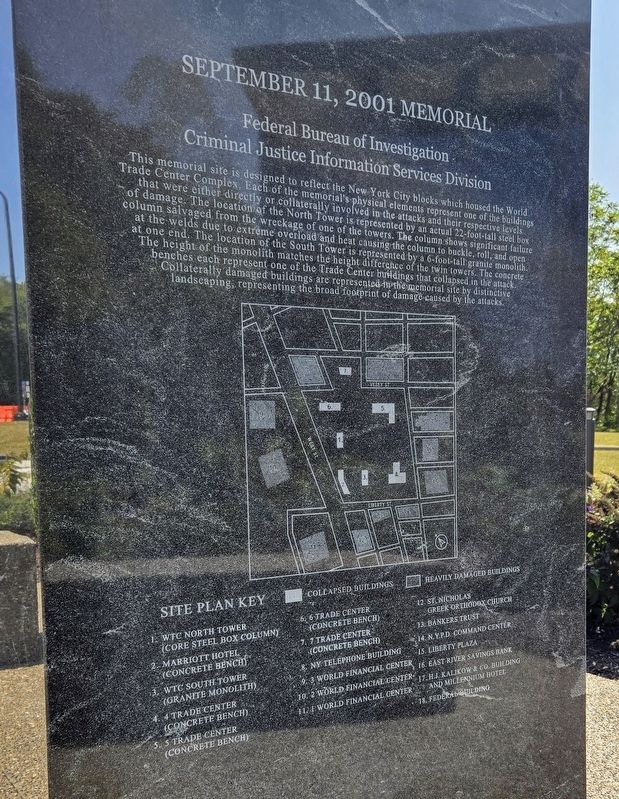
This memorial site is designed to reflect the New York City blocks which housed the World Trade Center Complex. Each of the memorial's physical elements represent one of the buildings that were either directly or collaterally involved in the attacks and their respective levels of damage. The location of the North Tower is represented by an actual 22-foot-tall steel box column salvaged from the wreckage
this page online
Site Plan Key
(Includes collapsed buildings and heavily damaged buildings)
1. WTC North Tower
(core steel box column)
2. Marriott Hotel
(concrete bench)
3. WTC South Tower
(granite monolith)
4. 4 Trade Center
(concrete bench)
5. 5 Trade Center
(concrete bench)
6. 6 Trade Center
(concrete bench)
7. 7 Trade Center
(concrete bench)
8. NY Telephone Building
9. 3 World Financial Center
10. 2 World Financial Center
11. 1 World Financial Center
12. St. Nicholas Greek Orthodox Church
13. Bankers Trust
14. Ν.Υ.P.D. Command Center15. Liberty PlazaPhotographed by Bradley Owen, September 9, 20242. September 11, 2001 Memorial(Rear)
16. East River Savings Bank
17. H.J. Kalikow & Co. Building and Millennium Hotel
18. Federal Building
Erected 2024 by Federal Bureau of Investigation, Bridgeport, WV.
Topics and series. This historical marker and memorial is listed in these topic lists: 9/11 Attacks • Disasters • Law Enforcement. In addition, it is included in the World Trade Center Beams series list. A significant historical date for this entry is September 11, 2001.
Location. 39° 19.886′ N, 80° 14.817′ W. Marker is near Bridgeport, West Virginia, in Harrison County. It is on Jerry Dove Drive (County Route 13/5) 0.1 miles west of Shinns Run Road (County Route 707), on the right when traveling west. Memorial is located in the parking lot for the Federal Bureau of Investigation Visitor Center. Touch for map. Marker is in this post office area: Bridgeport WV 26330, United States of America. Touch for directions.

Regionally, this marker and memorial is in West Virginia’s Little Kanawha Valley. It is also in the American South, specifically in the Upper South, in Appalachia, and specifically in Northern Appalachia. Globally, it is in
Photographed by Bradley Owen, September 9, 2024
3. September 11, 2001 Memorial
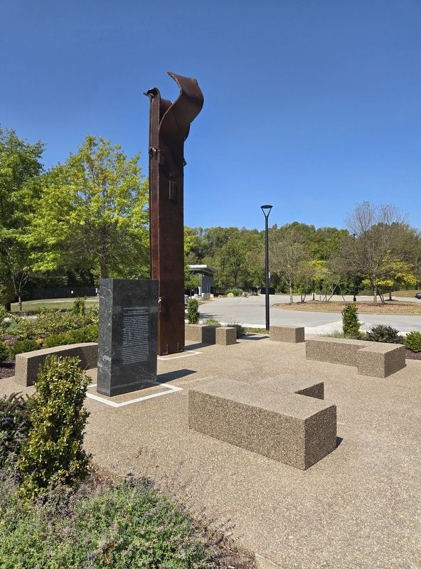
Memorial includes an actual 22-foot-tall steel box column salvaged from the wreckage of one of New York's Twin Towers.
Other nearby markers. At least 8 other markers are within 3 miles of this marker, measured as the crow flies: Combat Wounded (approx. 1.2 miles away); a different marker also named Combat Wounded (approx. 1.2 miles away); Home of Bridgeport Little League (approx. 1.8 miles away); Simpson Creek Covered Bridge (approx. 2.3 miles away); Saltwell (approx. 2½ miles away); In Memory of Aaron Smith (approx. 2.6 miles away); Old Baptist Cemetery (approx. 2.8 miles away); Baptist Meeting House (approx. 2.9 miles away). Touch for a list and map of all markers in Bridgeport.
Credits. This page was last revised on September 10, 2024. It was originally submitted on September 10, 2024, by Bradley Owen of Morgantown, West Virginia. This page has been viewed 168 times since then and 25 times this year. Photos: 1, 2, 3. submitted on September 10, 2024, by Bradley Owen of Morgantown, West Virginia.
