
Downtown in Fairbanks in Fairbanks North Star Borough, Alaska — Northwest (North America)
Chena River Flood Control
Photographed by William Fischer, Jr., August 17, 2024
1. Chena River Flood Control Marker
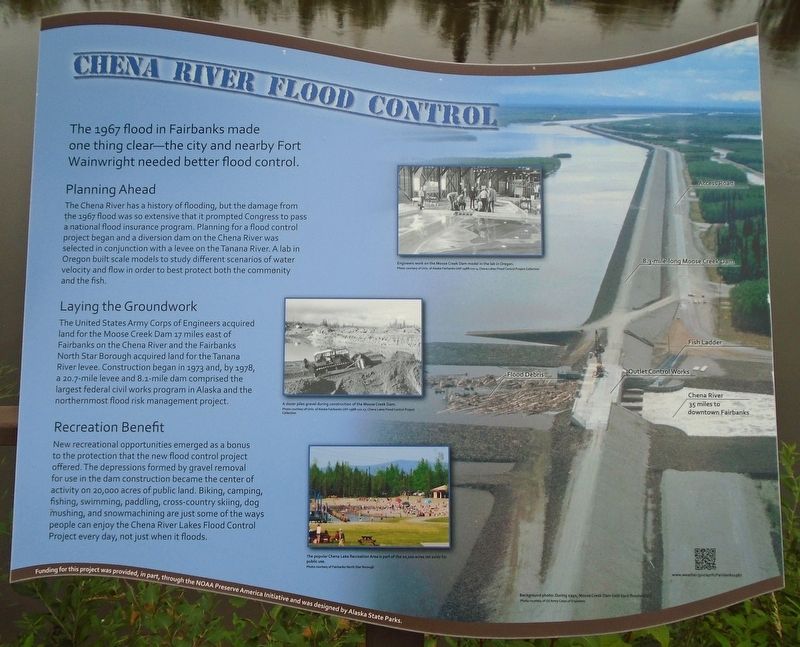
The 1967 flood in Fairbanks made one thing clear-the city and nearby Fort Wainwright needed better flood control.
Planning Ahead
The Chena River has a history of flooding, but the damage from the 1967 flood was so extensive that it prompted Congress to pass a national flood insurance program. Planning for a flood control project began and a diversion dam on the Chena River was selected in conjunction with a levee on the Tanana River. A lab in Oregon built scale models to study different scenarios of water velocity and flow in order to best protect both the community and the fish.
Laying the Groundwork
The United States Army Corps of Engineers acquired land for the Moose Creek Dam 17 miles east of Fairbanks on the Chena River and the Fairbanks North Star Borough acquired land for the Tanana River levee. Construction began in 1973 and, by 1978, a 20.7-mile levee and 8.1-mile dam comprised the largest federal civil works program in Alaska and the northernmost flood risk management project.
Recreation Benefit
New recreational opportunities emerged as a bonus to the protection that the new flood control project offered.
this page online
Background photo: During 1992, Moose Creek Dam held back floodwaters.
[Photo captions, top to bottom, read]
• Engineers work on the Moose Creek Dam model in the lab in Oregon.
• A dozer piles gravel during construction of the Moose Creek Dam.
• The popular Chena Lake Recreation Area is part of the 20,000 acres set aside for public use.
Erected by City of Fairbanks, NOAA Preserve America Initiative, and Alaska State Parks.
Topics and series. This historical marker is listed in these topic lists: Charity & Public Work • Disasters • Waterways & Vessels. In addition, it is included in the National Oceanic and Atmospheric Administration (NOAA) series list. A significant historical date for this entry is August 15, 1967.
Location. 64° 50.663′ N, 147° 43.198′ W. Marker is in Fairbanks,
Photographed by William Fischer, Jr., August 17, 2024
2. Chena River Flood Control Marker

Regionally, this marker is in the Alaska Railroad Corridor, in the Athabascan Region, and in Interior Alaska. It is also on the American Pacific Coast. Globally, it is in North America, the Pacific Rim, the Western Hemisphere, the Western World, and the Anglosphere. Historically, it finds itself in what was once the Russian Empire.
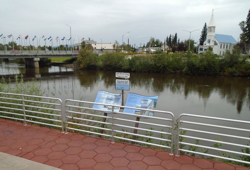
Other nearby markers. At least 8 other markers are within walking distance of this marker: Chena River Flood (here, next to this marker); The 1967 Chena River Flood (here, next to this marker); Pioneer Press: The Fairbanks Daily News-Miner Story (a few steps from this marker); History of North Slope Oil Development (a few steps from this marker); Greater Fairbanks Community Hospital Foundation (a few steps from this marker); Alaskan Communications (a few steps from this marker); Dr. William Ranson Wood (a few steps from this marker); Alaska's Rich Mineral Resources (a few steps from this marker). Touch for a list and map of all markers in Fairbanks.
Also see . . . Chena River Lakes Flood Control Project. (Submitted on September 11, 2024, by William Fischer, Jr. of Reynoldsburg, Ohio.)
Credits. This page was last revised on September 26, 2024. It was originally submitted on September 11, 2024, by William Fischer, Jr. of Reynoldsburg, Ohio. This page has been viewed 448 times since then and 61 times this year. Photos: 1, 2. submitted on September 11, 2024, by William Fischer, Jr. of Reynoldsburg, Ohio.
