Near Sherman in Grayson County, Texas — The American South (West South Central)
Old Cedar Community
Photographed by James Hulse, September 10, 2024
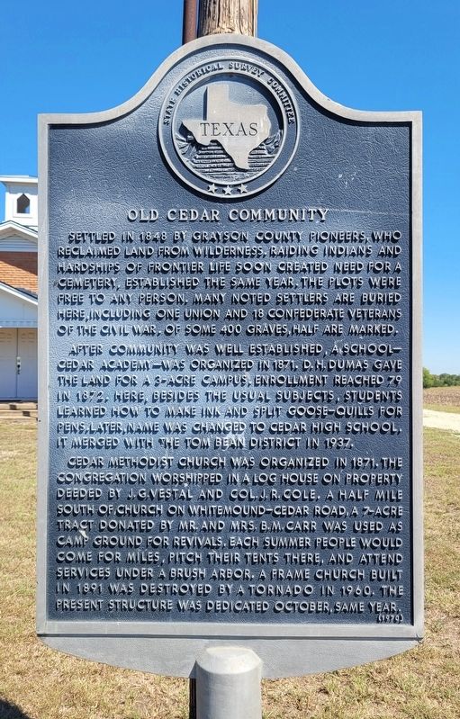
1. Old Cedar Community Marker
After community was well established, a school - Cedar Academy - was organized in 1871. D.H. Dumas gave the land for a 3-acre campus, enrollment reached 79 in 1872. Here, besides the usual subjects, students learned how to make ink and split goose-quills for pens. Later, name was changed to Cedar High School. It merged with the Tom Bean District in 1937.
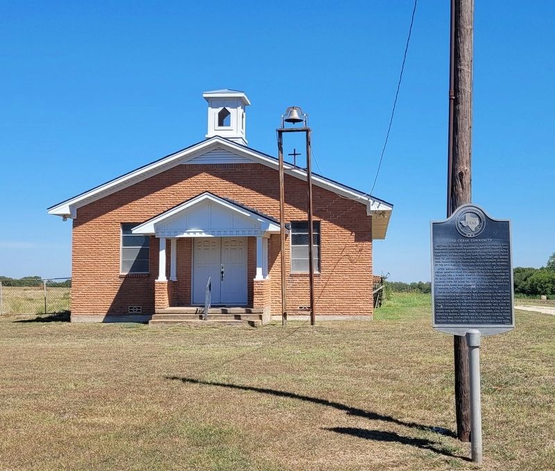
Cedar Methodist Church was organized in 1871. The congregation worshipped in a log house on property deeded by J.G. Vestal and Col. J.R. Cole. A half mile south of church on Whitemound-Cedar Road, a 7-acre tract donated by Mr. and Mrs. B.M. Carr was used as camp ground for revivals. Each summer people would come for miles, pitch their tents there, and attend services under a brush arbor. A frame church built in 1891 was destroyed by a tornado in 1960. The present structure was dedicated October, same year.
Erected 1970 by State Historical Survey Committee. (Marker Number 7346.)
Topics. This historical marker is listed in these topic lists: Cemeteries & Burial Sites • Education • Religion & Religious Structures • Settlements & Settlers. A significant historical year for this entry is 1848.
Location. 33° 33.774′ N, 96° 30.352′ W. Marker is near Sherman, Texas, in Grayson County. It is at the intersection of Cedar Road and Campground Road, on the left on Cedar Road. The marker is located in front of the community huilding. Touch for map. Marker is at or near this postal address:
this page online

Regionally, this marker is in the Prairies & Lakes Region. It is also in the American South. Globally, it is in North America, a Gulf of Mexico state, the Western Hemisphere, the Western World, and the Anglosphere. Historically, it finds itself in what was once New Spain, the Republic of Texas, one of the Confederate States of America, and the Antebellum South.
Other nearby markers. At least 8 other markers are within 6 miles of this marker, measured as the crow flies: First United Methodist Church (approx. 2.6 miles away); Site of Early Grayson County Settlement Whitemound (approx. 3.2 miles away); City of Tom Bean (approx. 3.2 miles away); In Honor of Tom Bean Area Veterans (approx. 3.2 miles away); Washburn Cemetery (approx. 3.9 miles away); Antioch Baptist Church (approx. 4.6 miles away); Kentucky Town (approx. 4.9 miles away); Everheart-Canaan Cemetery (approx. 5.3 miles away).
Photographed by James Hulse, September 10, 2024
2. Cedar Community Marker
Credits. This page was last revised on September 13, 2024. It was originally submitted on September 11, 2024, by James Hulse of Medina, Texas. This page has been viewed 247 times since then and 36 times this year. Photos: 1, 2. submitted on September 13, 2024, by James Hulse of Medina, Texas.
