Front Royal in Warren County, Virginia — The American South (Mid-Atlantic)
Race For The River
“Burn the Bridges!”
| — | The Battle of Front Royal - May 23, 1862 | — |

Photographed by Linda Walcroft, August 26, 2024
1. Race for the River
Shots and shouts filled the air here on the afternoon of May 23, 1862. Union troops swarmed past this spot as they raced to cross a wagon bridge that spanned the river in front of you. Pursuing Confederates were hot on their heels. One Union officer fell dead almost at your feet.
Flanked out of his position on Richardson's Hill, Union Col. John R. Kenly had hurried his command north to cross the bridges that spanned the forks of the Shenandoah River. Two bridges crossed the South Fork to the peninsula beyond, the wagon bridge here and a railroad bridge 400 yards to your right. Another span, the Pike Bridge, crossed the North Fork.
Once Kenly's men were safely across, they packed hay onto the bridges and set it afire. But the wooden beams, soaked by recent rains, proved hard to set alight. Confederates from the 1st Maryland threw the blazing hay off the wagon bridge and crossed here, while 8th Louisiana soldiers under Gen. Richard Taylor stepped on the railroad ties to cross that bridge—although some fell into the river below.
Hurrying across the Pike Bridge, Kenly ordered that span burned as well, and a section
this page online
(sidebar)
Medal of Honor at Front Royal
Union Sgt. William Taylor received the Medal of Honor for helping to burn the Pike Bridge. His citation read, "he was painfully wounded while obeying an order to burn a bridge, but persevering in the attempt, he burned the bridge and prevented its use by the enemy."
Erected by Virginia Civil War Trails.
Topics and series. This historical marker is listed in these topic lists: Bridges & Viaducts • War, US Civil. In addition, it is included in the Virginia Civil War Trails series list. A significant historical date for this entry is May 23, 1862.
Location. 38° 56.535′ N, 78° 11.659′ W. Marker is in Front Royal, Virginia, in Warren County. It can be reached from North Royal Avenue 0.1 miles north of Depot Avenue when traveling north. N Royal Ave dead ends at the South Fork of the Shenandoah River at the old bridge site. The marker is 500 feet north of the railroad overpass. Touch for map. Marker is in this post
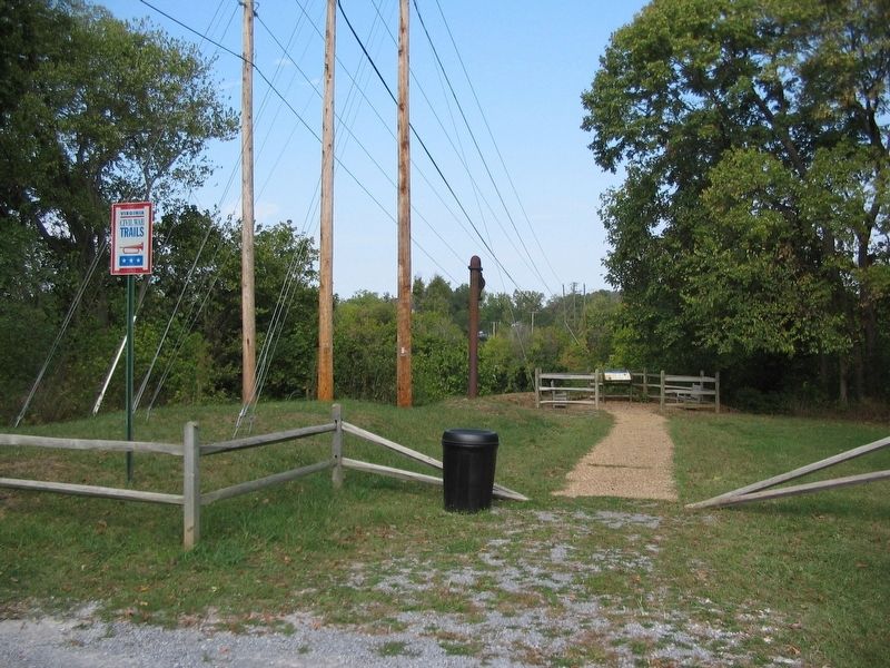
Photographed by Craig Swain, October 7, 2007
2. Dead End of Royal Avenue
At the time of the battle, the south end of the bridge stood where the marker stands today.

Regionally, this marker is in the Washington Metropolitan Area and in the Shenandoah Valley. It is also in the American South, specifically in the Upper South, and in the Mid-Atlantic. Globally, it is in North America, the Western Hemisphere, the Western World, and the Anglosphere. Historically, it finds itself in what was once the territory of the Mississippian Culture, one of the original Thirteen Colonies, one of the Confederate States of America, and the Antebellum South.
Other nearby markers. At least 8 other markers are within 2 miles of this marker, measured as the crow flies: A different marker also named Richardson's Hill (approx. 0.4 miles away); a different marker also named Guard Hill (approx. 0.6 miles away); Guard Hill Engagement (approx. 0.8 miles away); Execution of Mosby’s Men (approx. 0.8 miles away); Battle of Front Royal (approx. 0.8 miles away); Rose Hill (approx. 0.8 miles away); Brother Against Brother (approx. 1.4 miles away); a different marker also named Battle of Front Royal (approx. 1.4 miles away). Touch for a list and map

Photographed by Linda Walcroft, August 26, 2024
3. Remains of the Old Bridge
Piers that once supported the bridge in this location are now covered with vegetation.
Other markers no longer nearby. The Bridges (was here, next to this marker but has been replaced with another marker now near it); Richardson’s Hill (was approx. 0.4 miles away but has been replaced with another marker now near it); Execution of Mosby’s Rangers (was approx. 0.4 miles away but has been permanently removed); Guard Hill (was approx. half a mile away but has been replaced with another marker now near it).
Related marker. Click here for another marker that is related to this marker. Old CWT Marker At This Location titled "The Bridges".
Credits. This page was last revised on September 16, 2024. It was originally submitted on September 2, 2024, by Linda Walcroft of Woodstock, Virginia. This page has been viewed 324 times since then and 30 times this year. Last updated on September 14, 2024, by Carl Gordon Moore Jr. of North East, Maryland. Photos: 1. submitted on September 1, 2024, by Linda Walcroft of Woodstock, Virginia. 2. submitted on October 14, 2007, by Craig Swain of Leesburg, Virginia. 3. submitted on September 15, 2024, by Linda Walcroft of Woodstock, Virginia. • Bernard Fisher was the editor who published this page.
