
Fort Recovery in Mercer County, Ohio — The American Midwest (Great Lakes)
St. Clair Massacre
Photographed by Dale K. Benington, June 5, 2009
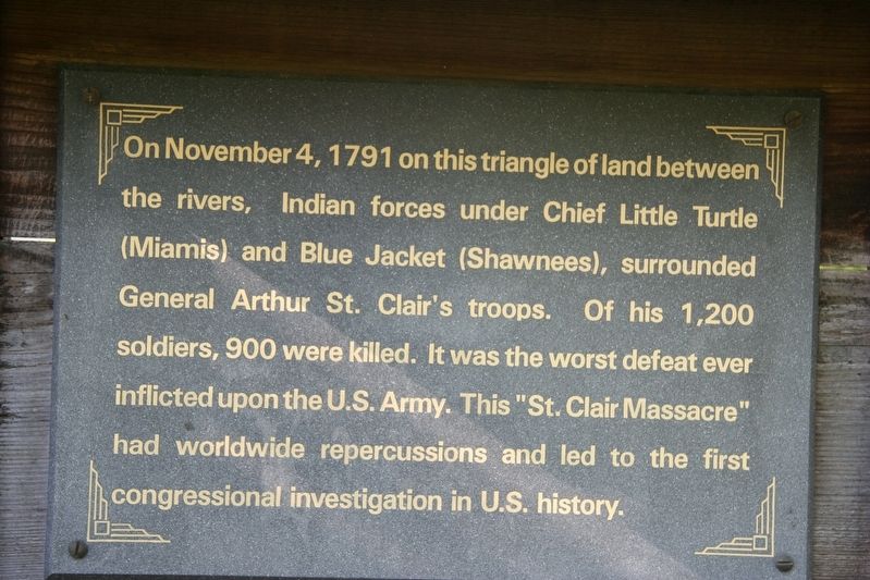
1. St. Clair Massacre Marker
On November 4, 1791 on this triangle of land between the rivers, Indian forces under Chief Little Turtle (Miamis) and Blue Jacket (Shawnees), surrounded General Arthur St. Clair's troops. Of his 1,200 soldiers, 900 were killed. It was the worst defeat ever inflicted on the U.S. Army. This "St. Clair Massacre" had worldwide repercussions and led to the first congressional investigation in U.S. history.
Topics. This historical marker is listed in these topic lists: Forts and Castles • Indigenous Peoples and Communities. A significant historical date for this entry is November 4, 1791.
Location. Marker has been permanently removed. It was located near 40° 24.858′ N, 84° 46.833′ W. Marker was in Fort Recovery, Ohio, in Mercer County. It was on Fort Site Street just south of West Boundary Street, on the right when traveling south. Touch for map. Marker was at or near this postal address: 1 Fort Site St, Fort Recovery OH 45846, United States of America.
We have been informed that this marker is no longer there and will not be replaced. This page is an archival view of what was.
Regionally, this marker was in Ohio’s Till Plains.

this page online
Other nearby markers. At least 8 other markers are within walking distance of this location: Greene Ville Treaty Line (a few steps from this marker); St. Clair's Defeat / Battle of Fort Recovery (within shouting distance of this marker); Fort Recovery State Historic Site (within shouting distance of this marker); The Wabash (Ouabache) River (within shouting distance of this marker); Native Cultures (within shouting distance of this marker); The Old Wabash River (within shouting distance of this marker); On This Triangle of Land (within shouting distance of this marker); The Battle of Fort Recovery (within shouting distance of this marker). Touch for a list and map of all markers in Fort Recovery.
Photographed by Dale K. Benington, June 5, 2009
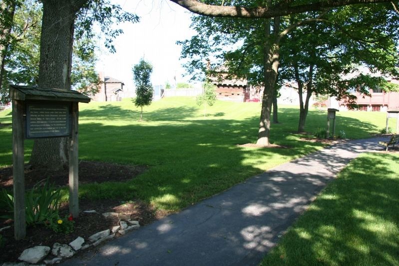
2. St. Clair's Defeat Battlegound
View of interpretative trail along the battle area, on the Ohio Historic Society's property.
Credits. This page was last revised on September 17, 2024. It was originally submitted on January 28, 2021, by Dale K. Benington of Toledo, Ohio. This page has been viewed 1,126 times since then and 82 times this year. Last updated on September 16, 2024, by Craig Doda of Napoleon, Ohio. Photos: 1, 2. submitted on June 14, 2009, by Dale K. Benington of Toledo, Ohio. • Devry Becker Jones was the editor who published this page.
