Near Rosendale in Ulster County, New York — The American Northeast (Mid-Atlantic)
Plank Roads
Horse-drawn Railroads & Locomotive Railways
| — | Welcome to Williams Lake | — |
Photographed by Steve Stoessel, September 15, 2024
1. Plank Roads Marker
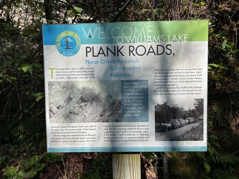
Two cement companies joined forces to build a horse-drawn railroad known as the Hickory Bush-Eddyville Railroad, which replaced the plank road.
The image below, taken in 1893, shows the cement mines and the tracks of the Wallkill Valley Railroad in the area known as Hickory Bush. These mines were part of the Lawrence Cement Company works. Just north of this area were the cement works of the Newark Rosendale Lime and Cement Company.
The two companies' operations here in the northern reaches of the Binnewater region were located too far north to be able to access the D&H Canal in Rosendale (to the south) to ship their cement. The two companies needed to devise a way to get their product north to the navigable waters of the Rondout Creek of Eddyville. In 1850 they formed a corporation to construct a plank road) from Hickory Bush through Whiteport to Eddyville. Although it was better than an unimproved road, the plank road soon outlived its usefulness. Again the two companies joined forces, this time to build a horse drawn railroad known as the Hickory Bush-Eddyville Railroad, which replaced the plank road
this page online
In 1872, the arrival of the Wallkill Valley Railroad (now the Wallkill Valley Rail Trail) allowed for even more efficient shipping of cement from this region.
Erected by Williams Lake Project.
Topics. This historical marker is listed in these topic lists: Industry & Commerce • Railroads & Streetcars • Roads & Vehicles.
Location. 41° 52.369′ N, 74° 4.469′ W. Marker is near Rosendale, New York, in Ulster County. It is on Wallkill Valley Rail Trail ¼ mile south of Hickory Bush Road, on the right when traveling south. Touch for map. Marker is in this post office area: Kingston NY 12401, United States of America. Touch for directions.

Regionally, this marker is in Upstate New York and in the Hudson Valley. It is also in the American Northeast, in the Mid-Atlantic, and on the Eastern Seaboard. Globally, it is in the North Atlantic Region, North America, the Western Hemisphere, the Western World, and the Anglosphere. Historically, it finds itself in what was once New Netherland and also one of the original Thirteen Colonies.
Other nearby markers. At
Photographed by Steve Stoessel, September 15, 2024
2. Plank Roads Marker
Also see . . . A History of the Rosendale natural Cement Industry. (Submitted on September 21, 2024, by Steve Stoessel of Niskayuna, New York.)

Photographed by Steve Stoessel, September 15, 2024
3. Plank Roads Marker
Credits. This page was last revised on September 21, 2024. It was originally submitted on September 17, 2024, by Steve Stoessel of Niskayuna, New York. This page has been viewed 218 times since then and 27 times this year. Photos: 1, 2, 3. submitted on September 17, 2024, by Steve Stoessel of Niskayuna, New York.
