Downtown in Fairbanks in Fairbanks North Star Borough, Alaska — Northwest (North America)
Yukon Quest Trail Map and Elevations

Photographed by William Fischer, Jr., August 17, 2024
1. Yukon Quest Trail Map and Elevations Marker
With its challenging 1,000-miles of terrain and few checkpoints, the Yukon Quest International Sled Dog Race has been billed as the "world's toughest sled dog race." Conditions can include -60°F, rough jumble ice on the Yukon and fierce storms. The idea was hatched in 1983 by founders Leroy Shank and Roger Williams, among others, over a few brews at the former Bull's Eye Saloon on Chena Hot Springs Road. The work of tireless volunteers has kept it going now for more than a quarter-century.
Fairbanks
Known as the Golden Heart City, Fairbanks is the gateway to the north and the second-largest city in Alaska. Although founded and established in 1901 by Captain E.T. Barnette, the discovery of gold in 1902 by Felix Pedro is what brought thousands of people to Fairbanks. The city is the race's Alaska headquarters and hosts the start in even years downtown on the Chena River.
Two Rivers
Thirty miles east of Fairbanks, Two Rivers is a hotbed for dog mushing because of its extensive trail system. Sonny Lindner, the Yukon Quest's first champion in 1984, and the only female champion, Ally Zirkle in 2000, both reside in Two Rivers. Now located at the Twin Bears Campground 45 trail miles from the finish, Two Rivers is the race's first checkpoint in even years and the last checkpoint in odd years.
Mile 101
Located in an old mining district at Mile 101 Steese Highway, mushers are required to check in and out because of its location between Rosebud (3,640 feet) and Eagle (3,685 feet) summits, two of the race's highest points. Mile 101, known for its hospitality, is also a very strategic place for mushers because of its location between the two climbs.
Eagle Summit, 3,685 ft
Eagle Summit is one of the most difficult obstacles mushers will encounter on their 1,000-mile journey. History has proven that the steep climb from Central and the potential for harsh weather can slow down even the strongest of dog teams. Any musher will agree that no lead is big enough with Eagle Summit still to conquer. The exposed summit is often the epicenter of drama, including a helicopter rescue in 2006 and annual acts of sportsmanship as mushers team up.
Central
Located on the Steese Highway, Central is situated in the heart of the Central Alaskan Mining District. In even years it is the starting point of a long run to Circle on the frigid Birch Creek, and in odd years it is the last stop before Eagle Summit. The checkpoint at the Steese Roadhouse provides a steak dinner to all mushers. Central is also home to many long-time Yukon Quest trailbreakers.
Circle City
The northernmost point of the race, Circle is located at the end of the Steese Highway on the banks of the Yukon River. It is notorious for being bitter cold and in even years is the start of a 150-mile trek along the Yukon River to Eagle. Checkpoint headquarters is the Circle Fire Hall, and exhausted musters often sleep on top of the fire engine, oblivious to the activity around them.
Slaven's Roadhouse
Slaven's Roadhouse is 93 miles upriver of Circle City in the Yukon-Charley Rivers National Preserve. The National Park Service opens up and staffs the spacious roadhouse during the race. Slaven's is a favorite stop because of the friendly volunteers that provide a good meal and a warm and quiet place to sleep. In winter, the roadhouse is accessible only by dog sled, snowmachine or plane.
Eagle
The town of Eagle, population 129, has the only checkpoint not reachable by road in winter. The checkpoint is located in the former schoolhouse and is staffed by local kids as well as adults. Mushers have a mandatory 4-hour rest here to allow veterinarians to examine their team[s]. In May 2009, Eagle was hit by a devastating flood and many riverfront buildings were damaged or destroyed by water and massive ice chunks. The impact of the flood on the Yukon Quest remains to be seen.
[U.S.-Canada Border]
Dawson City
Historic Dawson City was the endpoint for 100,000 stampeders during the Klondike Gold Rush of the 1890's. Today it is a bustling town that hosts the midway point of the Quest. Mushers take a mandatory 36-hour layover in Dawson, the only place where they can get assistance from handlers. Dawson is a pivotal point in the race; the more rest and recovery the dogs and mushers get, the better off they will be for the second half. The first musher to Dawson wins 4 ounces of placer gold.
Scroggie Creek
Scroggie Creek is a remote dog drop between Dawson City and Pelly Crossing. Located on the Stewart River, it was once a distribution hub for local placer mining. Scroggie is a popular spot for mushers to take a break because of a warm wall tent to sleep in, volunteers cooking food and a race vet and official on hand.
Stepping Stone
Stepping Stone is a privately-owned hospitality stop about 30 miles from Pelly Crossing that has great camping for the dogs, homemade food and a warm place to sleep. Mushers often prefer the remote hospitality stops to checkpoints because they are generally quiet and allow for good rest.
Pelly Crossing
Located in the territory of the Selkirk First Nation, Pelly Crossing is near the historic site of Fort Selkirk at the confluence of the Pelly and Yukon rivers. In odd years this is the last checkpoint before a 200-mile trek to Dawson. Many mushers take a longer break here to load their sleds for the challenging trail ahead.
McCabe Creek
Located on the banks of the Yukon River, McCabe Creek is the homestead of the Kruse family. Shortly after the 2009 race the building that housed the dog drop burned down. To show his appreciation, Quest musher Hugh Neff donated $5,000 of his race winnings to help the Kruse family rebuild the building. Thanks Hugh!
Carmacks
On the banks of the Yukon River and in the Territory of the Little Salmon/Carmacks First Nation, Carmacks (population 426) was a transportation artery before the construction of the Klondike highway. Carmacks is the second-to-last checkpoint in even years and is the last glimpse mushers get of the mighty Yukon River after traveling on it for nearly 200 miles. Carmacks is where the true race for the finish begins in even years.
Braeburn
Braeburn is located on the trans-Canada trail system and is the last checkpoint in even years. Here mushers and their teams take a mandatory 8-hour break and get a complete check by veterinarians before the 100-mile run to the finish line in Whitehorse. Braeburn is famous for its tasty, monstrous cinnamon buns.
Whitehorse
The largest city and capital of the Yukon Territory, Whitehorse was once a junction for trains and riverboats. At the head of navigation on the Yukon river, the city was an important location during the Klondike Gold Rush. It is now the main transportation and supply hub for the Yukon and surrounding territories. Whitehorse serves as the race's start in odd years and finish in even years.
Erected by Yukon
this page online
Topics. This historical marker is listed in these topic lists: Animals • Environment • Settlements & Settlers • Sports. A significant historical year for this entry is 1983.
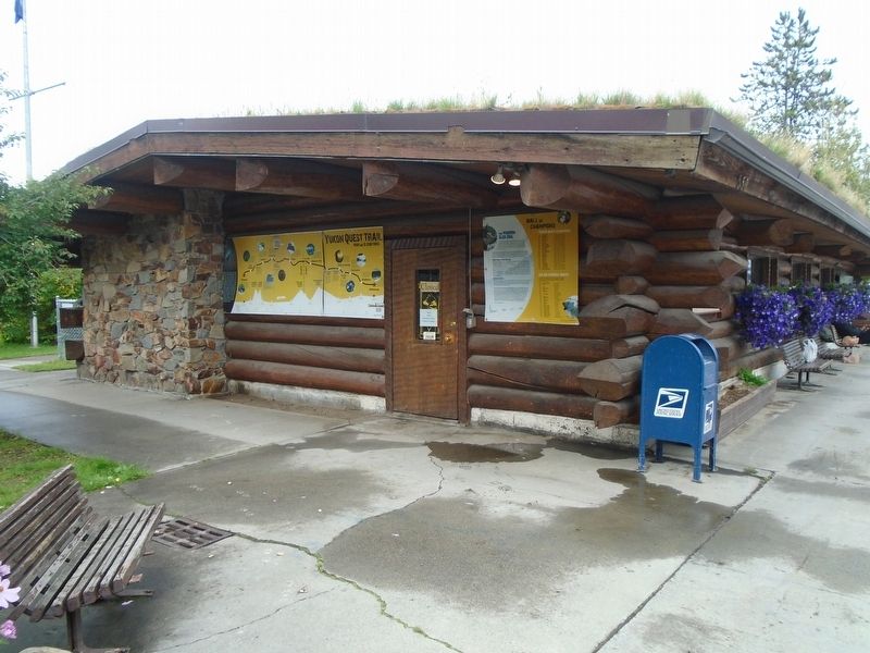
Location. 64° 50.643′ N, 147° 43.223′ W. Marker is in Fairbanks, Alaska, in Fairbanks North Star Borough. It is in Downtown. It is on 1st Avenue just east of Cushman Street, on the left when traveling east. Marker is at the Yukon Quest Alaska Headquarters. Touch for map. Marker is at or near this postal address: 550 1st Avenue, Fairbanks AK 99701, United States of America. Touch for directions.

Regionally, this marker is in the Alaska Railroad Corridor, in the Athabascan Region, and in Interior Alaska. It is also on the American Pacific Coast. Globally, it is in North America, on the Pacific Rim, in the Western Hemisphere, in the Western World, and in the Anglosphere. Historically, it finds itself in what was once the Russian Empire.
Other nearby markers. At least 8 other markers are within walking distance of this marker: The Modern Sled Dog / Wall of Champions (here, next to this marker); Bridge of Flags (a few steps from
Photographed by William Fischer, Jr., August 17, 2024
2. Yukon Quest Trail Headquarters and Marker
Also see . . .
1. Yukon Quest Alaska. (Submitted on September 17, 2024, by William Fischer, Jr. of Reynoldsburg, Ohio.)
2. Yukon Quest Canada. (Submitted on September 17, 2024, by William Fischer, Jr. of Reynoldsburg, Ohio.)
Credits. This page was last revised on September 17, 2024. It was originally submitted on September 17, 2024, by William Fischer, Jr. of Reynoldsburg, Ohio. This page has been viewed 1,167 times since then and 197 times this year. Photos: 1, 2. submitted on September 17, 2024, by William Fischer, Jr. of Reynoldsburg, Ohio.
