Harpers Ferry in Jefferson County, West Virginia — The American South (Appalachia)
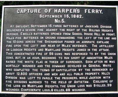
Capture of Harper's Ferry,
September 15, 1862.
| — | No. 5. | — |
Photographed by Craig Swain, August 12, 2007
1. Capture of Harpers Ferry Marker
At daylight, September 15, three batteries of Jackson's Division delivered a severe fire against the right of the Bolivar Heights defense. Ewell's batteries opened from School House Hill in front. Hill's five Batteries on ground commanding the left of the line and the 10 guns across the Shenandoah poured an accurate enfilade fire upon the left and rear of Miles' defenses. The artillery on Loudoun Heights and Maryland Heights joined the attack. This concentrated fire of 58 guns was responded to by the Union guns but, in an hour, beginning to run short of ammunition Miles raised the white flag in token of surrender. Soon after he was mortally wounded and the command devolved on General White who completed the terms of capitulation by the surrender of about 12,500 officers and men and all public property. Hill's Division was left to parole the prisoners, while Jackson with five divisions marched to the field of Antietam. Exclusive of the loss on Maryland Heights, the Union loss was 9 killed, 39 wounded; Confederate loss 6 killed, 69 wounded.
Erected by Antietam Battlefield Board. (Marker Number No. 5.)
Topics and series.
this page online
Location. 39° 19.381′ N, 77° 43.744′ W. Marker is in Harpers Ferry, West Virginia, in Jefferson County. It is at the intersection of South Potomac Street and Shenandoah Street, on the right when traveling east on South Potomac Street. Located on just past the railroad overpass, at the overlook to the juncture of the Potomac and Shenandoah Rivers. Touch for map. Marker is at or near this postal address: 814 Shenandoah St, Harpers Ferry WV 25425, United States of America. Touch for directions.

Regionally, this marker is in the Washington Metropolitan Area and in the Eastern Panhandle. It is also in the American South, specifically in the Upper South, in Appalachia, and specifically in Northern Appalachia. Globally, it is in North America, the Western Hemisphere, the Western World, and the Anglosphere. Historically, it finds itself in what was once the territory of the Mississippian Culture and also the Antebellum South.
Other nearby markers. At
Photographed by Craig Swain, September 22, 2007
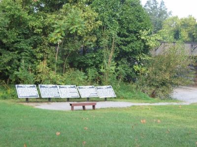
2. Five War Department Tablets at The Point of Harpers Ferry
Regarding Capture of Harper's Ferry,. This is one of five tablets at Harpers Ferry describing the action here related to the Battle of Antietam.
Also see . . . 1862 Battle of Harpers Ferry. From the National Parks Service. (Submitted on October 12, 2007, by Craig Swain of Leesburg, Virginia.)
The Capture and Execution of John Brown: A tale of Martyrdom by Elijah Avey
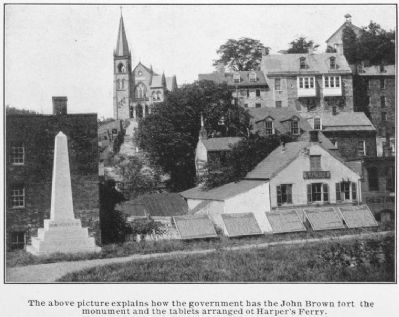
3. The Capture of Harpers Ferry Markers
Photographed by Craig Swain, March 11, 2007
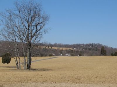
4. Murphy Farm
Hill's Division moved into a position flanking the Federal line on Bolivar Heights (in the background) on the night of the 13th.
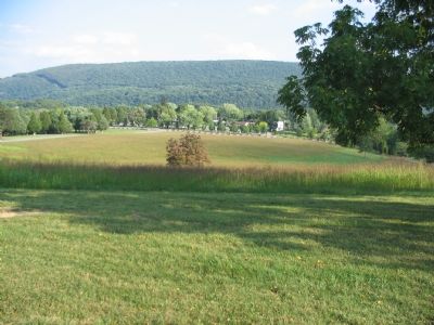
Photographed by Craig Swain, September 22, 2007
5. Surrender Area
On the low ground behind Bolivar Heights, the Federal troops formed and were reviewed by Gen. Jackson as part of the formal surrender.
Credits. This page was last revised on September 18, 2024. It was originally submitted on October 12, 2007, by Craig Swain of Leesburg, Virginia. This page has been viewed 2,043 times since then and 35 times this year. Last updated on September 18, 2024, by Carl Gordon Moore Jr. of North East, Maryland. Photos: 1, 2. submitted on October 12, 2007, by Craig Swain of Leesburg, Virginia. 3. submitted on August 26, 2011, by Howard C. Ohlhous of Duanesburg, New York. 4, 5. submitted on October 12, 2007, by Craig Swain of Leesburg, Virginia. • Devry Becker Jones was the editor who published this page.
