Tate Springs in Lynchburg, Virginia — The American South (Mid-Atlantic)
Fort McCausland
The Confederate Right Flank
| — | Battle of Lynchburg | — |
Photographed by Bradley Owen, October 15, 2017
1. Fort McCausland Marker
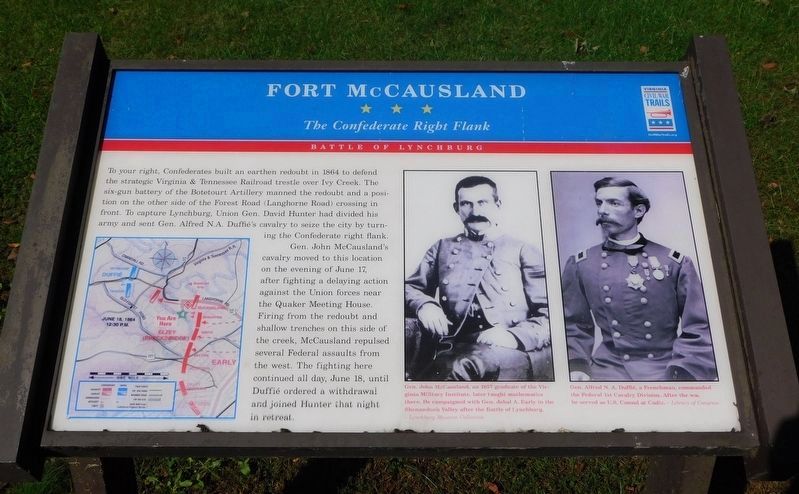
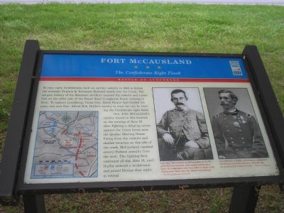
To your right, Confederates built an earthen redoubt in 1864 to defend the strategic Virginia & Tennessee Railroad trestle over Ivy Creek. The six-gun battery of the Botetourt Artillery manned the redoubt and a position on the other side of Forest Road (Langhorne Road) crossing in front. To capture Lynchburg, Union Gen. David Hunter had divided his army and sent Gen. Alfred N.A. Duffie’s cavalry to seize the city by turning the Confederate right flank.
Gen. John McCausland cavalry moved to this location on the evening of June 17, after fighting a delaying action against the Union forces near the Quaker Meeting House. Firing from the redoubt and shallow trenches on this side of the creek, McCausland repulsed several Federal assaults from the west. The fighting here continued all day, June 18, until Duffie ordered a withdrawal and joined Hunter that night in retreat.
Erected by Virginia Civil War Trails.
Topics and series. This historical marker is listed in this topic list: War, US Civil. In addition, it is included in the Virginia Civil War Trails series list. A significant historical date for this entry is June 17, 1864.
Location. 37° 24.802′ N,
this page online

Regionally, this marker is in Central Virginia. It is also in the American South and specifically in the Upper South. Globally, it is in North America, the Western Hemisphere, the Western World, and the Anglosphere. Historically, it finds itself in what was once the territory of the Mississippian Culture, one of the original Thirteen Colonies, one of the Confederate States of America, and the Antebellum South.
Other nearby markers. At least 8 other markers are within one mile of this marker, measured as the crow flies: A different marker also named Fort McCausland (a few steps from this marker); Lynchburg College (approx. 0.8 miles away); Walker Alumni House (approx. 0.9 miles away); Locust Thicket (approx.
Photographed by Bill Coughlin, April 26, 2007
2. Fort McCausland - The Confederate Right Flank
This marker is part of the Battle of Lynchburg Trail of the Virginia Civil War Trails.
More about this marker. On the lower left is a map illustrating the portion of the battle described in the text.
On the right a portrait of "Gen. John McCausland, an 1857 graduate of the Virginia Military Institute, later taught mathematics there. He campaigned with Gen. Jubal A. Early in the Shenandoah Valley after the Battle of Lynchburg." From the Lynchburg Museum Collection.
To the right of that portrait is one of "Gen. Alfred N.A. Duffie, a Frenchman, commanded the Federal 1st Cavalry Division. After the war, he served as U.S. Consul at Cadiz." From the Library of Congress
Regarding Fort McCausland. This is one in a series of Civil War Trails markers interpreting the Battle of Lynchburg (17-18 June 1864) and the city's role in the Civil War. Select the Civil War Virtual Tour by Marker link below to see other related markers.
Also see . . . Civil War Lynchburg Virtual Tour by Markers.
Photographed by Bill Coughlin, April 26, 2007
3. Fort McCausland marker - Battle of Lynchburg
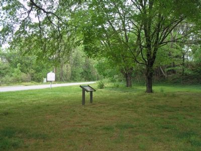
The remains of Fort McCausland can be seen in the trees to the right of the markers.
Credits. This page was last revised on September 18, 2024. It was originally submitted on December 2, 2007, by Bill Coughlin of Woodland Park, New Jersey. This page has been viewed 4,843 times since then and 145 times this year. Last updated on September 18, 2024, by Carl Gordon Moore Jr. of North East, Maryland. Photos: 1. submitted on March 20, 2021, by Bradley Owen of Morgantown, West Virginia. 2, 3. submitted on December 2, 2007, by Bill Coughlin of Woodland Park, New Jersey. • Devry Becker Jones was the editor who published this page.
