Near Hamilton in Martin County, North Carolina — The American South (South Atlantic)
Spring Green Primitive Baptist Church
Built 1878
| — | Historic Churches of Martin County | — |
Photographed by Dave W, June 24, 2023
1. Spring Green Primitive Baptist Church Marker
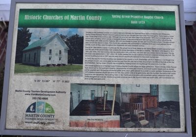
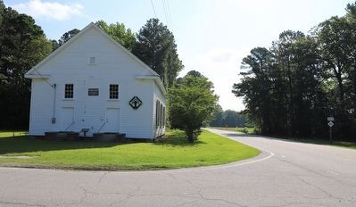
Situated at the northeast junction of a rural crossroads between the Roanoke River towns of Hamilton and Williamston. Spring Green Primitive Baptist Church’s pastoral setting has changed little from when this front-gable, frame meeting house was constructed over a century ago. Although the pine and oak trees cited in its December 1878 deed no longer stand, the church and cemetery, which occupy a triangular-shaped, three-and-a-half acre tract spilling over on either side of Spring Green Road (SR 1409) and NC Highway 903, and are shaded by pines, an oak, and small flowering trees. The area immediately around the church is bare. The church and cemetery are surrounded by cultivated fields and small patched of pine woods, much as they were throughout the nineteenth and early twentieth century.
Due to an 1884 Martin County Courthouse fire, the actual first of three deeds for the Spring Green property cannot be found and the part of the second deed that contains the actual description of the land is missing. The deeds were issued in 1811, 1851 and 1878. The first building was log construction with a dirt floor, one door and
this page online
In 1878, the land for the third building was deeded to the church by S.W. Outerbridge and R.D. Matthews. It is thought that the present church was constructed across the road from the one that burned. According to the Official Records of the War and Rebellion, Spring Green Church was occupied by Federal forces moving through the area in the Civil War.
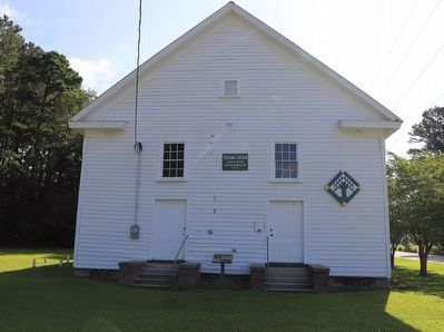
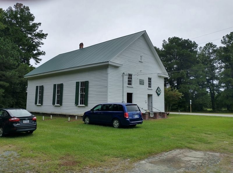
The overall appearance of Spring Green Primitive Baptist Church is that of a large gabled box. There is late Greek Revival style discerned by the building’s massing, the proportions of doors and windows, and small exterior details such as molded corner pilasters and handsome pedimented gable ends, each gable pierced by a small louvered ventilator. Dimensions of the 1879 weather-boarded church are thirty-six feet, four inched wide at its gable ends, and fifty-five feet, four-and-a-half inches long at its side elevations. The building
Photographed by Dave W, June 24, 2023
2. Spring Green Primitive Baptist Church Marker
Marker seen here between the doors.
Erected by Martin County Tourism Development Authority.
Topics and series. This historical marker is listed in these topic lists: Architecture • Religion & Religious Structures • War, US Civil. In addition, it is included in the Martin County Historic Church Trail series list. A significant historical year for this entry is 1878.
Location. 35° 53.688′ N, 77° 11.68′ W. Marker is near Hamilton, North Carolina, in Martin County. It is at the intersection of Spring Green Road and North Carolina Route 903, on the right when traveling north on Spring Green Road. Touch for map. Marker is at or near this postal address: 1219 Spring Green Rd, Williamston NC 27892, United States of America. Touch for directions.

Regionally, this marker is in North Carolina’s Coastal Plain. It is also in the American South and specifically in the Upper South. Globally, it is in North America, the Western Hemisphere,
Photographed by Dave W, June 24, 2023
3. Spring Green Primitive Baptist Church Marker
Other nearby markers. At least 8 other markers are within 6 miles of this marker, measured as the crow flies: A different marker also named Spring Green Primitive Baptist Church (here, next to this marker); a different marker also named Fort Branch (approx. 2.3 miles away); a different marker also named Fort Branch (approx. 2.6 miles away); St. Martin's Episcopal Church (approx. 3.3 miles away); a different marker also named St. Martin's Episcopal Church (approx. 3.3 miles away); Everetts Christian Church (approx. 4½ miles away); a different marker also named Everetts Christian Church (approx. 4½ miles away); First Christian Church of Robersonville (approx. 5.9 miles away). Touch for a list and map of all markers in Hamilton.
Another marker is no longer nearby. Fort Branch (was approx. 2.3 miles away but has been replaced with another marker now near it).
Related markers. Click
Photographed by Tom Bosse, September 14, 2024
4. Spring Green Primitive Baptist Church
Also see . . . Martin County Historic Site. Website listed on the marker.
Martin County is full of historic areas and architecture, from Civil War reenactments to one of the oldest courthouses in North Carolina, you’re sure to find engaging and eductional material for that inner history buff!(Submitted on June 28, 2023, by Dave W of Co, Colorado.)
Credits. This page was last revised on September 19, 2024. It was originally submitted on June 28, 2023, by Dave W of Co, Colorado. This page has been viewed 512 times since then and 72 times this year. Last updated on September 18, 2024, by Tom Bosse of Jefferson City, Tennessee. Photos: 1, 2, 3. submitted on June 28, 2023, by Dave W of Co, Colorado. 4. submitted on September 18, 2024, by Tom Bosse of Jefferson City, Tennessee. • Bernard Fisher was the editor who published this page.
