
Roxbury in Boston in Suffolk County, Massachusetts — The American Northeast (New England)
Roxbury "Puddingstone"
Roxbury Heritage State Park

Photographed by Marc Posner, July 13, 2024
1. Roxbury "Puddingstone" Marker
More than 500 million years ago, as the continents drifted into their current locations, rocks from all over the world were deposited in the Boston Basin. Chunks of speckled granite, quartzite, and pink rhyolite mixed together. Then, deep underground, finer sand and minerals were squeezed and pressed between the larger pieces, forming a kind of natural cement. Later, over thousands of years, surface erosion exposed some of this conglomerate rock. When the first English settles found so many outcroppings or coke they named the town Rocksbury (rocks borough), and they called the rock "puddingstone."
( photo captions )
— With its lumpy texture, the bedrock under Roxbury looks like an old-fashioned, fruit-filled pudding.
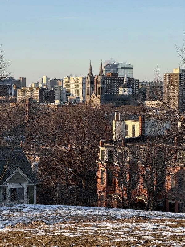
— Building with Pudding(stone) All around Roxbury, in Copley Square, and beyond to Newton, you can find buildings built with Roxbury Puddingstone. It was once cut from Dudley Cliff, nearby on Malcolm X Boulevard, or Timothy McCarthy’s quarry on Parker Hill, across from Mission Church, shown at the right.
— Roxbury conglomerate is visible at nearby Horatio Harris Park.
— The Museum of the
this page online
— When you polish Roxbury conglomerate, the variety of different broken rocks, or “clasts,” embedded in the mix become beautifully visible.
Topics. This historical marker is listed in these topic lists: Architecture • Natural Features • Natural Resources. A significant historical year for this entry is 1872.
Location. 42° 19.829′ N, 71° 5.402′ W. Marker is in Boston, Massachusetts, in Suffolk County. It is in Roxbury. It can be reached from Roxbury Street east of John Eliot Square, on the right when traveling west. Located in Roxbury Heritage State Park. Touch for map. Marker is in this post office area: Roxbury MA 02119, United States of America. Touch for directions.

Regionally, this marker is in Massachusetts’ Historic Boston. It is also in the American Northeast, in New England, and on the Eastern Seaboard. Globally, it is in the North Atlantic Region, North America, the Western Hemisphere, the Western World, and the Anglosphere. Historically, it finds itself in

Photographed by Marc Posner, July 13, 2024
2. Roxbury Puddingstone Marker
The wall is made of Roxbury Puddingstone.
Other nearby markers. At least 8 other markers are within walking distance of this marker: Roxbury Begins Here! (a few steps from this marker); The First People of Roxbury (a few steps from this marker); A Revolutionary View of Boston, 1776 (a few steps from this marker); Orchards and Gardens: Agricultural Innovation (within shouting distance of this marker); Meetinghouse at First Church in Roxbury (within shouting distance of this marker); John Eliot Square (about 300 feet away, measured in a direct line); Gen. Henry Knox Trail (about 400 feet away); Artillery Delivered from Fort Ticonderoga (about 400 feet away). Touch for a list and map of all markers in Boston.
Also see . . . Roxbury Conglomerate (Wikipedia). (Submitted on September 27, 2024, by Michael Herrick of Southbury, Connecticut.)
Photographed by G.W.Bartlett, January 24, 2026
3. View of Mission Church, Boston from nearby Highland Park aka Fort Hill Park, Roxbury
Credits. This page was last revised on February 14, 2026. It was originally submitted on September 19, 2024, by Marc Posner of Somerville, Massachusetts. This page has been viewed 912 times since then and 134 times this year. Photos: 1, 2. submitted on September 19, 2024, by Marc Posner of Somerville, Massachusetts. 3. submitted on January 28, 2026, by G.W.Bartlett of Hingham, Massachusetts. • Michael Herrick was the editor who published this page.
