Slaterville in Fairbanks in Fairbanks North Star Borough, Alaska — Northwest (North America)
Denali
The Coldest Mountain in the World

Photographed by William Fischer, Jr., August 17, 2024
1. Denali Marker
Denali's high latitude (north of 63°) and high altitude (20,310 ft.) create intensely cold and windy conditions. Spring offered the optimal weather for approaching and climbing the mountain in 1913. Still, its remote location and frigid conditions forced the Denali Expedition to haul one and a half tons of food, heating fuel, gear, and supplies to the mountain. There they expanded their outfit with firewood and wild game. Beyond 11,500 feet, they labored without the help of dogs, relaying their outfit upward on their backs. The weeks of travel, hauling supplies, building the base camp, and relaying work required of the 1913 Expedition far exceeded the burdens of mountaineers on Denali today.
Low barometric pressure at high altitude reduces the oxygen taken in with each breath. Above 5,000 to 10,000 feet, oxygen deprivation can cause shortness of breath, nausea, headaches, dizziness, fatigue, disruption to sleep patterns, and confusion. All four members of the ascent team experienced various symptoms of altitude sickness. Because Walter was least affected, Karstens put him in the lead on summit day.
[Top center graphic highlights]
Karstens'
this page online
Fairbanks
March 13
Stuck, Karstens, and Harper departed from St. Matthew's Episcopal Church in Fairbanks heading for Nenana with one dog team and a sled packed with supplies.
Nenana
March 15-16
Tatum, Johnny, and Esaias joined the expedition. They split their outfit between two sleds, and on March 17, the expedition struck out toward the Kantishna mining district in the foothills of Denali.
Diamond City - In the Fall of 1912, Karstens had traveled up the Tanana and Kantishna rivers to Diamond City on the Bear Claw River, where he stashed food and supplies for the climb.
Timberline Camp - 2,000 ft
April 4
Here the team camped for five days as they relayed their outfit to the camp and forward. they also chopped a supply of firewood.
"We made camp in an exceedingly pretty spot... the willows, all in bud, perfumed the air, and Denali soared clear and brilliant, far above the range, right in front of us."
-Hudson Stuck, Ascent of Denali
McGonagall Pass - Charles McGonagall, a member of the Sourdough Expedition that summited Denali's north peak in 1910, discovered this access route to Muldrow Glacier and
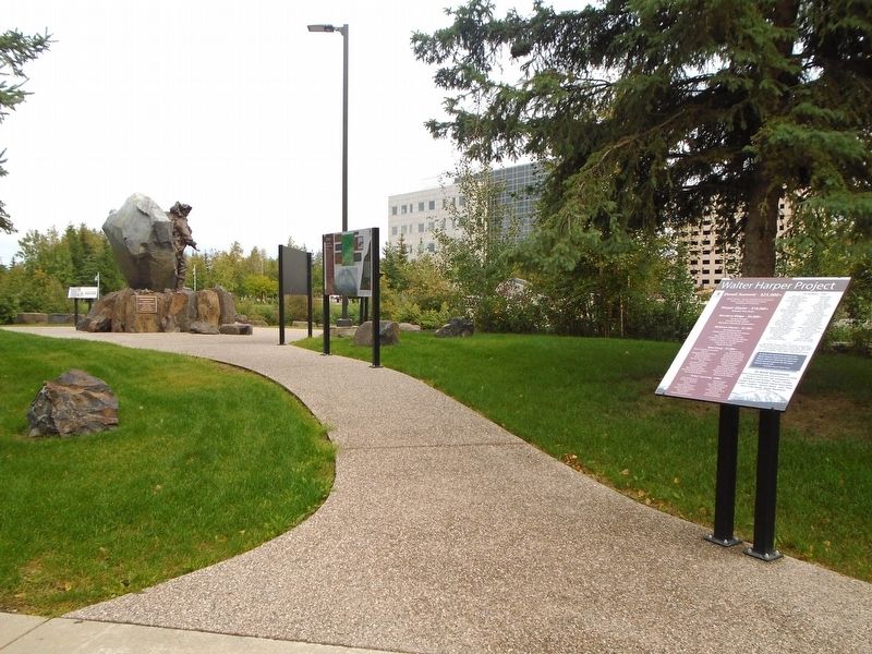
Photographed by William Fischer, Jr., August 17, 2024
2. Denali Marker
The Way In - The 1913 expedition spent four weeks traveling to their base camp at 4,000 feet.
[Right marker graphic]
The 1913 Muldrow Glacier route took the climbers 60 days from base camp at 4,000 feet to the peak at 20,310 feet. Moving supplies from one camp to the next required expedition members to make multiple trips, resulting in many ups and downs. With the advance of technology and modern-day equipment, current-day expeditions are much less labor intensive than in 1913. This graphic compares the hardships of the 1913 climb in terms of time and distances traveled to current expeditions [15 days].
1913 [Expedition] total feet climbed 100,000 ft
[Text to right of Denali photo reads]
Denali (Deenaalee), meaning the high one, is the Denaakk'e (Koyukon) name for the mountain. Other Dena' groups have used similar names. In 1896, the prospector William Dickey named North America's tallest mountain in honor of presidential candidate William McKinley of Ohio. In 1975, the State of Alaska petitioned the U.S. Board of Geographic Names (USBGN) to recognize the mountain as Denali. President Barack Obama officially restored the mountain's name to Denali in 2015.
[Bottom right text reads]
The USGS partnered with NOAA's National Geodetic Survey, Dewberry, CompassData and the University of Alaska-Fairbanks to conduct a precise Global Positioning measurement of a specific point at the mountain's peak. On September 2, 2015, the U.S. Geological Survey announced that the mountain is 20,310 feet, not 20,320 feet as measured in 1952 using photogrammetry.
Erected 2022 by Doyon, Limited.
Topics. This historical marker is listed in these topic lists: Environment • Exploration. A significant historical year for this entry is 1913.
Location. 64° 50.73′ N, 147° 43.206′ W. Marker is in Fairbanks, Alaska, in Fairbanks North Star Borough. It is in Slaterville. It is on Doyon Place. Touch for map. Marker is at or near this postal address: 1 Doyon Place, Fairbanks AK 99701, United States of America. Touch for directions.

Regionally, this marker is in the Alaska Railroad Corridor, in the Athabascan Region, and in Interior Alaska. It is also on the American Pacific Coast. Globally, it is in North America, on the Pacific Rim, in the Western Hemisphere, in the Western World, and in the Anglosphere. Historically, it finds itself in what was once the Russian Empire.
Other nearby markers. At least 8 other markers are within walking distance of this marker: The 1913 Pioneer Ascent of Denali (here, next to this marker); Walter Harper (here, next to this marker); Sled Dogs (a few steps from this marker); The Artist (a few steps from this marker); Fairbanks Riverfront (about 300 feet away, measured in a direct line); 1967 Chena River Flood (about 300 feet away); Community Volunteers (about 300 feet away); Gordon and Doris Wear (about 300 feet away). Touch for a list and map of all markers in Fairbanks.
More about this marker. Marker is part of the Walter Harper Memorial Project.
Credits. This page was last revised on September 20, 2024. It was originally submitted on September 19, 2024, by William Fischer, Jr. of Reynoldsburg, Ohio. This page has been viewed 257 times since then and 25 times this year. Photos: 1, 2. submitted on September 19, 2024, by William Fischer, Jr. of Reynoldsburg, Ohio.
