Charlevoix in Charlevoix County, Michigan — The American Midwest (Great Lakes)
The Last Swing Bridge

Photographed by J. J. Prats, September 10, 2024
1. The Last Swing Bridge Marker
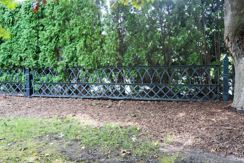
The City of Charlevoix gratefully acknowledges the contribution by Mrs. Mildred Campbell of the railings salvaged from the 1901 swing bridge which spanned the Pine River Channel. The railings now used as park fencing serve as a reminder of Charlevoix's past.
Erected by Charlevoix City Council, Charlevoix Downtown Development Authority.
Topics. This historical marker is listed in these topic lists: Bridges & Viaducts • Parks & Recreational Areas. A significant historical year for this entry is 1901.
Location. 45° 19.118′ N, 85° 15.573′ W. Marker is in Charlevoix, Michigan, in Charlevoix County. It can be reached from Park Avenue west of Bridge Street, on the right when traveling west. It is in Hoffman Park, which is between 105 and 103 Park Avenue.
this page online

Regionally, this marker is in Northern Michigan Lower Peninsula, in the Grand Traverse Bay Region, and in one of the Lake Michigan Shore counties. It is also in the American Midwest. Globally, it is in North America, on the Great Lakes, in the Western Hemisphere, in the Western World, and in the Anglosphere. Historically, it finds itself in what was once the Northwest Territory.
Other nearby markers. At least 8 other markers are within walking distance of this marker: 103 Main Street (now Park Avenue) (within shouting distance of this marker); History of Indigenous People in the Region / History of Indigenous People in the Area (within shouting distance of this marker); The Lower Channel / Bridges, Boats, and the Weathervane Inn (about 300 feet away, measured in a direct line); Robert Bridge Memorial Park (about 300 feet away); Fishing and Lumbering - Round Lake, North Shore / Bridge Park and Bridge Street (about 300 feet away); The Lower Channel Bridges (about 300 feet away); The First Congregational Church
Photographed by J. J. Prats, September 10, 2024
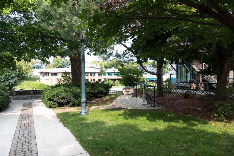
2. Hoffman Park and Marker
Marker is on the boulder in the middle distance to the right of the lamppost. Click on image to zoom in to examine the huge green-painted bridge "key" (to the right of the marker) used by the bridge tender to manually operate the gears to slowly turn the bridge aside so boats could pass.
Also see . . . Charlevoix Bridges. Drawings and photographs of the various bridges that have spanned the channel at this point. Excerpt:
In contrast to the delicate tracery of its predecessor, this bridge was a bold, compact network of steel girders on a concrete base. Like the third bridge it also rode on a turntable. Bridge tender Elmer Johnson, who began his thirty-three year career in 1899, was instrumental in the conversion to steam power after an exhaustive Sunday in 1901 when he worked a twenty-one hour shift turning the bridge ninety-two times with the manual key. The key was retired and is on display in Hoffman Park on Park Avenue just off Bridge Street.(Submitted on September 21, 2024.)
Photographed by J. J. Prats, September 10, 2024
3. Swing Bridge Railings Now Fences Hoffman Park
Photographed by J. J. Prats, September 10, 2024
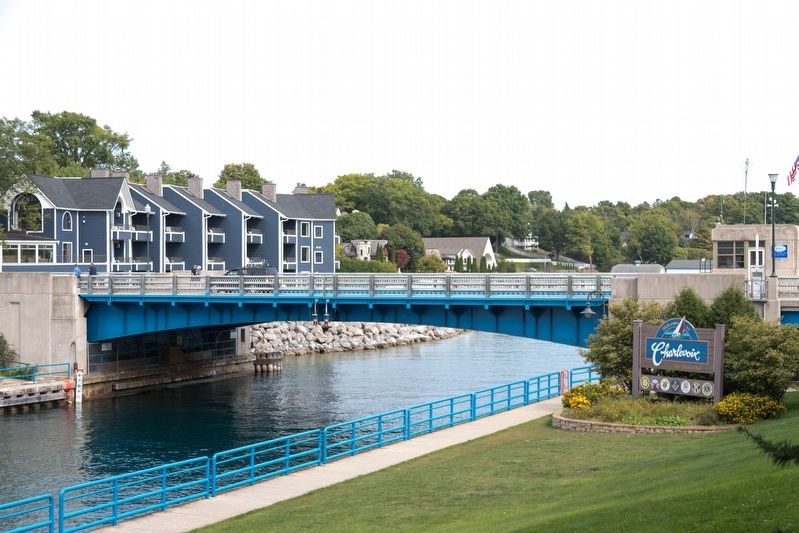
4. Swing Bridge’s Replacement, The 1948 Drawbridge
This view is from the marker. Bridge carries U.S. 31 over the channel between Round Lake and Lake Michigan.
Credits. This page was last revised on September 21, 2024. It was originally submitted on September 21, 2024, by J. J. Prats of Powell, Ohio. This page has been viewed 270 times since then and 56 times this year. Photos: 1, 2, 3, 4. submitted on September 21, 2024, by J. J. Prats of Powell, Ohio.
Editor’s want-list for this marker. A close up view of the bridge "key" located to the right of the marker. • Can you help?
