Near Modoc in Randolph County, Illinois — The American Midwest (Great Lakes)
Economic Development of the Lower Kaskaskia River
Photographed by Thomas Smith, September 6, 2024
1. Economic Development of the Lower Kaskaskia River Marker
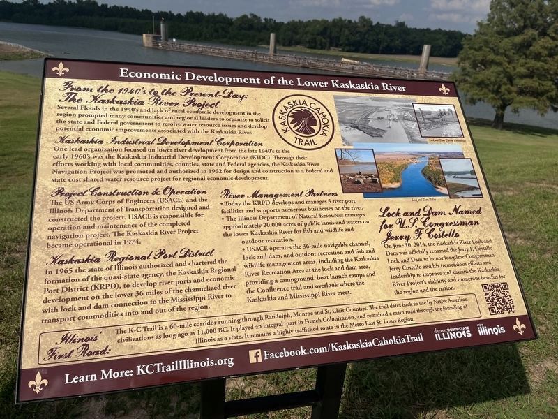
From the 1940's to the Present-Day: The Kaskaskia River Project
Several Floods in the 1940's and lack of rural economic development in the region prompted many communities and regional leaders to organize to solicit the state and Federal government to resolve water resource issues and develop potential economic improvements associated with the Kaskaskia River.
Kaskaskia Industrial Development Corporation
One lead organization focused on lower river early 1960's was the Kaskaskia Industrial Development Corporation (KIDC). Through their efforts working with local communities, counties, state and Federal agencies, the Kaskaskia River Navigation Project was promoted and authorized in 1962 for design and construction as a Federal and state cost shared water resource project for regional economic development.
Project Construction & Operation
The US Army Corps of Engineers (USACE) and the Illinois Department of Transportation designed and constructed the project. USACE is responsible for operation and maintenance of the completed navigation project. The Kaskaskia River Project became operational
this page online
Kaskaskia Regional Port District
In 1965 the state of Illinois authorized and chartered the formation of the quasi-state agency, the Kaskaskia Regional Port District (KRPD), to develop river ports and economic development on the lover 36 of the channelized river with lock and dam connection to the Mississippi River to transport commodities into and out of the region.
River Management Partners
• Today the KRPD develops and manages 5 river port facilities and supports numerous businesses on the river.
• The Illinois Department of Natural Resources manages approximately 20.000 acres of public lands and waters on the lower Kaskaskia River for fish and wildlife and outdoor recreation.
• USACE operates the 36-mile navigable channel, lock and dam, and outdoor recreation and fish and wildlife management areas, including the Kaskaskia River Recreation Area at the lock and dam area, providing a campground, boat launch ramps and the Confluence trail and overlook where the Kaskaskia and Mississippi River meet.
Lock and Dam Named for U.S. Congressman Jerry F. Costello
On June 10, 2014, the Kaskaskia River Lock and Dam
Photographed by Thomas Smith, September 6, 2024
2. Economic Development of the Lower Kaskaskia River Marker
Illinois' First Road:
The K-C Trail is a 60-mile corridor running through Randolph, Monroe and St. Clair Counties. The trail dates back to use by Native American civilizations as long ago as 11,000 BC. It played an integral part in French Colonization, and remained a main road through the founding of Illinois as a state. It remains a highly trafficked route in the Metro East St. Louis Region.
Erected 2024 by Discover Downstate Illinois; Enjoy Illinois.
Topics. This historical marker is listed in these topic lists: Government & Politics • Industry & Commerce • Waterways & Vessels. A significant historical date for this entry is June 10, 2014.
Location. 37° 59.055′ N, 89° 56.823′ W. Marker is near Modoc, Illinois, in Randolph County. It is on Levee Road 3.3 miles south of Roots Road, on the right when traveling north. Touch for map. Marker is at or near this postal address: 4800 Lock and Dam Road, Modoc IL 62261, United States of America. Touch for directions.

Regionally, this marker is in Southern Illinois — Little Egypt. It is also in the American Midwest, in the Corn Belt, and in the Great River Road Region. Globally, it is in North America, the Western Hemisphere, the Western World, and the Anglosphere. Historically, it finds itself in what was once the Viceroyalty of New France, the territory of the Mississippian Culture, and the Northwest Territory.
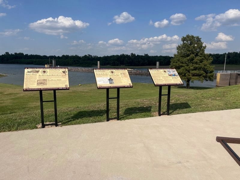
Other nearby markers. At least 8 other markers are within 3 miles of this marker, measured as the crow flies: History of the Mississippi and Kaskaskia Rivers Confluence Area (here, next to this marker); a different marker also named History of the Mississippi and Kaskaskia Rivers Confluence Area (here, next to this marker); Kaskaskia Confluence Area (approx. ¼ mile away); Reily Lake (approx. 1.8 miles away); Lewis and Clark in Illinois (approx. 2.2 miles away); Kaskaskia Island (approx. 2.3 miles away); Dedicated in Memory of George Rogers Clark (approx. 2.3 miles away); Kaskaskia Village (approx. 2.3 miles away). Touch for a list and map of all markers in Modoc.
Another marker is no longer nearby. Beaver Island (was approx. 2.3 miles away but has been confirmed missing).
Credits. This page was last revised on October 16, 2024. It was originally submitted on September 22, 2024, by Thomas Smith of Waterloo, Ill. This page has been viewed 120 times since then and 16 times this year. Photos: 1, 2. submitted on September 22, 2024, by Thomas Smith of Waterloo, Ill. • Devry Becker Jones was the editor who published this page.
