Northborough in Worcester County, Massachusetts — The American Northeast (New England)
Northborough's First and Second Meeting House
Photographed by Conrad Ward, May 28, 2024
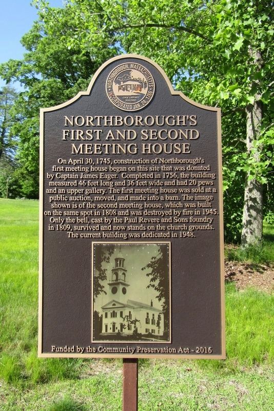
1. Northborough's First and Second Meeting House Marker
On April 30, 1745, construction of Northborough's first meeting house began on this site that was donated by Captain James Eager. Completed in 1756, the building measured 46 feet long and 36 feet wide and had 20 pews and an upper gallery. The first meeting house was sold at a public auction, moved, and made into a barn. The image shown is of the second meeting house, which was built on the same spot in 1808 and was destroyed by fire in 1945. Only the bell, cast by the Paul Revere and Sons foundry in 1809, survived and now stands on the church grounds. The current building was dedicated in 1948.
Funded by the Community Preservation Act - 2016
Erected 2016 by Town of Northborough.
Topics. This historical marker is listed in these topic lists: Colonial Era • Religion & Religious Structures.
Location. 42° 19.301′ N, 71° 38.76′ W. Marker is in Northborough, Massachusetts, in Worcester County. It is on Church Street west of Whitney Street, on the right when traveling west. Touch for map. Marker is in this post office area: Northborough MA 01532, United States of America. Touch for directions.

Regionally, this marker is in the Quiet Corner and in Greater Worcester. It is also in the American Northeast and in New England. Globally, it is in North America, the Western Hemisphere, the Western World, and the Anglosphere. Historically, it finds itself in what was once one of the original Thirteen Colonies.
Other nearby markers. At least 8 other markers are within walking distance of this marker: Northborough World War I Memorial (within shouting distance of this marker); PFC. Neil R. Ellsworth (about 300 feet away, measured in a direct line); Old Burial Map of the Howard Street Cemetery (about 400 feet away); Cold Harbor Brook Bridge (about
this page online
Also see . . . First Parish Unitarian Universalist of Northboro - Home. (Submitted on September 22, 2024, by Conrad Ward of Guilford, Connecticut.)
Photographed by Conrad Ward, May 28, 2024
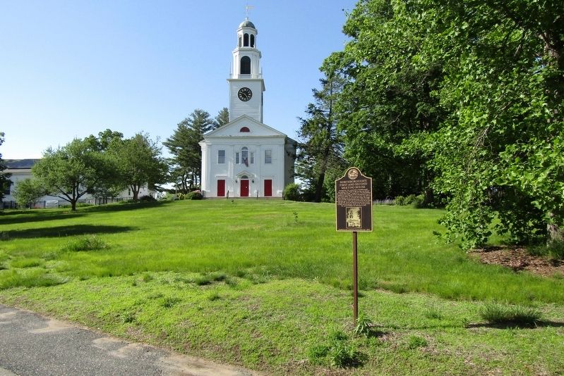
2. Northborough's First and Second Meeting House Marker
Credits. This page was last revised on September 30, 2024. It was originally submitted on September 22, 2024, by Conrad Ward of Guilford, Connecticut. This page has been viewed 184 times since then and 19 times this year. Photos: 1, 2. submitted on September 22, 2024, by Conrad Ward of Guilford, Connecticut. • Michael Herrick was the editor who published this page.
