
Streetsville in Mississauga in Peel Region, Ontario — Central Canada (North America)
Streetsville Memorial Cemetery
“Scotch Burying Ground”
| — | 1824 - 1891 | — |

Photographed by Tim Boyd, September 14, 2024
1. Streetsville Memorial Cemetery Marker
Erected by City of Mississauga.
Topics. This historical marker is listed in these topic lists: Cemeteries & Burial Sites • Religion & Religious Structures • Settlements & Settlers. A significant historical year for this entry is 1824.
Location. 43° 34.715′ N, 79° 42.555′ W. Marker is in Mississauga, Ontario, in Peel Region. It is in Streetsville. It is on Queen Street South 0.1 kilometers north of Church Street, on the right when traveling north. Touch for map. Marker is at or near this postal address: 299 Queen St S, Mississauga
this page online

Regionally, this marker is in Greater Toronto, specifically on the Golden Horseshoe, and in the Toronto Metropolitan Area. It is also in Central Canada. Globally, it is in North America, the Western Hemisphere, the Western World, and the Anglosphere. Historically, it finds itself in what was once a British colony, the Viceroyalty of New France, the Haudenosaunee (Iroquois) Confederacy, and Rupert’s Land.
Other nearby markers. At least 8 other markers are within walking distance of this marker: Streetsville (here, next to this marker); Remembering Our 1812 Heroes (here, next to this marker); St. Andrews Presbyterian Church (within shouting distance of this marker); a different marker also named Streetsville (about 150 meters away, measured in a direct line); Streetsville Grammar School (about 180 meters away); Queen & Main Street (approx. 0.4 kilometers away); Reid Mill / Moulin Reid (approx. 0.6 kilometers away); Streetsville Public Utilities Commission Water Wheel (approx. 0.6 kilometers away). Touch for a list and map of all markers in Mississauga.

Photographed by Tim Boyd, September 14, 2024
2. Streetsville Memorial Cemetery Marker (on the left side of the arch)

Photographed by Tim Boyd, September 14, 2024
3. Streetsville Memorial Cemetery
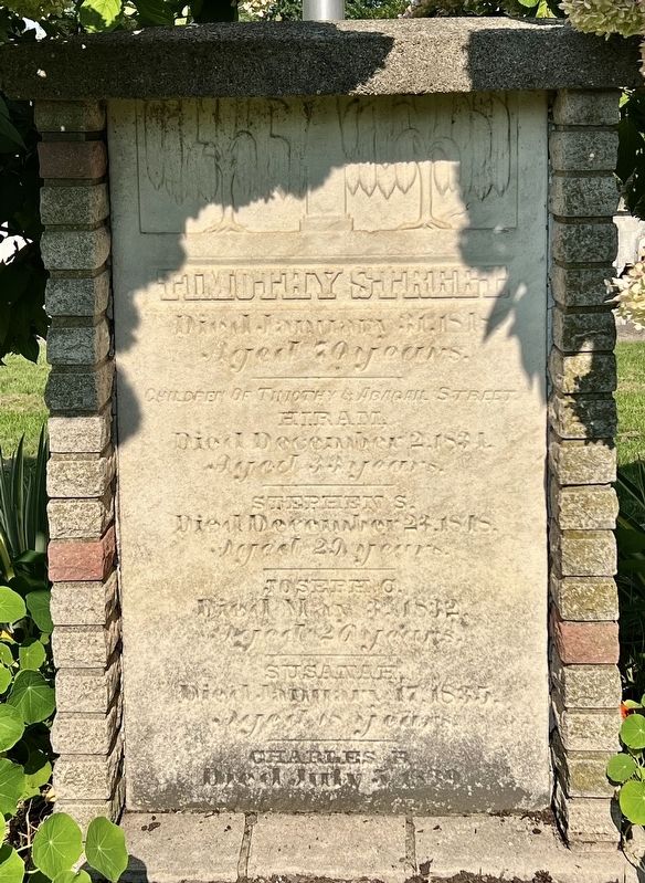
Photographed by Tim Boyd, September 14, 2024
4. Timothy Street gravestone, in Streetsville Memorial Cemetery

Photographed by Tim Boyd, September 14, 2024
5. Streetsville Memorial Cemetery and St. Andrew’s Presbyterian Church
Credits. This page was last revised on September 24, 2024. It was originally submitted on September 23, 2024, by Tim Boyd of Hamilton, Ontario. This page has been viewed 256 times since then and 23 times this year. Photos: 1, 2, 3, 4, 5. submitted on September 23, 2024, by Tim Boyd of Hamilton, Ontario. • Andrew Ruppenstein was the editor who published this page.
