Near Henrico in Henrico County, Virginia — The American South (Mid-Atlantic)
Malvern Hill
Day Seven of the Seven Days
| — | Malvern Hill Battlefield - Richmond National Battlefield Park | — |
Photographed by Craig Swain, March 21, 2010
1. Malvern Hill Marker
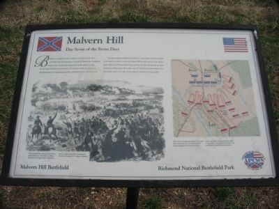
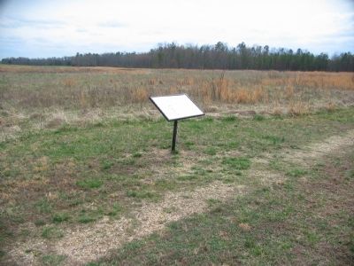
Through misunderstanding by Confederate commanders, Southern infantry were ordered to advance, across the Carter's Mill Road behind you, then up the gentle slope toward the powerful Union position. In 1862, the ground was open farmland in all directions. Wave after wave of Confederates pressed against the Federal line, many to be slain at long range by well-served Union artillery.
Erected by Association for the Preservation of Civil War Sites, Inc.
Topics. This historical marker is listed in this topic list: War, US Civil. A significant historical date for this entry is July 1, 1862.
Location. 37° 25.237′ N, 77° 15.157′ W. Marker is near Henrico, Virginia, in Henrico County. It is at the intersection of Carters Mill Road and Willis Church Road (Virginia Highway 156), on the
this page online

Regionally, this marker is in Virginia’s Piedmont, in Central Virginia, and in the Richmond Metropolitan Area. It is also in the American South, specifically in the Upper South, and on the Eastern Seaboard. Globally, it is in the North Atlantic Region, North America, the Western Hemisphere, the Western World, and the Anglosphere. Historically, it finds itself in what was once the territory of the Mississippian Culture, one of the original Thirteen Colonies, one of the Confederate States of America, and the Antebellum South.
Other nearby markers. At least 8 other markers are within walking distance of this marker: Confederate Futility (within shouting distance of this marker); Outgunned (within shouting distance of this marker); "Madness" (about 400 feet away, measured in a direct line); a different marker also named Confederate Futility (about 400 feet away); Battlefield Burials

2. Malvern Hill - CWPT
Civil War Preservation Trust's efforts to preserve portions of the battlefield.
Click for more information.
Click for more information.
More about this marker. In the center of the marker is a wartime drawing depicting the Confederate attacks. The Confederates attacked across the fields before you. McClellan's artillery, firing from the ridge today marked by cannon, devastated the Confederate columns. (Drawing from Harper's Weekly)
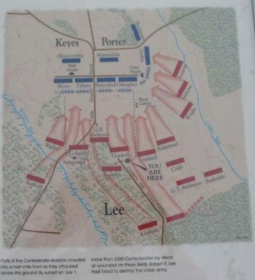
On the right is a map showing the tactical situation. Parts of five Confederate divisions crowded into a half-mile front as they attacked across this ground. By sunset on July 1, more than 5000 Confederates lay dead or wounded on these fields. Robert E. Lee had failed to destroy the Union army.
Photographed by Craig Swain, March 21, 2010
3. Battle Map
Photographed by Craig Swain, March 21, 2010
4. Malvern Hill Marker
Photographed by Craig Swain, March 21, 2010
5. Confederate Artillery
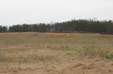
An authentic bronze 6-pdr Field gun and two replica 3-inch Ordnance Rifles represent the Confederate batteries deployed on the north edge of the battlefield.
Photographed by Craig Swain, March 21, 2010
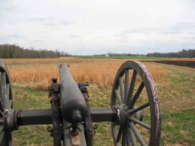
6. Confederate Gunner's View
Looking down one of the replica Ordnance Rifles toward the West House and the Federal lines.
Credits. This page was last revised on September 28, 2024. It was originally submitted on April 1, 2010, by Craig Swain of Leesburg, Virginia. This page has been viewed 1,407 times since then and 32 times this year. Last updated on September 27, 2024, by Carl Gordon Moore Jr. of North East, Maryland. Photos: 1. submitted on April 1, 2010, by Craig Swain of Leesburg, Virginia. 2. submitted on March 28, 2010, by Craig Swain of Leesburg, Virginia. 3, 4, 5, 6. submitted on April 1, 2010, by Craig Swain of Leesburg, Virginia. • Bernard Fisher was the editor who published this page.
