Fife Lake Township in Grand Traverse County, Michigan — The American Midwest (Great Lakes)
Bandstands
1880 and 1920
| — | Fife Lake Historical Walk | — |
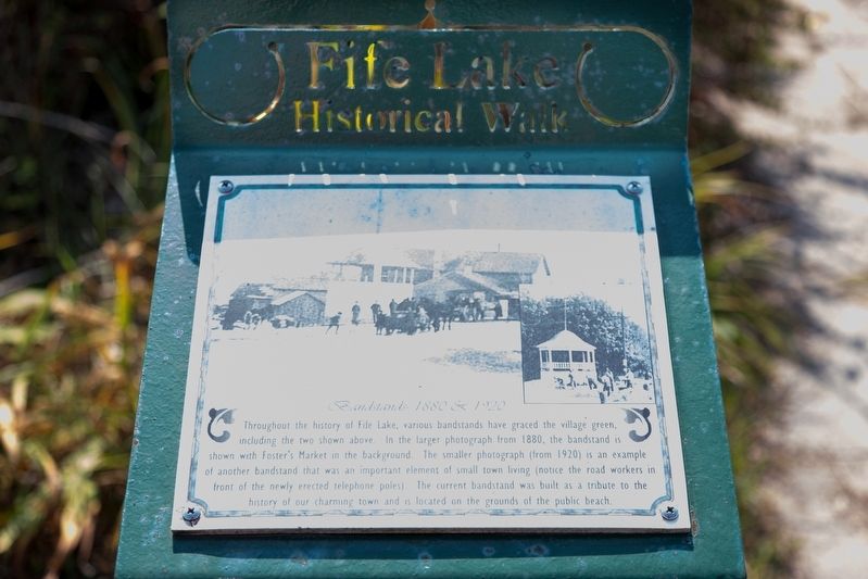
Photographed by J. J. Prats, September 13, 2024
1. Bandstands Marker
Erected by Fife Lake Historical Society. (Marker Number 14.)
Topics. This historical marker is listed in these topic lists: Entertainment • Parks & Recreational Areas. A significant historical year for this entry is 1880.
Location. 44° 34.612′ N, 85° 21.034′ W. Marker is in Fife Lake, Michigan, in Grand Traverse County. It is in Fife Lake Township. It is at the intersection of West State Street and Jane Street, on the right when traveling east on West State Street. Touch for map. Marker is at or near this postal address: 104 Janet St, Fife Lake MI 49633, United States of America.
this page online

Regionally, this marker is in Northern Michigan Lower Peninsula and in the Grand Traverse Bay Region. It is also in the American Midwest. Globally, it is in North America, the Western Hemisphere, the Western World, and the Anglosphere. Historically, it finds itself in what was once the Northwest Territory.
Other nearby markers. At least 8 other markers are within walking distance of this marker: Voice Bros. Auto Sales (within shouting distance of this marker); Logging and Saw Mills (within shouting distance of this marker); Ice Plant (within shouting distance of this marker); City Hotel (about 300 feet away, measured in a direct line); Hodges House (about 300 feet away); LaBar House (about 300 feet away); Early Village Merchant (about 400 feet away); The Sugar Bowl (about 400 feet away). Touch for a list and map of all markers in Fife Lake.

Photographed by J. J. Prats, September 13, 2024
2. Bandstands Marker
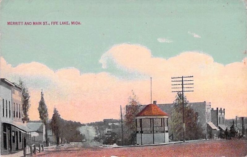
J.J. Prats Postcard Collection, circa 1920
3. Merritt and Main Streets, Fife Lake, Mich.
This hand-colored photograph postcard does not name the company that printed it.
Credits. This page was last revised on October 11, 2024. It was originally submitted on September 28, 2024, by J. J. Prats of Powell, Ohio. This page has been viewed 136 times since then and 12 times this year. Photos: 1, 2. submitted on September 28, 2024, by J. J. Prats of Powell, Ohio. 3. submitted on October 11, 2024, by J. J. Prats of Powell, Ohio.
Editor’s want-list for this marker. better photos • a photo of the bandstand which is now at the public beach • Can you help?
