Dyea in Skagway in Skagway Borough, Alaska — Northwest (North America)
Captain Moore's Vision: The Gateway to the Klondike Goldfields
Historic Moore Homestead
| — | Klondike Gold Rush National Historical Park | — |
Photographed by William Fischer, Jr., August 24, 2024
1. Captain Moore's Vision: The Gateway to the Klondike Goldfields Marker
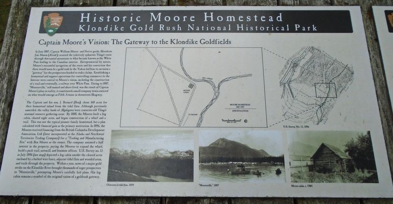
In June 1887, Captain William Moore and Native guide, Skookum Jim Mason (Keish), scouted the relatively unknown Tlingit route through the coastal mountains to what became known as the White Pass leading to the Canadian interior. Entrepreneurial by nature, Moore's successful navigation of the route and his conviction that there would soon be a gold rush to the Yukon led him to envision a "gateway" for the prospectors headed to stake claims. Establishing a homestead and support operations for controlling commerce to the Interior were central to Moore's vision, including the construction of a trail and eventually, a railway over White Pass. Dating to 1887, "Mooresville," self-named and short-lived, was the result of Captain Moore's plan; in reality, it constituted a small company town centered on what would emerge as Fifth Avenue in downtown Skagway.
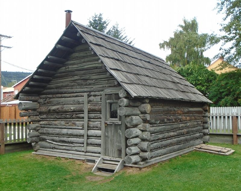
The Captain and his son, J. Bernard (Ben), chose 160 acres for their homestead inland from the tidal flats. Although previously unsettled, the valley lands of Shghagwei were centuries-old Tlingit seasonal resource gathering areas. By 1888, the Moores built a log cabin, cleared
this page online
[Illustration captions, clockwise from top center, read]
• Moore Homestead 1887-1897 Site Evolution [map] from U.S. Survey No. 13, 1896
Photographed by William Fischer, Jr., August 24, 2024
2. Captain Moore's Vision: The Gateway to the Klondike Goldfields Marker
• "Mooresville," 1897
• Overview of tidal flats, 1894
Erected by National Park Service, U.S. Department of the Interior.
Topics. This historical marker is listed in these topic lists: Exploration • Industry & Commerce • Roads & Vehicles • Settlements & Settlers. A significant historical month for this entry is June 1887.
Location. 59° 27.302′ N, 135° 18.845′ W. Marker is in Skagway, Alaska, in Skagway Borough. It is in Dyea. It is on 5th Avenue east of Broadway, on the left when traveling east. Touch for map. Marker is at or near this postal address: 400 Spring St, Skagway AK 99840, United States of America. Touch for directions.

Regionally, this marker is on the American Pacific Coast. Globally, it is in North America, on the Ring of Fire, on the Pacific Rim, in the Western Hemisphere, in the Western World, and in the Anglosphere. Historically, it finds itself in what was once the Russian Empire.
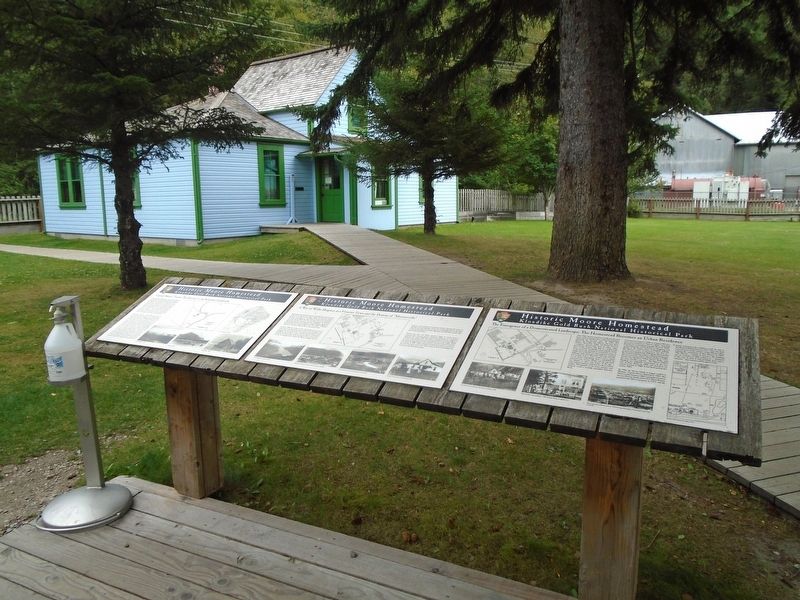
Other nearby markers. At least 8 other markers are within walking distance of this marker: A War of Wills: Skagway as a Frontier Town and the Demise of "Mooresville" (here, next to this marker);
Photographed by William Fischer, Jr., August 24, 2024
3. Captain Moore's Cabin
Photographed by William Fischer, Jr., August 24, 2024
4. Moore Homestead
Credits. This page was last revised on January 2, 2025. It was originally submitted on September 29, 2024, by William Fischer, Jr. of Reynoldsburg, Ohio. This page has been viewed 290 times since then and 43 times this year. Photos: 1, 2, 3, 4. submitted on September 29, 2024, by William Fischer, Jr. of Reynoldsburg, Ohio.
