Goodland in Sherman County, Kansas — The American Midwest (Upper Plains)
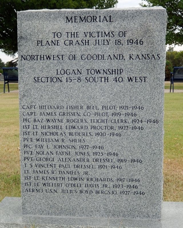
Memorial to the Victims of Plane Crash July 18, 1946
Photographed by Cosmos Mariner, September 5, 2024
1. Memorial to the Victims of Plane Crash July 18, 1946 Marker
Logan Township
Section 15-8 South 40 West
Capt. Hillyard Fisher Bell, Pilot, 1921-1946
Capt. James Grissen, Co-pilot, 1919-1946
PFC Baz Wayne Rogers, Flight Clerk, 1924-1946
1st Lt. Hershel Edward Proctor, 1922-1946
1st Lt. Nicholas Budures, 1920-1946
Pvt. William R. Sheils
PFC. Fay E. Johnson, 1927-1946
Pvt. Nolan Fayne Jones, 1925-1946
Pvt. George Alexander Dressel, 1919-1946
T5 Vincent Paul Dressel, 1921-1946
Lt. James R. Daniels Jr.
1st Lt. Kenneth Edwin Richards, 1917-1946
1st Lt. Wilfert O’Dell Davis Jr., 1923-1946
AER M3 U.S.N. Julius Boyd Bergsjo, 1927-1946
Topics. This historical marker is listed in these topic lists: Air & Space • Cemeteries & Burial Sites • Disasters • Military. A significant historical date for this entry is July 18, 1946.
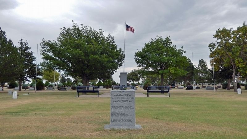
Location. 39° 21.964′ N, 101° 42.878′ W. Marker is in Goodland, Kansas, in Sherman County. It can be reached from the intersection of North Main Avenue and Armory Road (County Road 66), on the left when traveling north. The marker is located near the center of Goodland Cemetery. Touch for map. Marker is at or near this postal address: 434 North Main Avenue,
this page online

Regionally, this marker is in the American Midwest, in the Corn Belt, on the prairies, on the Great Plains, on the Southern Plains, and specifically on the High Plains. Globally, it is in North America, the Western Hemisphere, the Western World, and the Anglosphere. Historically, it finds itself in what was once the Louisiana Purchase.
Other nearby markers. At least 8 other markers are within 2 miles of this marker, measured as the crow flies: In Honor of Those Who Serve (about 700 feet away, measured in a direct line); Roll of Honor (about 700 feet away); Courthouse Statue & Bell (approx. 1.1 miles away); United Telephone Building (approx. 1.2 miles away); United States Post Office (approx. 1.3 miles away); Carnegie Art Center (approx. 1.3 miles away); Ennis Handy House / Mary Seaman Ennis House (approx. 1.4 miles away); Chambers Fountain (approx. 1.4 miles away). Touch for a list and map of all markers in Goodland.
Also see . . .
1. C 47 45-930, Military Plane Crash, July 18, 1946. (includes crash site photos and personal memorials for the victims)
Excerpt:(Submitted on October 1, 2024, by Cosmos Mariner of Cape Canaveral, Florida.)The basic cause factor of this accident is weather, with contributing factors of failure of the weather warning service to adequately record and trace the path of storms of violent nature as passed over Denver, and the failure of the Army Flight Advisory service in Kansas City to have any knowledge of such storms.Photographed by Cosmos Mariner, September 5, 20242. Memorial to the Victims of Plane Crash July 18, 1946Looking east through the center of Goodland Cemetery.
2. Crash of a Douglas C-47B-45-DK near Goodland: 13 killed.
Excerpt:(Submitted on October 1, 2024, by Cosmos Mariner of Cape Canaveral, Florida.)
Type of aircraft: Douglas C-47 Skytrain (DC-3)
Operator: USAAF
Circumstances: The crew was performing a flight from Forbes AFB (Topeka) to Lowry AFB located near Aurora, Colorado. Enroute, while cruising in adverse weather conditions, the aircraft went out of control and crashed in a field located 4 miles north of Goodland. All 13 occupants were killed. It appears that at the time of the accident, weather conditions were poor with thunderstorm activity and electricity.
Probable cause: It is believed that the loss of control was caused by severe turbulence due to thunderstorm activity. Also, electricity in the stormy area may badly influenced on board equipment.
Credits. This page was last revised on October 2, 2024. It was originally submitted on October 1, 2024, by Cosmos Mariner of Cape Canaveral, Florida. This page has been viewed 576 times since then and 68 times this year. Photos: 1, 2. submitted on October 1, 2024, by Cosmos Mariner of Cape Canaveral, Florida.
