Quadrate in Mannheim, Baden-Württemberg, Germany — Central Europe
Der Friedrichs-Park 1
Der Schlossgarten Mannheim - Tafel 4
⎯⎯⎯
The Friedrichs-Park 1
The Mannheim Palace Garden - Panel 4
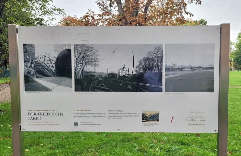
Photographed by James Hulse, September 23, 2024
1. Der Friedrichs-Park 1 / The Friedrichs-Park 1 Marker

Geschichte Dieses Drtes
Im nordwestlichen Teil des Schlossgartens entstand nach der Pfalzgaususstellung 1880 der Friedrichspark als bunter Erholungs- und Vergnügungspark. Zuver hatte sich hier nehen landschaftlichen Partien auch vin botanischer Garten befunden.
Dieses Projekt entstand in Zusammenarbeit Fotografen Robert Ettlinger, www.robert-ettlinger.de, mit den Staatlichen Schloessern und Gärten Baden-Württemberg, www.schloesser-und-gaerten.de
Bildunterschriften
Treppenaufgang mit Graffiti, H42-5, 2020
Jesuitenkirche und Alte Strenwarte. T439-5, 2020
Friedrichspark, unter der Hochstraße. H77-11, 2022
Joseph Paul Karg; Ansicht eines Theils des Parks von der Rhein Seite gegen die Sternwarte und die größe Hofkirche, 1819.
History of This Place
The northwestern part of the palace garden was developed as a park with diverse leisurely amenities (Friedrichspark) after 1880. Initially, the grounds encompassed a botanical garden alongside the English-style landscape garden
This project was created in collaboration with photographer Robert Ettlinger, www.robert-ettlinger.de, and the State Palaces and Gardens of Baden-Württemberg, www.schloesser-und-gaerten.de
Captions
Staircase with graffiti, H42-5, 2020
Jesuit Church and Old Observatory. T439-5, 2020
Friedrichspark, under the highstreet. H77-11, 2022
Joseph Paul Karg; View of part of the park from the Rhine side towards the observatory and the large court church, 1819.
Erected by Stadt
this page online
Topics. This historical marker is listed in these topic lists: Education • Parks & Recreational Areas. A significant historical year for this entry is 1880.
Location. 49° 29.026′ N, 8° 27.656′ E. Marker is in Mannheim, Baden-Württemberg. It is in Quadrate. It is on Bismarckstraße just south of A2. The marker is located on the campus of the University of Mannheim in Friedrichs Park. Touch for map. Marker is at or near this postal address: Bismarckstraße 10, Mannheim BW 68159, Germany. Touch for directions.

Regionally, this marker is on the German Upper Rhine. Globally, it is in Europe, the European Union, Atlantic Europe, Central Europe, the Schengen Area, Western Europe, and the Western World. Historically, it finds itself in what was once the Roman Empire, the Holy Roman Empire, and the former West Germany.
Other nearby markers. At least 8 other markers are within walking distance of this marker: Der Friedrichs-Park 2 / The Friedrichs-Park 2 (here, next to this marker); Karl Drais und seine Laufmaschine (within shouting distance of this marker); Wechselnde Schlossbewohner / Changing Palace Residents
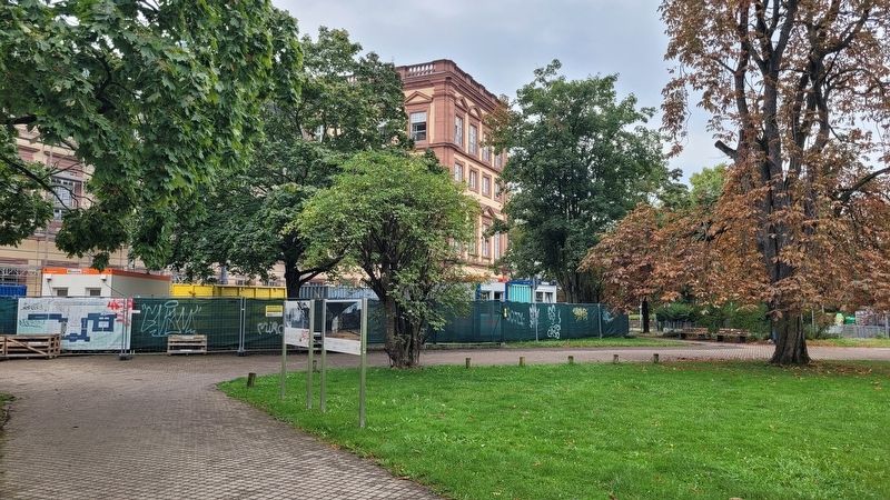
Photographed by James Hulse, September 23, 2024
2. The Friedrichs-Park 1 Marker is the left marker of the two markers
Also see . . . Mannheim Baroque Palace. Stadt Mannheim, Baden-Württemberg and Staatliche Schlösser und Gärten (Submitted on October 3, 2024, by James Hulse of Medina, Texas.)
Credits. This page was last revised on October 3, 2024. It was originally submitted on October 2, 2024, by James Hulse of Medina, Texas. This page has been viewed 101 times since then and 17 times this year. Photos: 1, 2. submitted on October 3, 2024, by James Hulse of Medina, Texas.
