St. Charles in Kane County, Illinois — The American Midwest (Great Lakes)
The Pottawatomi
Photographed by Sean P. Flynn, October 1, 2024
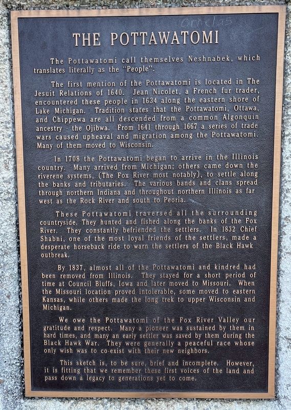
1. The Pottawatomi Marker
The first mention of the Pottawatomi is located in The Jesuit Relations of 1640. Jean Nicolet, a French fur trader, encountered these people in 1634 along the eastern shore of Lake Michigan. Tradition states that the Pottawatomi, Ottawa, and Chippewa are all descended from a common Algonquin ancestry - the Ojibwa. From 1641 through 1667 a series of trade wars caused upheaval and migration among the Pottawatomi. Many of them moved to Wisconsin.
In 1708 the Pottawatomi began to arrive in the Illinois country. Many arrived from Michigan; others came down the riverene systems, (The Fox River most notably), to settle along the banks and tributaries. The various bands and clans spread through northern Indiana and throughout northern Illinois as far west as the Rock River and south to Peoria.
These Pottawatomi traversed
this page online
By 1837, almost all of the Pottawatomi and kindred had been removed from Illinois. They stayed for a short period of time at Council Bluffs, Iowa and later moved to Missouri. When the Missouri location proved intolerable, some moved to eastern Kansas, while others made the long trek to upper Wisconsin and Michigan.
We owe the Pottawatomi of the Fox River Valley our gratitude and respect. Many a pioneer was sustained by them in hard times, and many an early settler was saved by them during the Black Hawk War. They were generally a peaceful race whose only wish was to co-exist with their new neighbors.
This sketch is, to be sure, brief
Photographed by Sean P. Flynn, October 1, 2024
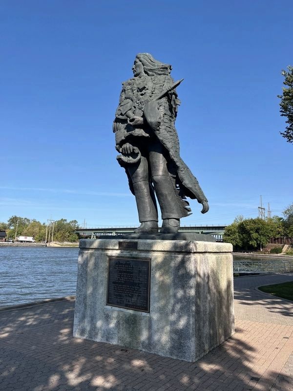
2. Ēkwabet statue
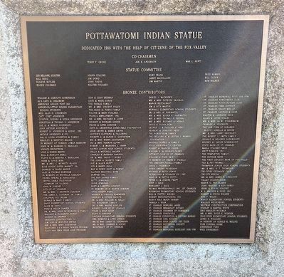
The Native American depicted on the statue stands overlooking the Fox River. The marker describing the statue is visible on the front of this photo. Not visible facing the river is a marker about the history of the Pottawatomi tribe; a marker about the statue's benefactors is on the rear side (facing north).
Erected 1989.
Topics and series. This historical marker is listed in these topic lists: Arts, Letters, Music • Exploration • Indigenous Peoples and Communities • Settlements & Settlers. In addition, it is included in the Black Hawk War series list. A significant historical year for this entry is 1640.
Location. 41° 54.946′ N, 88° 18.859′ W. Marker is in St. Charles, Illinois, in Kane County. It can be reached from Riverside Avenue north of State Avenue. The plaque is affixed to the front (Fox River-facing) side of the Ēkwabet statue. It is a roughly 250-yard walk along the river from the St. Charles City Hall. Touch for map. Marker is in this post office area: Saint Charles IL 60174, United States of America. Touch for directions.

Regionally, this marker is
Photographed by Sean P. Flynn, October 1, 2024
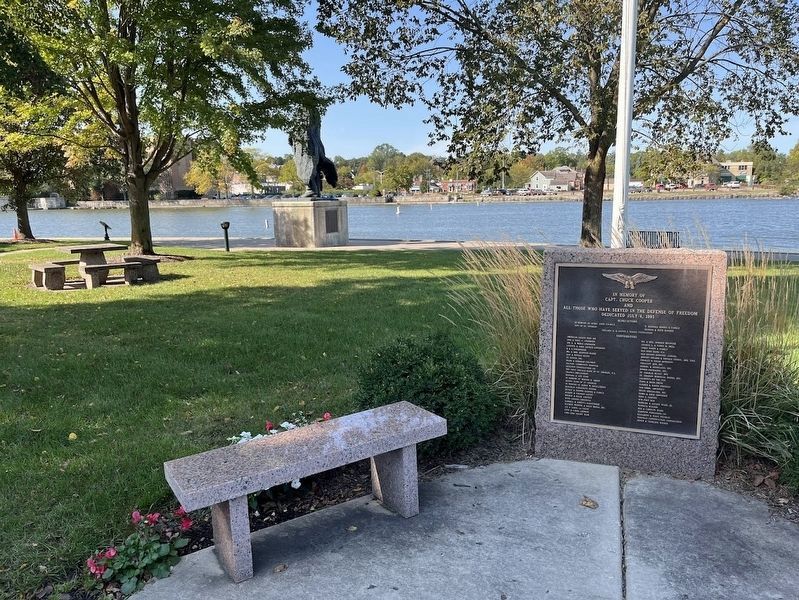
3. Rear view of the statue
A memorial to Chuck Cooper, a local pilot who died during the first Gulf War, is in the front of the photo.
Other nearby markers. At least 8 other markers are within walking distance of this marker: Ēkwabet (here, next to this marker); Historic St. Charles (a few steps from this marker); Capt. Chuck Cooper (within shouting distance of this marker); Veterans Memorial (within shouting distance of this marker); Shelby School Bell (about 400 feet away, measured in a direct line); The Legend of Charlemagne (about 700 feet away); a different marker also named Historic St. Charles (approx. 0.2 miles away); St. Charles, Illinois (approx. 0.2 miles away). Touch for a list and map of all markers in St. Charles.
More about this marker.
Courtesy of the Library of Congress
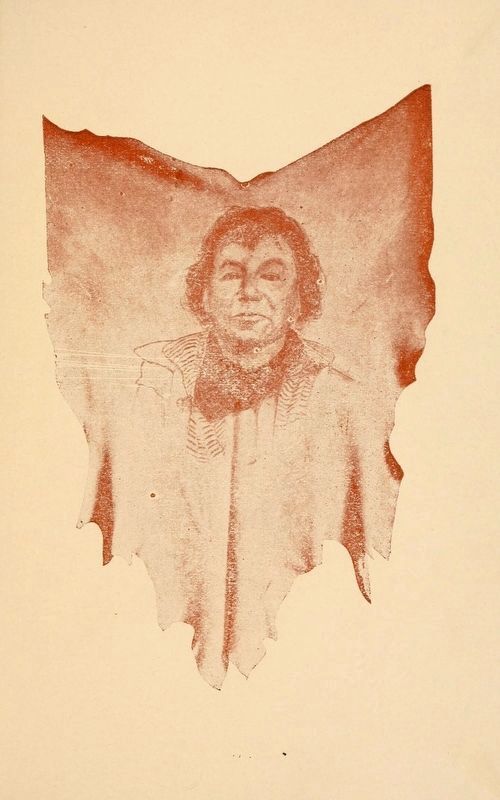
4. Chief Shabbona (Shabni)
From the 1915 book The Indian Chief Shabbona, by Luther A. Hatch, superintendent of public schools in DeKalb, Illinois, a photo of the Pottowatomi leader also known as Shabni.
Regarding The Pottawatomi. Shabni, referenced on the plaque, is the chief Benjamin Shabbona (or Shabonah, among other spellings). The village of Shabbona in neighboring DeKalb County is named after Shabni, who had land there that was taken away by the government. He is buried in Morris, Illinois, where he spent his final years on a plat of donated land.
Also see . . .
1. Historic Native Americans in the Fox River Valley. From the St. Charles History Museum (Submitted on October 5, 2024, by Sean P. Flynn of Oak Park, Illinois.)
2. Pottawatomi History.
Photographed by Sean P. Flynn, October 1, 2024
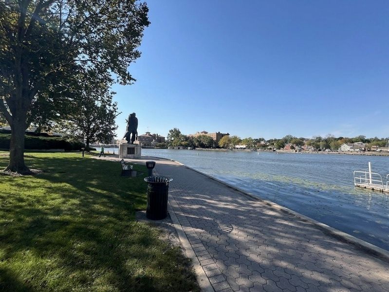
5. Ēkwabet statue
The statue alongside the Fox River, with downtown St. Charles in the distance.
Excerpt: "The Potawatomi fell on hard times in the 20 years after the [War of 1812] and were often unable to hunt and grow enough food to eat. They had little choice except to cede their land to the United States in exchange for money so they could survive. The state of Illinois was rapidly settled by Whites, and the governor and other elected officials were anxious to move the Potawatomi out of the state. The Potawatomi ceded some of their land in northwestern Illinois and southwestern Wisconsin in 1829. Many Illinois Potawatomi actively supported the United States Army during the Black Hawk War in 1832 to prevent or delay being removed westward, but this strategy backfired. On September 26, 1833, the Potawatomi of Illinois and Wisconsin signed the Treaty of Chicago, which ceded the last of their lands to the United States."(Submitted on October 5, 2024, by Sean P. Flynn of Oak Park, Illinois.)
3. Potawatomi Nation official site.
Photographed by Sean P. Flynn, October 1, 2024
6. The Ēkwabet statue dedication plaque
Credits. This page was last revised on October 9, 2024. It was originally submitted on October 5, 2024, by Sean P. Flynn of Oak Park, Illinois. This page has been viewed 594 times since then and 103 times this year. Photos: 1, 2, 3. submitted on October 5, 2024, by Sean P. Flynn of Oak Park, Illinois. 4. submitted on September 17, 2024, by Sean P. Flynn of Oak Park, Illinois. 5, 6. submitted on October 5, 2024, by Sean P. Flynn of Oak Park, Illinois.
