
St. Charles in Kane County, Illinois — The American Midwest (Great Lakes)
Historic St. Charles
The Municipal Plaza
Photographed by Sean P. Flynn, October 1, 2024
1. Historic St. Charles Marker
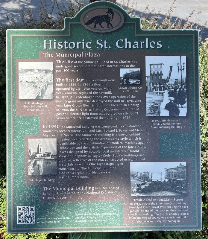
The first dam and a sawmill were built in 1836. In 1866 a flourmill, operated by Civil War veteran Major W.G. Conklin, replaced the sawmill. In 1877, A. Fredenhagen took over operation of the flour & grain mill. Fire destroyed the mill in 1896. One year later Crown Electric rebuilt on the site. Beginning in 1908, the St. Charles Fixture Co., a manufacturer of gas and electric light fixtures, operated on site for 21 years before fire destroyed the building in 1929.
In 1940 the Municipal Building was completed, its construction funded by local residents Col. and Mrs. Edward J. Baker and Mr. and Mrs. Lester J. Norris. The Municipal Building is a one-of-a-kind masterpiece reflecting the Art Moderne style which is identifiable by the combination of 'modern' machine age technology and the artistic expression of the late 1930's. It was designed by notable local architect R. Harold Zook and nephew D. Taylor Cody. Zook's buildings are creative, reflective of the era, constructed using natural materials as well
this page online
The Municipal Building is a Designated Landmark and listed in the National Register of Historic Places.
[Caption in top left:]
A. Fredenhagen Flour & Grain Mill circa 1877
[Caption in top right:]
In 1929 fire destroyed the St. Charles Fixture Manufacturing building
[Caption in bottom left:]
Municipal building
[Caption in bottom right:]
Train Accident on Main Street
In 1915, across the street from current day Municipal Plaza, Great Western Engine #214 ran off the end of the track on the riverfront spur line, crashing Into the St. Charles Fruit & Confectionery Shop. No one was injured; the shop was only slightly damaged.
Erected 2013 by Downtown St. Charles Partnership; City of St. Charles; St. Charles Heritage Center.
Topics and series. This historical marker is listed in these topic lists: Architecture • Industry & Commerce • Railroads & Streetcars • Waterways & Vessels. In addition, it is included in the Art Deco series list. A significant historical year for this entry is 1940.
Location. 41° 54.836′ N,
Photographed by Sean P. Flynn, October 1, 2024
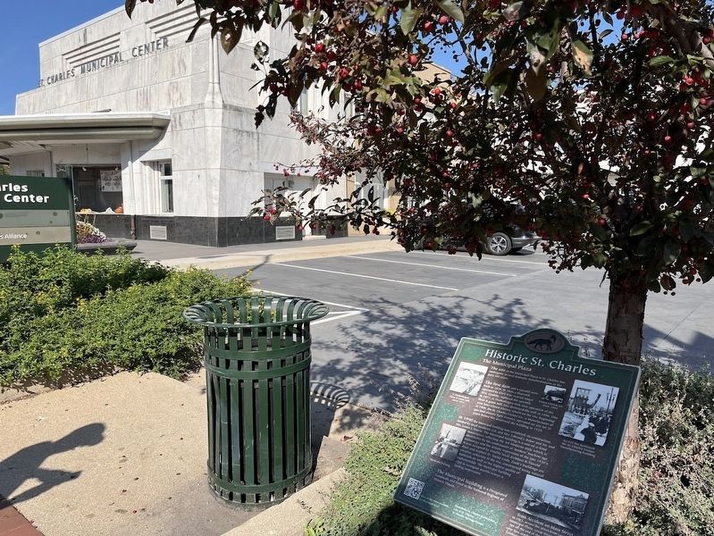
2. Historic St. Charles Marker and City Hall

Regionally, this marker is in Greater Chicago. It is also in the American Midwest. Globally, it is in North America, on the Great Lakes, in the Western Hemisphere, in the Western World, and in the Anglosphere. Historically, it finds itself in what was once the territory of the Mississippian Culture and also the Northwest Territory.
Other nearby markers. At least 8 other markers are within walking distance of this marker: St. Charles, Illinois (within shouting distance of this marker); The Legend of Charlemagne (about 300 feet away, measured in a direct line); Shelby School Bell (about 400 feet away); Wild Rose Farm Bell (about 500 feet away); Founders Wall and Eastside Gardens (about
Photographed by Sean P. Flynn, October 1, 2024
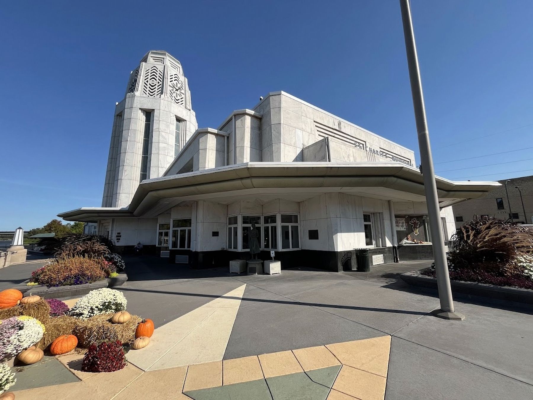
3. St. Charles Municipal Center
The 1940 building overlooking the Fox River is on the National Register of Historic Places.
More about this marker. The name of R. Harold Zook's nephew who was one of the architects on the building is D. Coder Taylor (not D. Taylor Cody, as listed on the marker).
Also see . . .
1. St. Charles Municipal Building. The building's listing on the SAH Archipedia from the Society of Architectural Historians.
Excerpt: "A polished black granite base and sparkling white marble walls conceal the building’s concrete and steel construction. White Lustron steel panels cover the underside of the deep overhang along the river and North Avenue. The building had an extraordinary lighting program, including changing, multi-colored lights in the tower, glowing bands of light under the overhang, concealed lighting in the ceiling reveals, and fluorescent fixtures throughout. This was one of the earliest buildings to be lit entirely by fluorescent tubing."(Submitted on October 5, 2024, by Sean P. Flynn of Oak Park, Illinois.)
2. R. Harold Zook.
Photographed by Sean P. Flynn, October 1, 2024
4. St. Charles City Hall
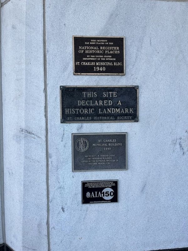
Plaques at the entrance of the Muncipal Building (about 50 yards west of the historical marker) note its national and local landmark status. It was also named one of the 150 "Great Places in Illinois" by the American Institute of Architects in 2007.
3. What's happening with the St. Charles Dam?. From the Preservation Partners of the Fox Valley, this article looks at recent plans to remove all of the Fox River dams in Kane County, including the prominently placed one in downtown St. Charles, whose origins are referenced on this historical marker.
Excerpt: "According to an unpublished history of the St. Charles dam by Eric Krupa, Curator of the St. Charles History Museum, the dam 'was built in 1836 and is the only dam on the Fox River to retain its original foundation.' This dam made St. Charles a magnet for settlement because water-powered mills could be built near the dam to mill wood, grain, paper, and other needs for white settlers flowing into the area after the Blackhawk War. The dam underwent extensive repairs in 1839, 1881, 1891, 1918, and 1939 and the evidence suggests at least some of the original foundation still exists. St. Charles was settled because of waterpower provided by the dam making the dam a part of the story of the city’s early history."(Submitted on October 6, 2024, by Sean P. Flynn of Oak Park, Illinois.)
Photographed by Sean P. Flynn, October 1, 2024
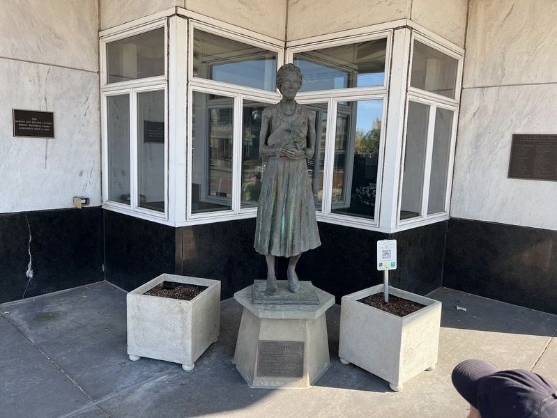
5. Dellora Norris statue
Near the front of the Municipal Complex is a statue of Dellora Norris (the "Mrs. Lester Norris" referenced on the marker), which was dedicated in 2006. The text of the plaque in front of the statue says, "Her vision and generosity shaped our community for generations to come."
Photographed by Sean P. Flynn, October 1, 2024
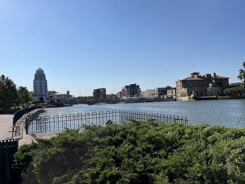
6. St. Charles, Illinois
In this south-facing view, the Fox River runs to the right of the Municipal Complex.

Photographed by Sean P. Flynn, October 1, 2024
7. Fox statues
The Municipal Building is in the background behind the fox statues on the Fox River bridge. The St. Charles Dam can be seen on the far left side.
Credits. This page was last revised on May 23, 2026. It was originally submitted on October 5, 2024, by Sean P. Flynn of Oak Park, Illinois. This page has been viewed 414 times since then and 105 times this year. Photos: 1, 2, 3, 4. submitted on October 5, 2024, by Sean P. Flynn of Oak Park, Illinois. 5, 6, 7. submitted on October 6, 2024, by Sean P. Flynn of Oak Park, Illinois.
